Updated 10% Yellow ATLANTIC Area of Persistent Convection.........No Name Storm a Weather Maker for Texas - Down the Road.... Will the Atlantic Basin Wake Up or Is it a Snooze Fest Til September?
New 10% Yellow Area.
For those of you on Twitter, you will know I've been obsessing on this area of extremel persistent convection. I made a video, I stared at it last night, this morning and the NHC has recently put up a yellow circle for an opening bid of 10% yellow. The text with the 8pm update is below.
Center stage there....
....definitely worth watching.
I'll also point out the orange circle off Carolinas.
But the center stage circle is very noticeable.
As I showed earlier today....
...there's a "bend" in the atmopshere.
Wind flow... Wavy like.
Solid ball of convection too!
We will see what we see...
..but at this point ignoring new African Waves
Watching this feature as it's stubborn!
Rest of blog is from this morning.
If you haven't read it, please do!
No name Texas Storm.
Will deliver rain....
...some flooding possible.
Nasty Weather.
Not great beach weather....
It's important not to ignore no name storms such as these as they can deliver quite a punch that many weak tropical depressions or named tropical storms do not. Especially in Texas in areas where they need the rain, but not too much rain at one time.
Models from Mike are shown above.
I love the juxtaposition on his site.
Rain moves inland.
I'll come back to this later...
... looks like a football game.
Red team at the line.
Blue team also lined up.
Red team has a wide receiver up near NE
Hasn't 2022 been the craziest summer?
Down the road there could be something off the E Coast.
Why this bugs me is the hot water there.
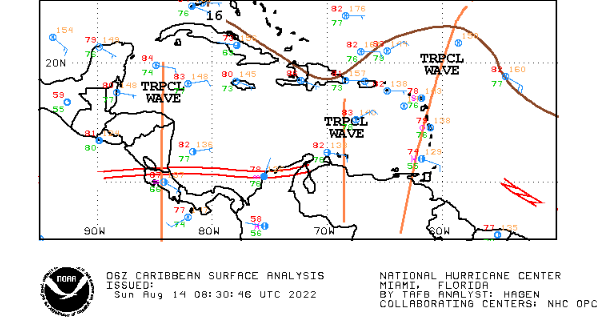
Not for lack of tropical waves traveling....
...Westbound into the Pacific.
Nothing wants to spin yet!
There's been talk the African waves are weak.
Not very wet.
Yet it's August not September.
We can re-evaluate this on August 26th....
...til then in theory things will develop down the road.
I know there's always 1999
Didn't wake up til Mid August.
Oh...it's Mid August 2022.
Hmnnn....
Mike has a nice Twitter Feed on his site.
Lots of good info.
Note the discussion on the early Noreaster!
Time will tell.
Again I love the way Mike juxtaposes his graphic information on his site Spaghetti Models. There are pages of information there but he has the most important information on the front. Purple splotch off the East Coast always lines up with an area I have been watching in my own backyard so to speak. A few models have whispered a lot of inneundo that a storm off the East Coast forms and slides close to the coast. I'm not going to speculate on those models or how strong the winds might be, but just know those models are blowing in the wind on the Internet. As always we have waves coming off of Africa, yet nothing wants to spin and when I say nothing wants to spin I mean ANYWHERE not just off of Africa. The Caribbean seems shut down for now, the MDR is ominously quiet and close in we have lots of weather, no named storms and oh yes as I have said for months not "fronts" that actually cooled off Raleigh this morning beautifully.
What month is this?
Listen I'll take it!
I'm just curious as to what comes next....
Another view of our no name storm.
Lots of curvature yet no real convection.
Yet, as they hit land they explode.
They always do.
They look meh over water but not land.
They tighten up.
GOM systems mostly...
Texas or Alabama they do that inland.
Let's start over Monday Morning. Remember, just because some storm doesn't have a name doesn't mean it doesn't cause a whole lot of pain. Enjoy the Sunday, I can't promise you Labor Day Weekend will be hurricane free, but at this rate nothing would surprise me!
Sweet Tropical Dreams,
BobbiStorm
@bobbistorm on Twitter and Instagram
Twitter mostly weather, Instagram whatever the mood hits me!


0 Comments:
Post a Comment
<< Home