TS Sean, Invest 94L in E ATL and Nasty Weather in the GOM
TS Sean in the East Atlantic
And another Invest moving West as well.
Shows models for Invest 94L (new wave)
Yes, sometihng may form in the NATL
More on that tomorrow.
Taking life one day at a time right now.
Time and the Tropics.
Models for TS Sean below.
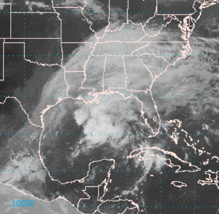
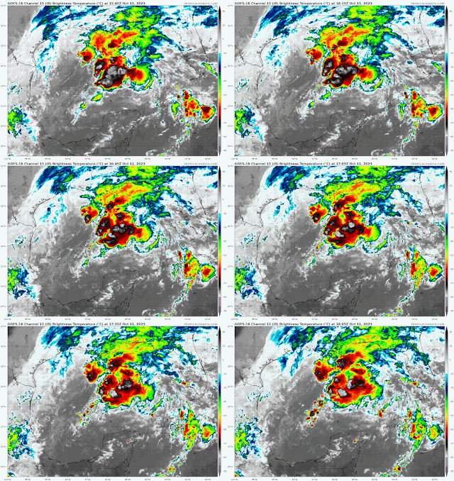
Then we have the Gulf of Mexico.
As I said this is bad weather in a fast flow.
Bad as in close to TS strength.
But not a TS.
Let's look at this in motion.
The Gulf of Mexico has concentrated cells of convection, strong weather and I'd say someone, somewhere it will have dangerous weather. No name, just bad storms. Follow local NWS offices and your local weather experts for fast breaking warnings.
There are long range models that develop this area in the GOM in the N ATL later, maybe... time will tell. If so it's moving away from land at that point.
As for Sean it's moving WNW at 13 MPH with 40 MPH Winds at this time. Does it go the distance? Some models show it falling apart whereas others show it staying alive. We have only just begun to watch Sean.
Invest 94L near Africa is being watched by many as being a player down the road as it has less curvature (currently) than the previous storms that all formed.
There is also a window later in October for development from the Carib/GOM area and long range models are taking stabs in the dark trying to show what may or may not happen.
Meanwhile cold fronts are on the move ...
There's a fast flow.
That's shear.
To the North a front is going to push down.
While there is much to watch...
...it's not a pattern friendly to development.
Real development more than 40 MPH TS.
I'll update as we know more...
... Hurricane Season not over yet.
Besos BobbiStorm
@bobbistorm on Twitter and Instagram


.gif)


0 Comments:
Post a Comment
<< Home