5PM TROPICAL STORM LEE FORMS from TD13 ... HIgh End Major Hurricane Forecast.96L Joins------- TD13 to become Hurricane Lee. Where Does It Go? Upgrade Coming Soon From NHCis
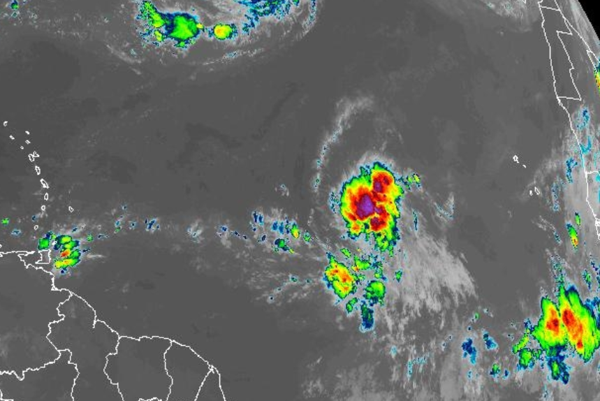
One look at Earthnull and I knew it was a TS
Even showing off the symbol a bit
Cone basically the same.
Direction and speed.
I'm leading with this above.
Wind Probs... all the Islands
But PR and VI have them.
When they are no longer in wind probs there is more of an "All Clear" while in the wind probabilities there's a chance they coiuld get those wind speeds, it's an important part of the forecast ignored because of the Cone. Also remember as this is expected to be a very strong Major Hurricane the size of the storm could be ...very large... so strong winds would be further from the center than say with Idalia.
So far the NHC has forecast 145 MPH WINDS.
NHC said this in Discussion.
There's guidance that shows it higher...
...than what they are forecasting.
They are forecasting 145 MPH.
Use your imagination.
I'll update tonight with thoughts.
I want to see the next set of model runs.
Making dinner.
Breakfast for dinner here tonight
Turkey Bacon, Eggs, Hashbrowns and salad.
Be back later with more details on models and thoughts.
***
TD 13 Forms
The NHC notes there is a bit of shear and that is forecast to disappear soon, while a High builds in to it's North keeping it moving WNW for now ....currently at 15 MPH forward Speed. TD13 is forecast to become a hurricane at the 24 hours mark and after that Rapid Intensification will make it a Major Hurricane within the forecast period.
Key Points
My thoughts at 11 AM? It's still too soon to know for sure the final track for Lee. I'm not serving Fish for dinner, can tell you that. The front shows up beautiful on modeling, if it's that strong I'll be happy in Raleigh, but it's been exponentially hot every day here and I'm waiting a bit longer before believing it. The Islands should pay attention, it's common for advisories to infer it'll miss it, but it clips it and the Virgin Islands are just a bit too far East to count out any impacts. The 11 AM has many of the Islands with low wind probabilities, but very in it.
Hurricanes are not a game, not a sport but life and death matters. Yes, many of us track, research and chase these storms (I've done all 3) but for the every day people in the path of the storm even a sideswipe by a Major Hurricane can hit you harder than you would expect.
If models are right and I don't disagree with them but they are tools and nothing more, I know from experience that things can and will change fast in the tropics.
Stay tuned............. it should be beautiful from a distance viewed on satellite imagery and will make many stop and stare. Be aware!
140 MPH from NHC on 1st advisory.
NHC tends to be conservative.
NHC advising the Leeward Islands to pay attn!
They have kept the Islands in the Cone.
Models just really love TD13
Stay tuned.
wave by Africa 96L
***
From 8 AM keep reading please
As the song goes...
...when the sun comes up.
It's just a matter of time.
Official Cone from NHC
Discussion.
TD or Lee...
...does it matter.
It begins.
Models
There's so much talk online.
WhatsApp groups are alive with chatter.
In truth when you see modes do this...
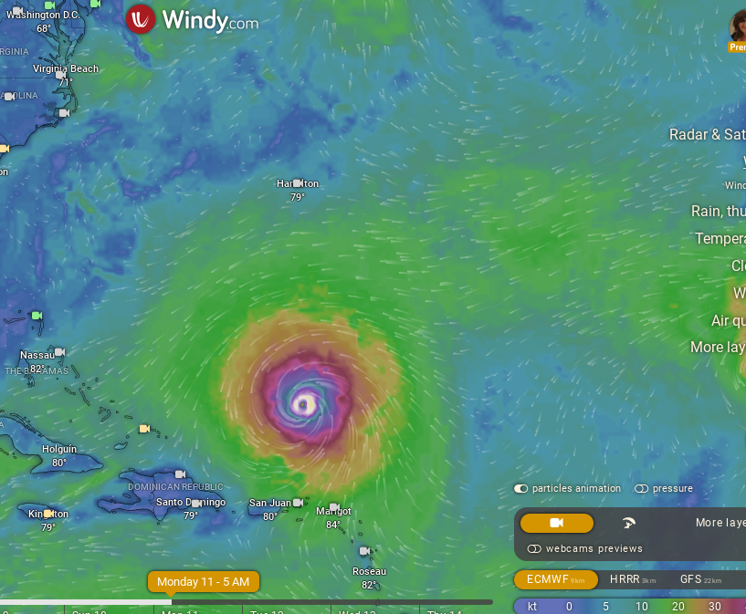
It does get the mind racing. Monday...GFS
EURO same day Monday
That does get the heart racing ....
..it's a REAL HURRICANE.
Real Hurricanes make people's heart spin!
Further down the road. Thursday
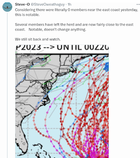
Ensembles:
Previously ensembles were E of Bermuda
Now they are W of Bermuda
Subtle changes, extrapolated over time.
Change much down the road.
Enjoy the beauty of Lee out in ATL
Wait before deciding if it's Fish or Foe?
Or where it goes....
What is called Wishcasting cuts both ways. Some are wishing it in and others are wishing it away. People woke up this morning and depending on what city they live in they are sure it's "their storm" and once in a while you get what you wish for.... careful what you wish for as we say!
So where does Lee go? In the short term, reliable term for modeling it moves West towards the Islands, probably missing the Islands though they may feel it's wrath in High Surf and surfers are on their way! Could they feel more? Truth? Anything is possible, though a curve or a clip is most likely. I imagine early Cones will err on the side of safety with a wide Cone at the end, narrow cone in the short term. We flirt with nailing the 7 day down, but we aren't really there yet. I'm more a 5 day girl, though I will peek for snow in the 15 day once Winter rolls in.
Bottom Line is basic:
You're supposed to be ready, prepared and you have a plan.
This deep into Hurricane Season ppl in Mid Atlantic wishing on snow already.
People in Florida watch the tropics til October as one will usher in lower temps maybe.
Stay tuned... we've only just begun.
Besos BobbiStorm
@bobbistorm on Twitter and Instagram


0 Comments:
Post a Comment
<< Home