Tornado Outbreak & Severe Weather Friday/Saturday! It's Just a Matter of Time... Then Hurricane Season. Use This Time Wisely....
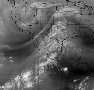
For most of us living on the East Coast or even along the Gulf of Mexico we tend to look at the world from the wrong perspective.... especially during this time of year. This feed of moisture comes in from the Pacific, crosses Mexico and pulls UP towards Texas, the Mississippi Valley and the Deep South varying on a few different influences that will tell the tale of who gets the most severe weather on any given day. The image below shows you that Winter is still holding on Out West and in the Northern regions. The in between regions where warm, moist air on the move slams into cooler descending air creates severe weather in the Spring. Especially when this set up is in place directing waves of severe weather every several days into two areas extremely prone to dangerous tornadoes in April. And, again April is only 2 days away and no this is not an Aprils Fools Joke.
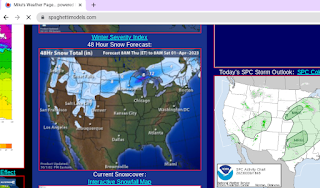
Mike has great winter weather maps up still.
You can see where the snow is....
...and below you can see www.weather.gov site.

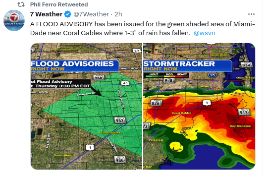
Lots of warnings up.
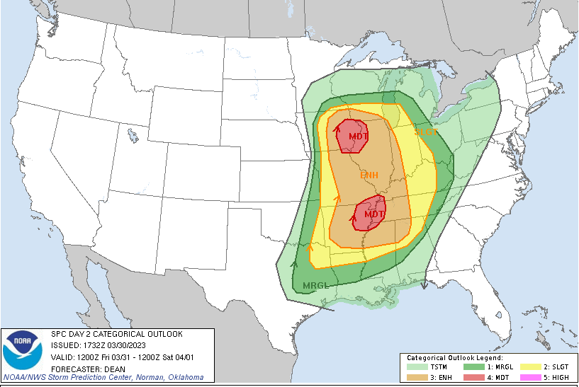
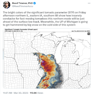
Here we see a double pronged threat for severe weather.
Later this week, going into the weekend.
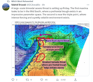
Above is a tweet for Des Moines, chosen randomly.

If you are on Twitter you know every chaser around is out there getting ready as every National Weather Service in the warned area is trying to warn people of the potential for dangerous weather. Every weather person on TV is talking away at the possibilities as APPs are showing the problem. And, yet someone, somewhere will say they didn't see this coming. Or the last time it was warned there would be a problem nothing happened in their area and they decided they no longer trust the weather people. Big mistake!
If you live in the warned area please pay attention to the dangers possible and watch in real time.
As for those in Miami and South Florida they are dealing with rain that looks tropical, but isn't. It's simply the tail end of a frontal boundary and extreme high temperatures making everyone jittery that the May Monsoons are beginning in March. While they are not, they may start ealier in late April if the trend continues.
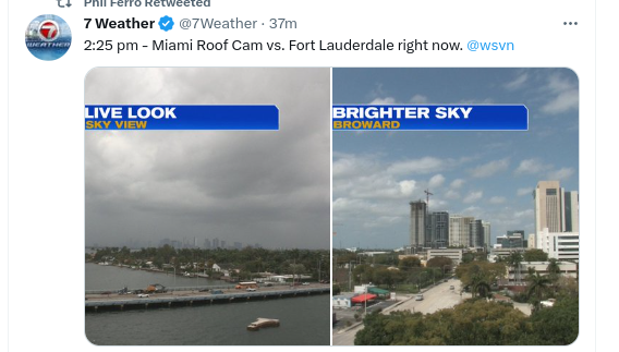
From Phil Ferro on WSVN and Twitter.
Mother Nature working over time everywhere!

South Florida at the Western edge of the front.
Later in May we get early storms from this set up.
Will the pattern linger?
The front tickles the already juiced up atmosphwere.
BOOM! The sky turns black and it pours.
Miami is tropical always!
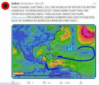
Dabuh posted this the other day.
It explains well why we watch patterns.
Patterns take time to form in real time.
And, oh look a way too early wave off Africa.
Too long, too early...but it's a start.

But til then we are dealing with Severe Weather Season.
Tornadoes .... Hail.... Twister Weather.
Use this time wisely.
Get a plan for Hurricane Season.
And if you live where tornadoes happen...
...take them seriously!
Always have a plan!
Stay tuned.
I really hope the concern is wrong.
But this year could be epic for tornadoes.
Just the set up....
... we can worry on Hurricane Season later.
But use this time wisely!
Home in Raleigh!
Going to anchor here a while.
Good to be home.
Colorado was beautiful...
..snowy, wintry and wonderful.
But it's always good to be home!
Besos BobbiStorm
@bobbistorm on Twitter and Instagram.
Twitter mostly weather, Instagram whatever.
posted by BobbiStorm @ 12:19 PM
![]()


0 Comments:
Post a Comment
<< Home