Update on Coastal Low and the Models. A Semi-Fictional Tropical Love Story

It's worth updating the blog here and going over a bit more information that has come out today on the probable coastal low that is forming. Will it be tropical or subtropical or just a coastal low? Stay tuned.
First of all note that the remnants of Invest 95 spinning in the Gulf of Mexico without a yellow circle has been caught by the trough and is now going the "wrong way" in that it's moving Eastish... to the RIGHT..
There is an obvious twist in the clouds over Florida and it's more and more likely with each model run that something is going to form from this west mess that has drenched Florida the last few days. Depending on timing... it could sit over the warm waters of the Gulf Stream and intensify into a moderately strong system.
Models show it coming closer to the coast this afternoon than earlier this morning. The coast being OBX also known as the Outer Banks.
https://twitter.com/DaDaBuh/status/382446293559156736/photo/1
I like these colors here...sort of Miami Dolphin colors (they are undefeated still...by the way)
7 Hours ago this was posted:
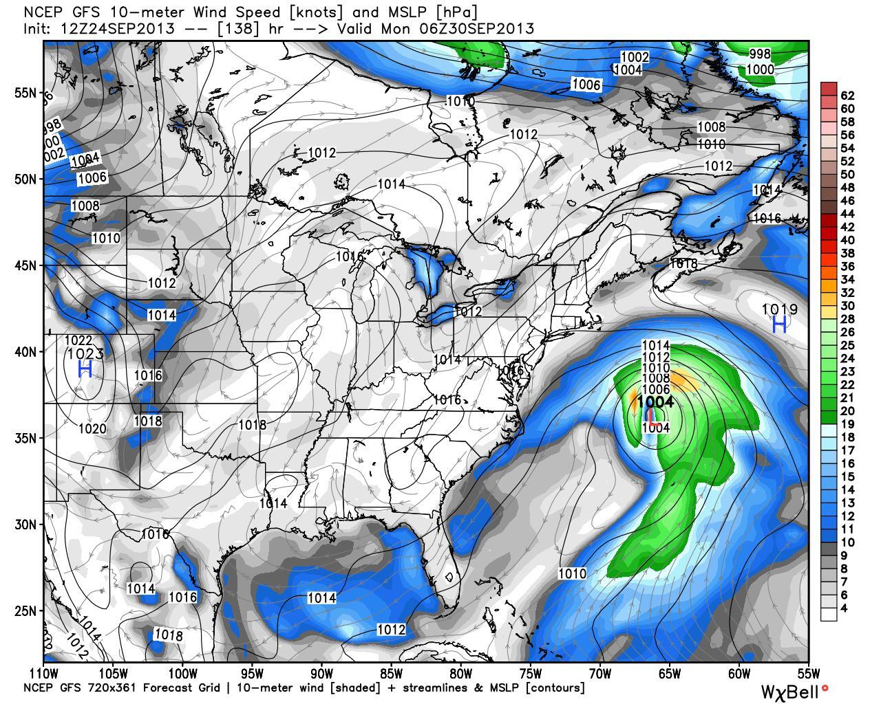
https://twitter.com/jimwxgator/status/382546646069817346/photo/1
Final destination is still in question... New York, New England or Canada or Out to Sea...
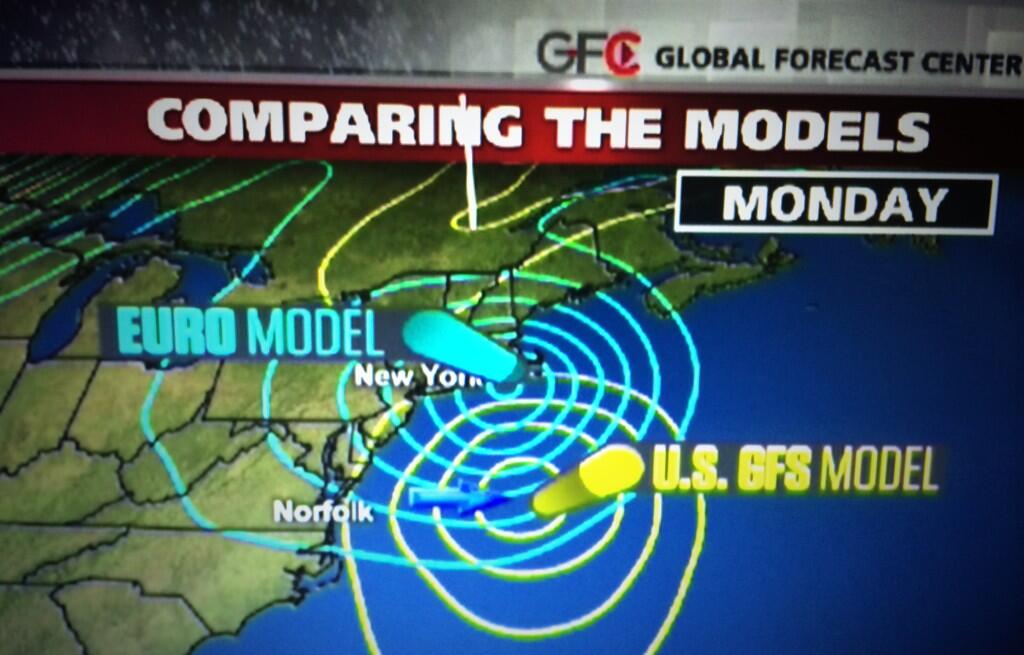
https://twitter.com/WCL_Shawn/status/382642794344349697/photo/1/large
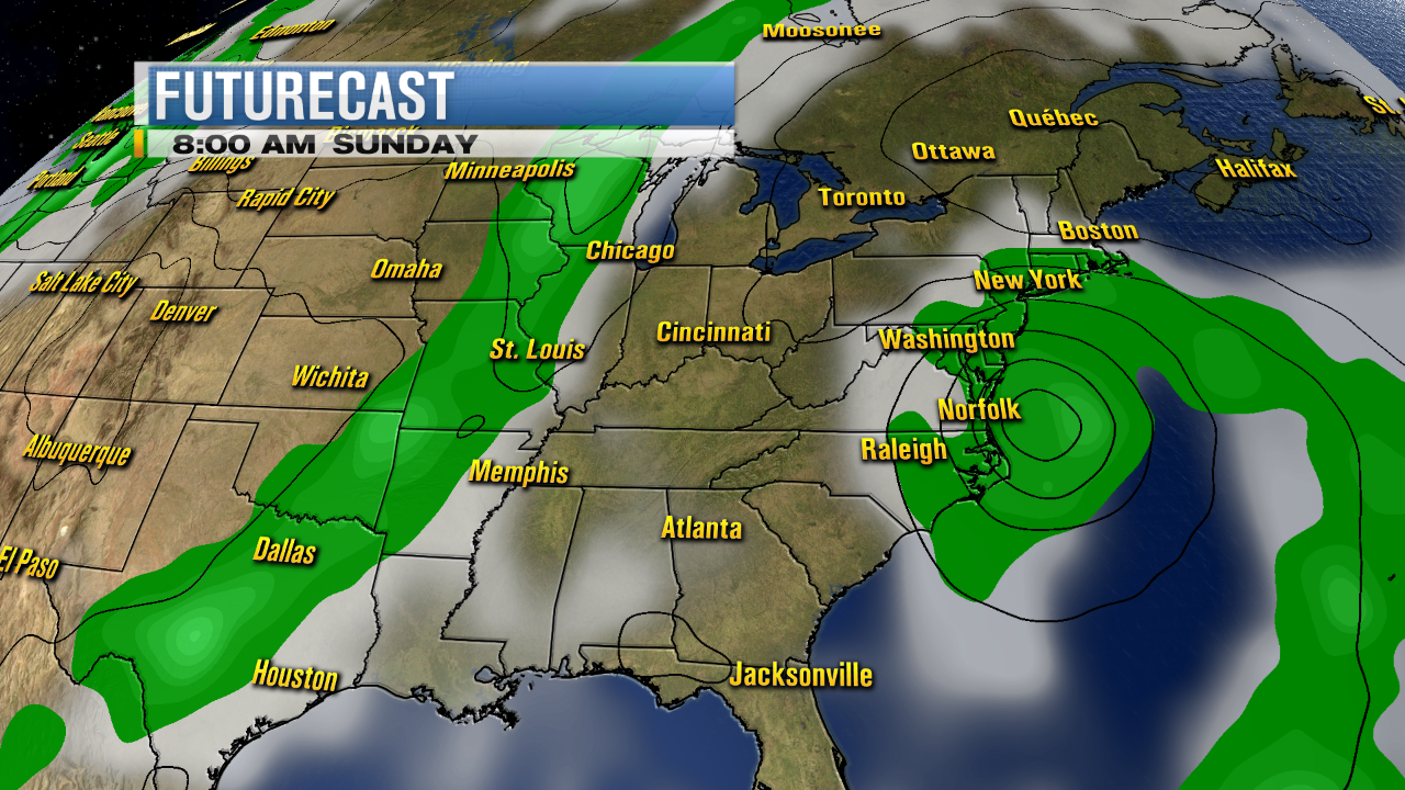
Cantore posted this 3 minutes ago...
Jim Cantore @JimCantore 3m
Should also point out that operational forecasts are farther west than ensemble members at this time. Early in the game to define impacts.
The point here is every one's posting and as he says.. it's too early in the game to define much... and we will watch tonight's model runs and tomorrow's model runs..
Mark Sudduth who knows this part of the woods really well blogged on it a little while ago. My brother, by the way, has always gone to his site for information before looking anywhere. Good site. Good blog.

http://hurricanetrack.com/2013/09/24/no-worries-a-repeat-of-sandy-not-likely-this-time-around/
(read his thoughts...)
Another meteorologist who knows that part of the world has this to say..
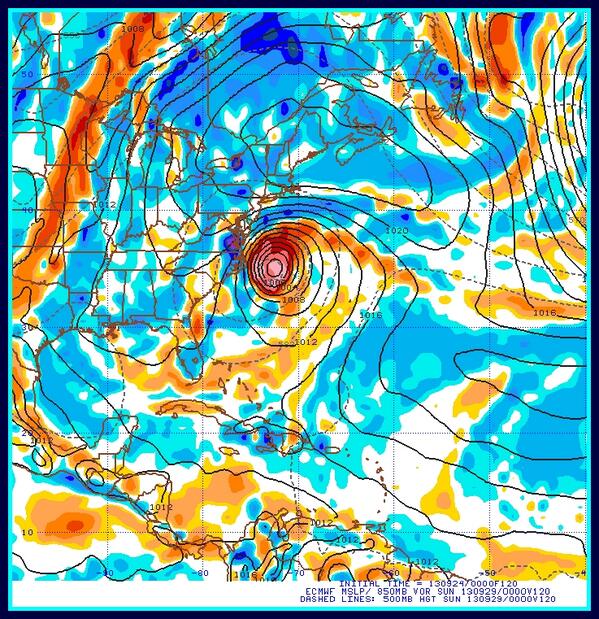
Craig Moeller 13News @13CraigMoeller 7h
The ECMWF model develops a coastal low this weekend. GFS and the UKMET not biting on it yet. pic.twitter.com/OTeCPi7rm7
Craig does the Hampton Roads area of Virginia..which is by the way "for lovers" so he really should be paying attention to anything lingering off the OBX this time of year and winding up into a strong storm as it cruises by to the East.
Weatherbell (where you can find Bastardi) is showing this scenario:

http://models.weatherbell.com/news/nasa_2013092300_precip6_gulf.gif

This is what the tropics look like today. See the inverted bubble to the East of Florida..
See the orange spot over Tampa...still there... moving across Florida... slowly..
This is what all the fuss is about online...
Also note a wave westbound in the Atlantic...
My point here is to show you the array of discussion on models that are forecasting a coastal low that has a chance to be more than just a coastal low. What it becomes will say a lot about the rest of September if you ask me. We are quickly moving through the seasons as an early cold set of fronts have made us feel more like early October than late September in the Carolinas. It's cool. When my husband refers to the weather in the morning as "chilly" it's colder than when he says "nippy" and as he is from upstate New York he knows the difference between the two. Jack Frost is hiding out there somewhere if you ask me..
And, everyone is reminding everyone this is "NOT SANDY" which is true... if they named it (chances low) it would be Jerry. Unless Invest 95 wants to come back to life as Jerry...
Can't seem to get pat the I name this year.
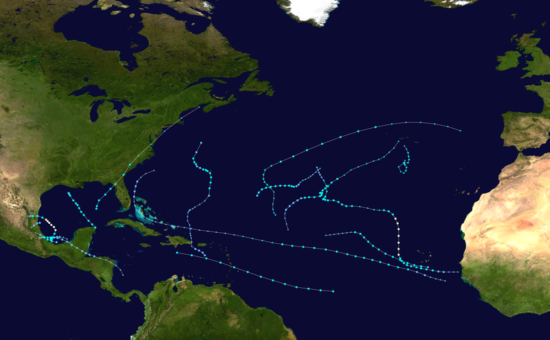
This is reality. The 2013 Atlantic Hurricane Season...so far.
Everything else is rumor and speculation.
But, it's fun to see something on the models to talk about...
Sweet Tropical Dreams,
BobbiStorm
Ps... Let's see what the next model runs show and well with this much smoke there is some fire here somewhere... what kind of Low is the question.
posted by BobbiStorm @ 5:02 PM
![]()


0 Comments:
Post a Comment
<< Home