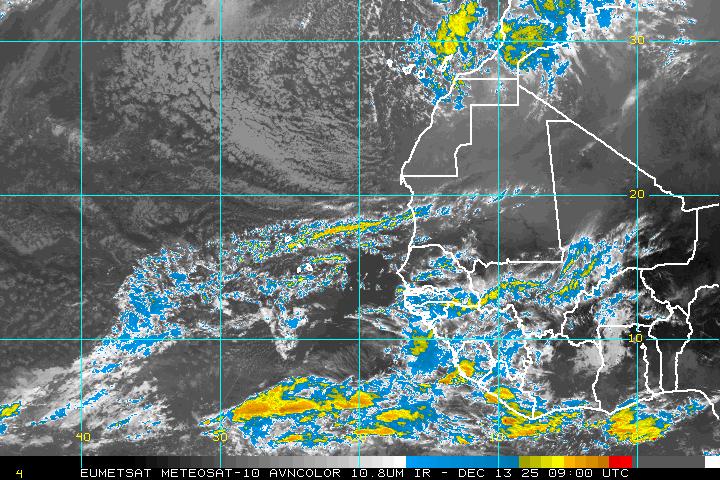
African Wave has a Heartbeat... Worth Watching, Orange becomes Yellow in the Atlantic
So, orange becomes yellow in the distant North Atlantic, which can only mean one thing... rain for England and no name for this area of weather that is not really tropical in nature.
If you click on the link for the NHC on the above page, you will see the Cape Verde African Wave hanging in there with what resembles the shape commonly seen in waves that do develop vs the ones that die a dusty death.

See how the image looks like a small round ball with a long tail that curves underneath and out in front of it and more so a long tail that drops down into the ocean near the Equator. Waves need to be up around 10 degrees North, however sometimes if they can anchor themselves better into the ITCZ than they have a better than average chance of developing.
Mind you it has a long way to go... especially with the swatch of dry air to the north above it and out ahead of it.
Surprises me that it looks so good and I have been afraid to even look at the waves as they have been almost dead on arrival this whole season and not worth mentioning. But, we are getting closer to that time of the year.

That's interesting, possibly a "game changer" lol and look at the wave just after it. The other scenario is that this wave "juices up" the atmosphere for the wave behind it. Weather lingo for storm trackers and chasers...by the way...
It also has the best "roll" forming on the "juice loop" that I have seen in a while. That said, I would expect it not to make it but..........I would not be surprised if this is a keeper.
Stay tuned....
Besos Bobbi
Ps ...no model input here, they have yet to really notice it but that may change...http://en.wikipedia.org/wiki/Intertropical_Convergence_Zone


0 Comments:
Post a Comment
<< Home