Hurricane Harbor

A writer and a tropical muse. A funky Lubavitcher who enjoys watching the weather, hurricanes, listening to music while enjoying life with a sense of humor and trying to make sense of it all!

Wednesday, October 30, 2013

Red Sox Win at Fenway Park !! From Maine to Key West


They say it's not true until you see it on Drudge............


So it must be true :) and yeah I watched and loved every minute of it...


Now you are wondering how and why I put this up on my blog...other than the obvious I am a very official member of the Red Sox Nation...

Did you know Key West is filled with Red Sox fans?? Really... every where you go in Key West are New Englanders who went South to the rock that has the most homes that look like they belong up in Cape Cod but that are surrounded by palm trees and frangipangi trees and a tropical breeze. To walk around Key West... down Simonton or up Simonton is to know that Key West is mostly New England Wooden homes that you would see in Maine or Boston with a little Southern trim added and ... palm trees, blue skies and a bit or paradise.

Jimmy Buffett at Fenway Park...


http://www.youtube.com/watch?v=RTlJyE14wIE


http://www.youtube.com/watch?v=mFQoPQiMNB0


This is supposed to be one of the best Red Sox watering holes in Key West...


Check out the reviews...


FLA or NE? 
Hmnnn Palm Trees...

A little bit of both... 

So................now you know the rest of the story :)

Wow... got to love it... winning at Home is the sweetest joy... 

Home is Home is Home... 

That's why they call it Home Field Advantage!

Besos Bobbi at home in Miami :)

Tuesday, October 29, 2013

Tropics Quiet... Anyone Interested in an El Nino Margarita En Miami??

current goes west and east northern hemisphere composite water vapor image

The song "It's a beautiful world" comes to mind when looking at this image.

Not a very tropical looking world... but a beautiful one.

I'm not going to sing the praises of the two tropical waves moving west way too low towards the Caribbean or rain that is falling as if it's still the hurricane season... oh it is......

Is it or isn't it?

It's the end of October and everyone is talking on their personal memories of Wilma and Sandy. Note...both busy seasons when we got the the S and the W names..


Here in Miami it's beautiful...


About as beautiful as it gets...  I was over there behind the boats up on the balcony sipping a margarita with my son watching the boats bob about in the bay. What a day.


Yup... there's always a Hurricane in Miami .. a Category 5 one at Fat Tuesdays at Bayside ;)

And, any number of tropical drinks to get while listening to some band play Santana by the water..


That bird there is the luckiest bird in the whole USA :)

The beauty of Miami is that there you are in the middle of the day and you can play tourist on vacation anytime...   Take a break from MDC (Miami Dade College...) or an office job on your lunch break and run over to Bayside and rest and relax. Everyone does... really... it's a local thing more than a tourist thing and that's saying a lot seeing as there are a whole lot of tourists there also.

And, these days the real flavor of Miami is Patron... in any form.

Pink Patron with all sorts of stuff in it ..not to mention blackberries...


Miami is Pink...and Turquoise and the feel of the breeze in the afternoon 

Christo knew what he was doing when he made those islands pink in the bay...


Miami.................love it.

Busy and noisy and colorful and wonderful. And, always some intrigue going on somewhere..

Miami's a funny place. Someone posted a YouTube of the International Space Station passing overhead... but...it's the sound of the police car or sirens in the background playing that makes me smile. Funny.

And, if you really are in a weather mood...you can get an El Nino Margarita ;)


Seriously??

Nope...no tropical weather in the Caribbean.. but lots of tropical drinks and pleasure in Miami..

Besos Bobbi

Monday, October 28, 2013

Cold Front in the Caribbean... Hmnnn


Nothing much happening...

Will be back today with some models that show possible weak development in a few days after the beautiful long cold front that is currently draped across the Caribbean.

That says a lot....

Be back later... taking care of some details regarding my mother's care at a nursing home in the Miami area.

Enjoy the beautiful day...

Besos Bobbi

Ps...Thank you everyone for your prayers and your patience :)

Friday, October 25, 2013

23 Degrees and South... Florida Keys. Yellow Circle in Atlantic..still

TC Activity

Beginning to feel like this is a semi-permanent feature out there in the Atlantic. Reminds me of a Jimmy Buffett song. Then again, everything reminds me of a Jimmy Buffett song. :)

Watching the tropics on Twitter and Messages and was away all day in the Florida Keys... On the road with my brother and just hanging out watching stormy, beautiful weather :)

Yeah, a lot of smiles. I'm home or officially was home when in Key Largo.. you know that spot where the Overseas Highway makes the turn around Surprise Bay and on you are about to go over the new bridge. Well, to be honest I'm home once I'm on the Palmetto or the Florida Extension Turnpike Road there... but when it flows south past the nurseries and the open land of Homestead and after a quick stop at my favorite Starbucks you pass the Last Chance Saloon (or what's left of it) and you are on the 18 Mile Stretch.. past the marina... driving south bound for the Keys. Home settles in on you. Every muscle in your body relaxes.. your neck no longer hurts and headaches fade away as you stare out at the open road and sky.


And, funny how the stupid "Belize" blue wall that everyone hated when it first went up and took forever to build has become some thing friendly and familiar; part of the trip as if it had always been there.

http://www.youtube.com/watch?v=0RxT_jy8hEU


Even on a gray day the Keys are beautiful. The water turns colors in the Keys on stormy days that Crayola never dreamed off...   little rivers of Key Largo Aqua and Florida Keys Sea Green pop up peek-a-boo style and the mangroves have this dark, muddy color that make them look like a setting for a 1950s B Movie that might be called "Mangrove Zombies" which really does sound more like a drink they might serve at Wahoos but you never know..  There is a sweet mystery about a day in the Keys... it simply unfolds, but only if you let it.

We stopped a lot for pictures. Went in to see my friend Linda at Rock Reef Resort...played in the water, stared out at the Bay...wow. Just sat there at one of my favorite writing spots and talked, stared and took pictures.


Looks beautiful always tucked away on the "Gulf Side" which is really Florida Bay or a small little piece of the Gulf of Mexico to  your West. Sunset there is BETTER THAN KEY WEST.. but you got to see it to believe it.

http://www.rockreefresort.com

Click the link... go see for yourself.. believe it.


My "baby" brother:


Earlier...driving...


:) Hey he was in the way when I went to shoot...so I shot him shooting pics! Bamn.. Actually was a very quiet ride as most people pass on stormy weather in the Keys vs those who go specially to shoot it on the chance you might see a waterspout dancing on the Atlantic Side.

So...there I sat checking the tropics on my new phone.. nothing really going on in the tropics, but me being home and doing what I do best..   stare at palm trees :) and the sky and feel finally back at one with the world.


Just that's the truth while cold fronts and frosts frolic up north ... I'm home waiting to see if anything develops down in the Caribbean as westbound tropical waves make their way west bound... longitude by longitude and it's all a matter of degrees ... all a matter of feeling the breeze... all a matter of waiting and watching and trying to have a little patience on this anniversary time of when Wilma came to visit my house in 2005 :)


http://www.youtube.com/watch?v=jrvf6SlDwWE

Oh...did I mention I'm home with Goya products and a cortadito in the morning with a guava pastelitos and taking long walks to walk off the oh so sweet calories. Nothing sounds like "home" more than hearing the rapid fire Spanish of my youth in Old Miami...where Southern accents and y'all mixed with besos and banos and any variation on Spanish and English you can imagine. Some people hate it..some people love it. To me it's the Mother Tongue of Miami...

I'll be back later with more on the tropics if the tropics would only give me some more to talk about ;)

Besos Bobbi
Ps...really it's all true.. kinda sort of.. really... everything is semi-true in ways.. its all a matter of your own reality. Wow..that sounds like it should be a Jimmy Buffett song too!


http://www.youtube.com/watch?v=xR5oBGIcYDc

Wednesday, October 23, 2013

BOC Again?? Yellow Circle


Interestingly enough the Yucatan is alive AGAIN with Zero chances of development which is sort of silly to say because if that was really true...there wouldn't be a yellow circle. It has to have some chances right?

Either way I mentioned this the other day... and you can see in the enhanced satellite image that there is something there..


Now... we are going to go to bed. Well, I am.. Just got into Miami. Exhausted despite having pumpkin flan and a soda and wow love being home in Miami.

Embedded image permalink

Joy in a can......................

Let's see what the BOC and GOM do tomorrow.

More importantly long range models show something coming together in the Caribbean.. maybe later this month.

Maybe being the KEYWORD for this WHOLE SEASON...

Besos Bobbi

Check back tomorrow :)

Tuesday, October 22, 2013

Hurricanes are unpredictable...Who Knew?


I was reading on Twitter and some news writers were complaining about the unpredictability of Hurricane Raymond. Really?? Can you imagine that... people in 2013 are living under the notion that Hurricanes hardly ever do random things such as intensify fast or switch directions just as fast or suddenly stall out.  Granted we have a much handle on them then when Ben Franklin and Paul Revere were observing weather...but we have a long way to go before they are predictable.

Lorenzo may be going out to sea...but he's not doing it the easy way. Models are a bit ...funny...


It's not doubling back and hitting South Florida.. but it's not zoom, zoom, zooming off either. But, it is supposedly moving in the right direction now after looking odd all day. And, Raymond seems closer to land than he was supposed to be also.


Some nice graphics from the world of the web and Twitterland to show you the set up in the Caribbean should anythng develop down there...ever...


Interesting spin over the Dominican Republic. Can you imagine if that was a hurricane not an ULL?


A little on the short side here. Packing and about to shut down to get on the road south bound back home...

Home where the pastelito is calling..home where the cafecito is calling...home where I'm not so silently waiting to be home. I love Miami. No matter where I roam..there is no place like home when it's Miami.
Raleigh is nice..but I don't know what all the fuss about it is.. I'd pick five other North Carolina cities to live in before the Raleigh-Durham area. I mean it's a "triangle" which makes me think of danger, danger warnings. Generally that is not something you WANT to see...


Morehead City is beautiful in an old Southern way, Wilmington wonderful...Charlotte exciting and Winston-Salem really, really nice. Anyway..............not my problem for the next few weeks...and when I get back up here I'm hoping every cicada will be gone as will the leaves off the trees so I can see the sky again.

Great song.. love it.......love the person who sent it to me.. Besos... Mucho Besos...


http://www.youtube.com/watch?v=hvKyBcCDOB4

Keep watching the tropics... five days or so and something may start to bubble in a bubble, bubble, toil and tropical trouble as Melissa might send one last kiss...before the season is over.

Sweet Tropical Dreams...

BobbiStorm


Monday, October 21, 2013

Tropical Storm Lorenzo!


Tropical Storm Lorenzo is a 40 MPH storm moving NNE at 7 MPH on his way out to sea. That is the system to the NNE of the other system to the SSW of it. Yes, it's still the Hurricane Season. This is a bit ahead of the official NHC forecast which kept it at TD for a longer period. Seems Lorenzo has other ideas.

Old info from 11 PM:
FORECAST POSITIONS AND MAX WINDS

INIT  21/1500Z 28.0N  55.1W   30 KT  35 MPH
 12H  22/0000Z 28.9N  54.1W   35 KT  40 MPH
 24H  22/1200Z 29.6N  52.5W   40 KT  45 MPH
 36H  23/0000Z 30.1N  50.5W   40 KT  45 MPH
 48H  23/1200Z 30.4N  48.9W   35 KT  40 MPH
 72H  24/1200Z 31.4N  46.5W   30 KT  35 MPH
 96H  25/1200Z...DISSIPATED"

New info at 5PM ..six hours later shows the new intensity forecast going some what higher.

INIT  21/2100Z 28.9N  54.9W   35 KT  40 MPH
 12H  22/0600Z 29.5N  53.9W   40 KT  45 MPH
 24H  22/1800Z 29.9N  52.5W   45 KT  50 MPH
 36H  23/0600Z 30.3N  51.1W   40 KT  45 MPH
 48H  23/1800Z 30.9N  49.8W   35 KT  40 MPH
 72H  24/1800Z 33.0N  46.5W   30 KT  35 MPH
 96H  25/1800Z...DISSIPATED

v

Looking good there Lorenzo.........

$$
[Image of 5-day forecast of predicted track, and coastal areas under a warning or a watch]


As for Raymond...wow now THOSE are SPAGHETTI MODEL TRACKS. Seems it's been a busy day for intensifying storms. Raymond came in a bit stronger than forecast also...


Hurricane RAYMOND RSS Feed iconSatellite | Buoys | NDFD | Storm Archive
...RAYMOND A LITTLE STRONGER BUT STILL STATIONARY...


Still watching the Caribbean for development down the line... in time...

Remember..it's not over until it's over..............and it's not over until AFTER Melissa!
Besos BobbiStorm
Ps Loving an old Valentines CD that is doing me in and yet saving me all at the same time...

http://www.youtube.com/watch?v=x11NA63gLDM


merci..

Tropical Depression 13 Forms in the Atlantic


As predicted... was just a matter of time... has looked like a TD all morning since 1st visible!

Short term tropical storm possible if the NHC Discussion plays out.

Salient points:

"THE DEPRESSION IS CURRENTLY IN DIFFLUENT FLOW ON THE NORTHEAST SIDE
OF AN UPPER-TROPOSPHERIC LOW NORTH OF PUERTO RICO. THE POSITION OF
THE TROPICAL CYCLONE RELATIVE TO THIS FEATURE SHOULD KEEP THE
WESTERLY SHEAR LOW ENOUGH DURING THE NEXT 24 TO 36 HOURS TO ALLOW
FOR SOME INTENSIFICATION WHILE THE DEPRESSION MOVES OVER WARM
WATERS.  BEYOND 36 HOURS...GLOBAL MODELS SHOW INCREASING WESTERLY
SHEAR THAT IS LIKELY TO CAUSE A DECOUPLING OF THE CYCLONE.
DISSIPATION IS FORECAST BY 96 HOURS...ALTHOUGH IT COULD OCCUR
SOONER. THE NHC INTENSITY FORECAST IS NEAR THE SHIPS/LGEM OUTPUT
THROUGH 36 HOURS AND THE NEAR THE MULTI-MODEL CONSENSUS FOR THE
REMAINDER OF THE FORECAST PERIOD.

FORECAST POSITIONS AND MAX WINDS

INIT  21/1500Z 28.0N  55.1W   30 KT  35 MPH
 12H  22/0000Z 28.9N  54.1W   35 KT  40 MPH
 24H  22/1200Z 29.6N  52.5W   40 KT  45 MPH
 36H  23/0000Z 30.1N  50.5W   40 KT  45 MPH
 48H  23/1200Z 30.4N  48.9W   35 KT  40 MPH
 72H  24/1200Z 31.4N  46.5W   30 KT  35 MPH
 96H  25/1200Z...DISSIPATED"

http://www.nhc.noaa.gov/text/refresh/MIATCDAT3+shtml/211437.shtml?

[Image of 5-day forecast and coastal areas under a warning or a watch]

Looking awfully Lorenzoish to me..


Big picture... definitely can see it from outer space...

20131021.1445.goes13.wv.fd.x.jpg image

Can also see Raymond.

Pretty far south of "the front" that brought whispers of frost in outlying areas to the Piedmont.
Note the next bigger "FRONT" should push it out to sea.  What's going on down by South America...wow. And Raymond getting stronger.


Check back later for all the weather details and as always...the devil is always in the details. 

Remember that. 

Besos Bobbi

Ps... Looking thru the Lorenzo files online...

Wow does this picture scream 80s or what? My gosh how did they get away with that ;)

"Lorenzo Lamas-Craig (born January 20, 1958) is an American actor. Lamas-Craig is known for playing Lance Cumson on the popular 1980s soap opera Falcon Crest"

Getting closer to Lorenzo...Lesson in How to Slice & Dice the Satelitte Loops


Salient part of the NHC discussion:

"A TROPICAL CYCLONE DURING THE NEXT 48 HOURS...AND A HIGH 
CHANCE...60 PERCENT...OF BECOMING A TROPICAL CYCLONE DURING THE
NEXT 5 DAYS WHILE IT MOVES NORTH-NORTHEAST...AND THEN TURNS EAST-
NORTHEASTWARD."

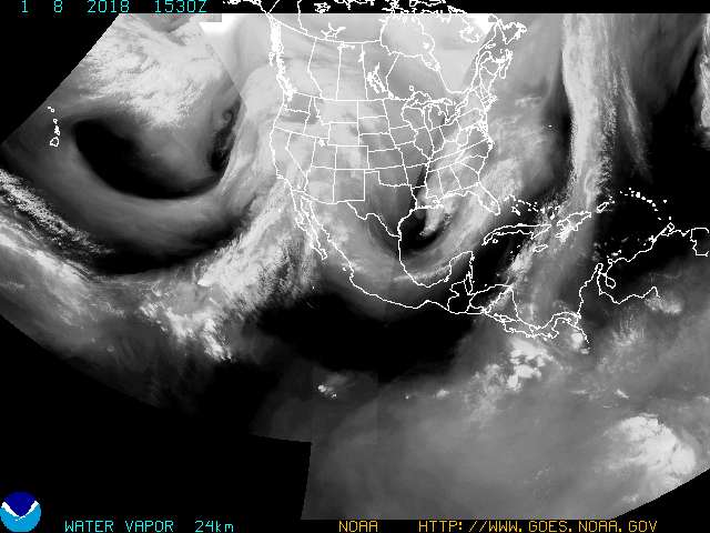
There is  reason I love the UNISYS Water Vapor and that's not because I'm old school. I'm actually kinda, sorta New Age-ish.

I like it because you can really toggle clean images of the wide views and compare and contrast them as if you had to write an essay on a college paper. Plenty of amazing sites to go to that allow you to zoom down into the eye of the storm, however the larger view really shows the flow and steering currents. Okay, long sentence. They say a picture is worth a thousand words. Here's two pictures and I'll write 2,000 words less ;)

(Before..12 hours ago)

Current...After... NOW @9AM Monday.

Note the image on top shows a weak Raymond hovering near the Mexican coast.
It also shows a weak area of low pressure in the Atlantic that has a yellow circle yesterday.

Note the image on the bottom... shows a Category 3 Hurricane Raymond that rapidly intensified over night.
It also shows an area that currenly has a 60% solidly red circle and what appears to be already a TD.

Put it in motion and watch them come together.

Visible Water Vapor - GOES East 12 hr Loop

Enhanced IR shows the intensity and drama clearer


Now we look at the FLOATER which is labeled 90L


Sort of dramatic over night improvement...
From a 10% to a 60% in less than 7 hours.

Both small systems and small systems do have a tendency to intensify faster than larger ones.


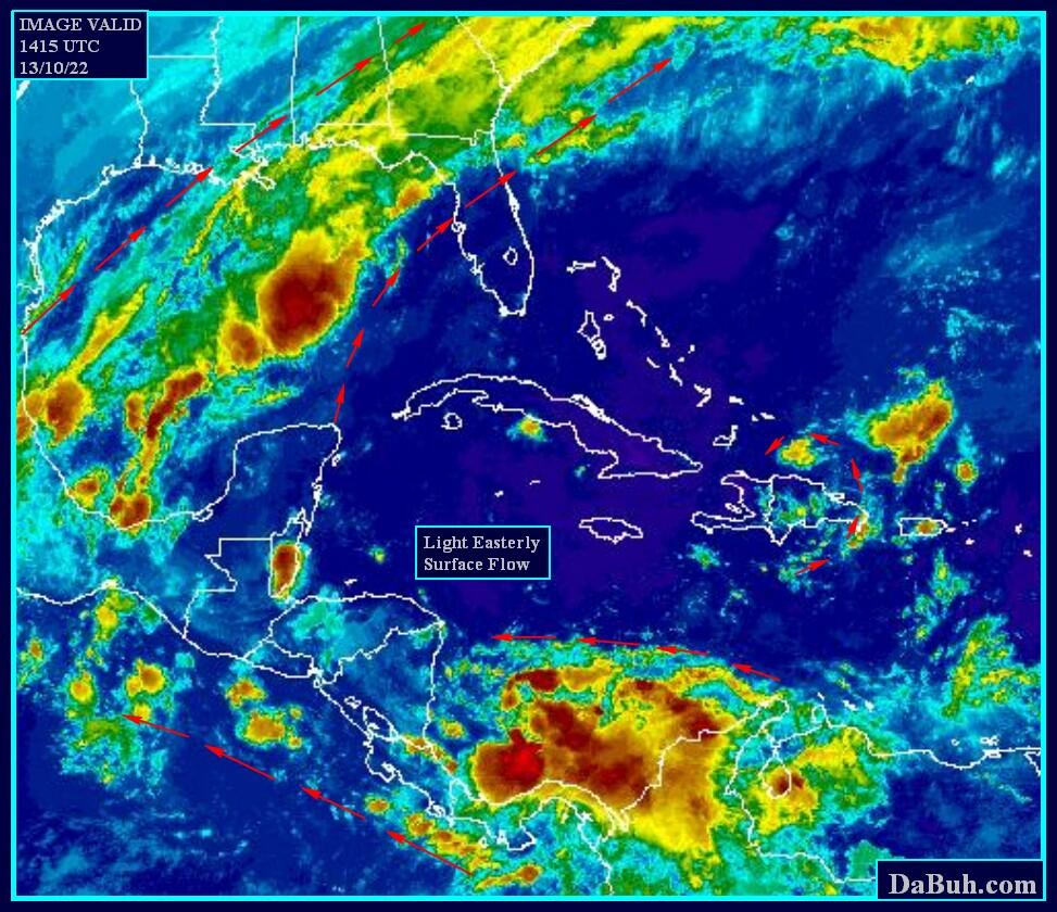
Keep watching the moisture in the Caribbean to see if more oranges and rusts begin to congregate.

Note Raymond is just a tease and playing with the Mexican coast...he is going west eventually.
If it was a female storm I'd call it a bad name used in high school ... but I won't.
Would work for guy storms too..but I digress... point is it's going out to sea...


Almost looks like part of a big frontal system that runs all the way up the East Coast of the US.


It's pulling away is the point.
Note that also the swirling thing N of PR is an ULL... Lorenzo is pulling away from that too.
(cute feature, fun to watch...)
but...Lorenzo is the swirl to the NE of it...
and clouds keep pumping up in the SW Caribbean... not ready for prime time yet

Usually you count 7 days or so before things spin up and develop in the Caribbean after an EPAC Cane.

This is a NOAA site... it's not just me singing the SW Caribbean Blues...

see...NOAA

Lastly look at the 7 day NWS loop and notice that a front has gone stationary South of  FL
draped across Cuba... 

Monday October 28, 2013 


A stalled out frontal boundary in the Caribbean in late October or early November
is one of the necessary ingredients to get something going..

So is the MJO..
...and the MJO is oozing it's way East into the SW Caribbean...
after stirring up Raymond's little tropical heart into a frenzy...


I'll be back later today with information on where Lorenzo might go (hint out to sea...) and any other relevant information that I think is worthy of passing along.

Thanks for joining me here on this ride down to the tropics. I enjoy your feedback and appreciate y'all more than you can imagine.

Besos Bobbi

Ps.. might be some kinks in the road for that fish storm path for Lorenzo