Hurricane Harbor

A writer and a tropical muse. A funky Lubavitcher who enjoys watching the weather, hurricanes, listening to music while enjoying life with a sense of humor and trying to make sense of it all!

Monday, September 30, 2013

October... 20% Yellow Cricle in Carib, TS Jerry ... October CLIMO

WELCOME TO OCTOBER IN THE TROPICS...

20130930.2315.goes13.x.wv1km.97LINVEST.20kts-1009mb-145N-800W.100pc.jpg image

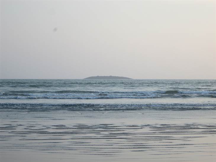
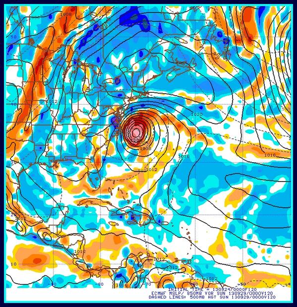
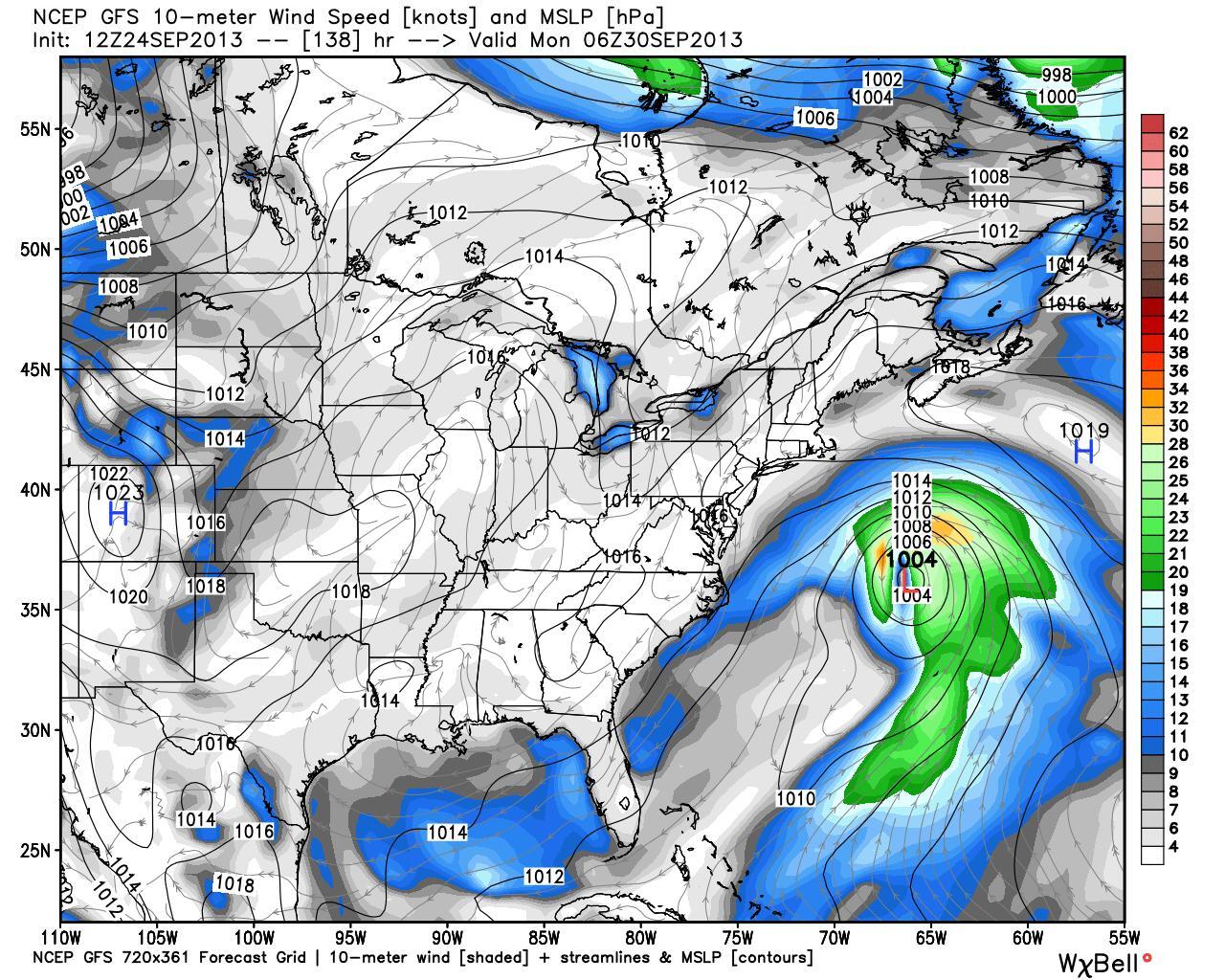
And the above image is Invest 97 in the Caribbean. Despite the weakness of this season's systems the Caribbean system shows up right on time according to CLIMO. Go figure.

In 2011 there was a similar system named Rina.. a much busier year but still in a similar place. Funny how people don't remember the ones who don't go all the way...  if they don't go to the distance we forget about them.

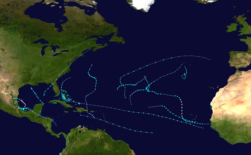
Here's an image of Rina down there in the Carib in October trying to come together...in 2011.


Some storms flare up fast, way too young and then flash out just as fast...

And, then she did it...late October and she became a Hurricane... a pretty one too.


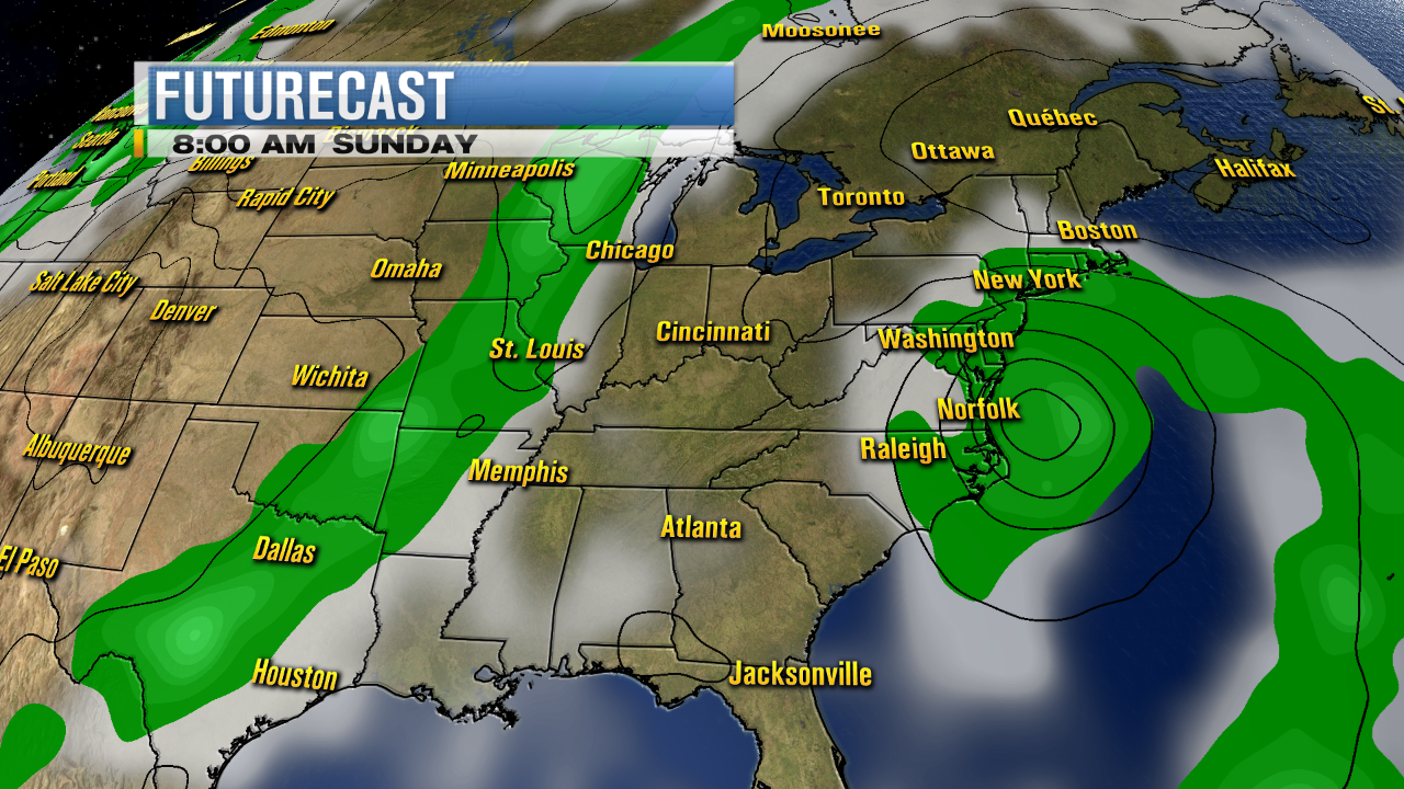
Tracks took her towards South Florida...

Look at that pin point eye..


Excitement builds......................and then..................the cone goes funny...


http://www.youtube.com/watch?v=1M9LnInBdNY&list=PL3DEAD3165C43E8D3&index=15


Next  thing you know she's slowing down... she's lost a little of that magic drive ... she's a fading star..

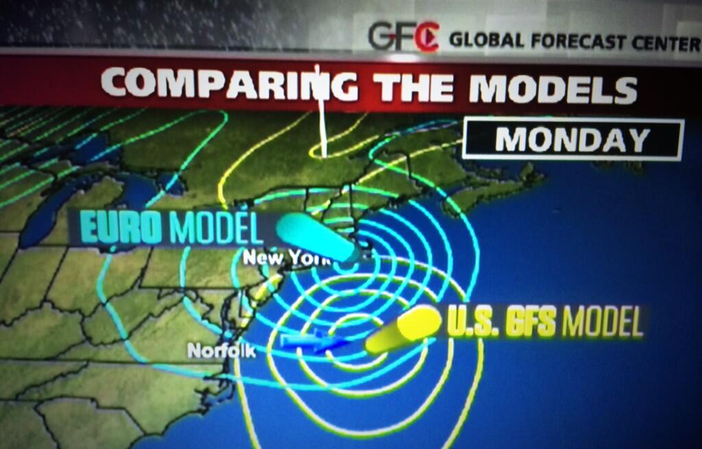
We all remember Hurricane Wilma... but we forget about storms like Rina... and yet... most October storms take a right turn somewhere. This is an unusual year and imagine it could play out not in accordance with CLIMO but....... doubt it.

A front is moving down and between the shear and the desire for Karen to merge and mingle and get absorbed into the stronger front would most likely be the scenario... if she becomes Karen at all. Not the best decision to get messed up with a big, bad front.. but what other options would she have?

Well....stay tuned.............because we just don't know and that is the beauty of tracking storms and studying them and writing about them.  We just don't know for sure...

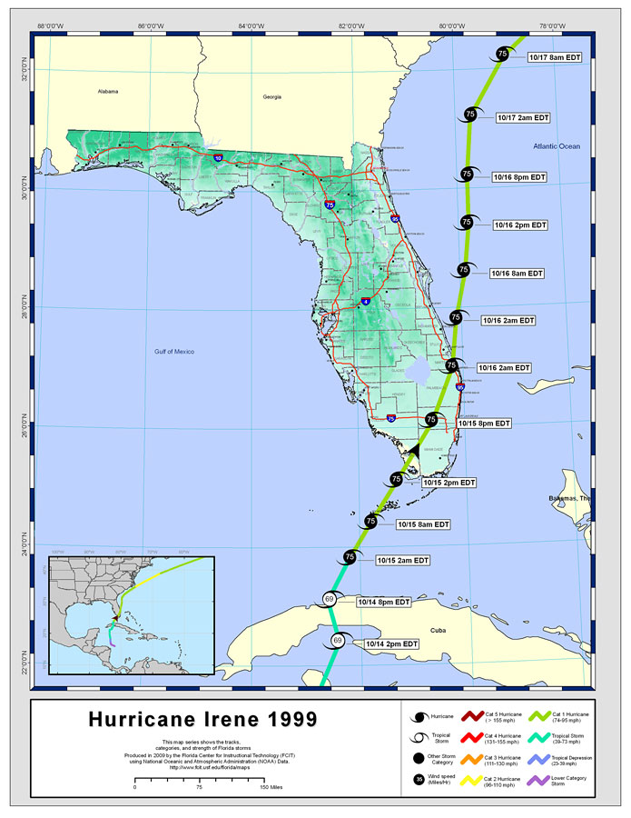
Where do October storms in the Caribbean usually go? That we know..


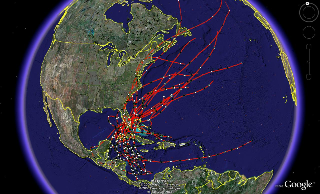
October storms ...from an article in 2008...

IF Karen forms from Invest 97 and makes it to the BOC it would be a neat trick...then again this is the year for Trick or Treat in the BOC.

In other areas of the world... getting harder and harder to ignore that wave in the Atlantic. You can say over and over "everyone says the Atlantic is dead" but someone should tell that wave.


More tomorrow... Sweet Tropical Dreams,

BobbiStorm


Tropical Storm Jerry Forms in Atlantic... Will Karen Form in the Carib?


Tropical Storm Jerry has formed in the Atlantic from the TD 11 that I like to think of as Oceans 11 as its staying out in the ocean obviously... looping in circles for days before eventually going out to sea.


Doesn't look very exciting but Jerry is there... out there.........far away....going nowhere fast.

There is your...ummmm bubble gum cone...

[Image of 5-day forecast and coastal areas under a warning or a watch]

She's not coming back to the USA... though she may spin in circles for day before moving out to sea ...

In the Caribbean Sea there is a system that is very slowly coming together and which could stay weak and move tropical moisture north across Cuba and South Florida or... it can pull together and move up into the Gulf of Mexico and the move a variety of ways. The models this morning are backing off from the hard right turn they have been showing that would put Florida under the gun.

First it needs to separate itself from the trough it's been anchoring for days... and become a separate entity. There are signs this morning on the visible that may be happening.


Look to the left (West) of the blow up of convection and you will see a "dot" and a small circulation beginning to show itself. The shear there is blowing off the convection to the East.. so a simple look at one image does not give the whole story correctly.


See one picture makes you think the system is further to the north than it is:


Again the DOT that remains is where the center is and it is more visible on the VISIBLE (duh...) and the shear blows it off to the East and then NE...

AGAIN..................IF this doesn't form the system will moisture will flow up over South Florida.

If the system WRAPS the moisture will wrap around and that won't happen.The hard right scenario could happen ... just more models are taking it off to the old stomping grounds of 2013 and Tampico, Veracruz and the Bay of Campeache.

Too far away to say or even guess for now.


In color :)


Hey truth is once it's in the Gulf it could go anywhere, it's landlocked and it's not getting away like Jerry.

But, everything depends on timing ...and the main issue is the timing on formation and intensity.

The graph below shows that the timing is down the road still and a lot can change up the road as to steering currents if this takes the later rather than the sooner route.

Elsewhere there is a small low off the coast of Carolina... just off shore and a wave in the Atlantic.


Intensity model for Invest 97 is also below. Later I will discuss the very warm waters that Karen could travel across slowly IF she forms and gets the show on the road.

This is the Wilma time of year...so everyone in South Florida pay attention even though odds this year would show her getting into the BOC but this is going to be OCTOBER not September and storms in October often have lots of tricks... and very few treats.

This is not 2005 and this is not going to be Wilma, but patterns repeat and it's more likely a storm will move North towards a front in a year like 2013 when there have been fronts dipping down. Oh.. but this week the fronts took a vacation didn't they???


http://en.wikipedia.org/wiki/Hurricane_Wilma

Right now we are still playing with intensities for a Tropical Storm NOT a Hurricane. Not yet anyway.


As for this year... we are worrying on the Government Shut Down.. funny but the Tropical Atlantic has been shut down all season and I never got a vote on that neither... Just saying...............

What will October 2013 bring??


The 7 Day NWS Loop does not show a named system in the Gulf. It does show a cold front that moves down across South Florida and then becomes stationary across Central Florida. Not a great scenario IF anything forms in the Caribbean down the road..


So Bobbi Storm's Bottom Line...

Yes this could be Tropical Storm Karen...I mean they named Jerry... but it's not in a hurry and right now we will worry in South Florida more about the Miami Dolphins game.. (they are still undefeated so far... ) and thinking New Orleans will be thinking on football too tonight and not a possible tropical system named Karen.

Short term... check back here later for any updates.

Long term... something, somewhere will form in October and I think it's pretty sure we will get a named storm sometime this October named Karen. Is Karen forming in the Caribbean...a definite maybe.

So what happens now? .... check back later...

Where is she going to??.... wait until she forms before you buy any particular forecast package from anyone.


Besos Bobbi...

Ps... how come they don't name storms Evita ever? Afraid??
Weak seasons often end with strong storms... one last big firework display on the satellites.. it's not over until it's over and it's over usually after October. Unless there's a November storm ;)


Sunday, September 29, 2013

Tropical Talk...Caribbean Invest & Track Discussion.


Let's talk about the tropics and what may or may not happen with regard to the new Invest 97 in the Carib.

From Tallahassee...

Note the constant discussion on timing below. I underlined a few points...

".LONG TERM [Wednesday through Sunday]...
Complex forecast throughout the long term period. A variety of
factors are at play here during the period and the lack of
consistent model agreement doesn`t help things very much. At the
start of the period a tropical disturbance will be nearing the
Yucatan Channel moving around the southwestern edge of a ridge of
high pressure off the Eastern CONUS. As moisture from this
disturbance streams northward, the large scale western CONUS
trough will continue to amplify as a potent upper low drops out of
the Gulf of Alaska and into the Pacific Northwest. As the pattern
evolves throughout the long term period, the Western CONUS trough
is expected to amplify and progress eastward into the Plains in
the Fri-Sun timeframe. Surface cyclogenesis is anticipated ahead
of this highly amplified and progressive trough by Friday in the
Central Plains. The aforementioned tropical disturbance and
associated moisture will gradually lift northward starting
Thursday night and continue into the weekend. The speed and
movement of this upper trough will have a significant impact on
how much tropical moisture gets into the region.

There has been some marginal consistency today with the last three
runs of the GFS, though there are the usual timing differences
with a Day 6-8 forecast. The 29/12z GFS has slowed slightly from
it`s 06z predecessor, but still is ahead of the Euro with this
system. The Canadian remains slow and given its difficulties
handling the tropical side of this system, it`s solution has been
discounted. It did increase forecast confidence slightly that the
29/12z GFS was reasonably close to the 29/00z GFS Ensemble mean,
indicating that we might be moving toward some sort of model
agreement with this system. Nevertheless, overall confidence in
the longer range portion of the forecast continues to be much
lower than normal.

With this forecast package, used a model blend weighted closer to
the 29/06z GFS solution with a smaller contribution from the 29/00z
Euro to account for potential slower progression of the system.
"

Tampa Bay has a shorter long term discussion. Also the same concerns over timing ...
and the model forecasts. 

"/ISSUED 418 AM EDT SUN SEP 29 2013/
HIGH DEGREE OF UNCERTAINTY REMAINS IN THE LONG RANGE DUE TO A
TROUGH OF LOW PRESSURE OVER THE CENTRAL AND SOUTHWESTERN CARIBBEAN
SEA WHICH IS EXPECTED TO GRADUALLY MOVE NORTHWEST TOWARD THE
SOUTHEAST GULF OF MEXICO WEDNESDAY AND THURSDAY. CANADIAN AND GFS
SHOW A RELATIVELY WELL DEVELOPED AREA OF LOW PRESSURE MOVING OVER
THE EASTERN GULF OF MEXICO. HOWEVER THE GFS SLOWS THE SYSTEM
BEFORE MOVING IT TOWARD WEST CENTRAL FLORIDA BY THE WEEKEND
WHEREAS THE CANADIAN IS MUCH MORE PROGRESSIVE MOVING IT TOWARD THE
FLORIDA PANHANDLE LATE THURSDAY. AND THE 28/12Z ECMWF IS MUCH
FURTHER WEST OVER THE CENTRAL GULF. REGARDLESS OF THE STRENGTH OF
THIS SYSTEM...DEEP TROPICAL MOISTURE ON THE EAST SIDE OF THE
TROUGH/LOW WILL LIKELY ADVECT OVER WEST CENTRAL AND SOUTHWEST
FLORIDA LATE WEDNESDAY INTO THURSDAY. INCREASING INSTABILITY
COMBINED WITH THE DEEP LAYER MOISTURE WILL GENERATE SCATTERED TO
NUMEROUS SHOWERS AND THUNDERSTORMS ACROSS THE AREA LATE WEDNESDAY
THROUGH FRIDAY WITH THE THREAT OF LOCALLY HEAVY RAIN. SYSTEM MAY
BE VERY SLOW MOVING...PER THE GFS...AND WAIT TO BE PICKED UP BY A
L/W TROUGH MOVING OVER THE SOUTHEAST U.S. LATE FRIDAY AND
SATURDAY. WILL TREND POPS AROUND 50 IN THE EXTENDED BASED ON
UNCERTAINTY IN EVOLUTION AND TRACK OF SYSTEM TO THE SOUTH."

The NWS loop out shows the path of the "system" taking a HARD right turn from the 6th Day to the 7th Day. It moves up into the Gulf of Mexico and then gets grabbed fast and pulled from west to east almost across South Florida.

Day 6:


See the low in the middle of the GOM?

Now watch....

Day 7:


It pulls to the right....


On www.canetalk.com tvsteve posted this great graphic that shows the models well.


Note the hard right turn towards Florida?


Really hard to say what will happen, because the TIMING issue here is the biggest question. 

It's forecast to stay a weak system by almost all models. The intensity is not in question, the timing is...


If the storm was developing right away it would most likely be sucked up towards the NNE... but, the forecast is for slow development.


Look at the dry air pushing down into the Caribbean from the north. Note though that the current set up will change and high pressure could develop aloft in the path of the system which would help it develop. Or... shear could kill it.

It's not a "sure thing"...it's not even a "50/50" thing but it is worth watching. Nothing else to watch. If there was a blizzard about to sling ten inches of snow across the Appalachians or spread flakes into the South I'd be watching something else. It's sort of like watching football on a Sunday afternoon when your team plays on Monday Night Football. Still fun to watch football, but not as fun...but worth watching. Yes, Miami Dolphins are for one more day Undefeated :)

So  thing to watch for fun is the slow progression of the wave out in the middle of the Atlantic making it's way slowly west.

One wave comes off low...one is a bit high as it travels across the Atlantic...


"...TROPICAL WAVES...                                             
A TROPICAL WAVE AXIS EXTENDS WEST OF THE CAPE VERDE ISLANDS FROM 
19N28W TO 07N29W AND MOVES W NEAR 15 KT. THE WAVE REMAINS 
EMBEDDED WITHIN A VERY MOIST ENVIRONMENT AS DEPICTED ON THE 
TOTAL PRECIPITABLE WATER IMAGERY. MIDDLE-LEVEL DIFFLUENCE FROM A 
HIGH CENTERED NW OF MAURITANIA AND AN INVERTED TROUGH WEST OF 
THE CAPE VERDE ISLANDS IS SUPPORTING SCATTERED MODERATE 
CONVECTION AND ISOLATED TSTMS FROM 10N-16N BETWEEN 24W-31W.

TROPICAL WAVE AXIS EXTENDS FROM 20N62W INTO THE CARIBBEAN TO 
13N66W MOVING W-NW NEAR 20 KT. THE WAVE IS MOVING AROUND THE 
BROAD SURFACE RIDGE THAT DOMINATES THE CENTRAL AND E ATLC AND 
REMAINS EMBEDDED WITHIN AN AREA OF MODERATE MOISTURE AS DEPICTED 
ON THE TOTAL PRECIPITABLE WATER IMAGERY. ISOLATED SHOWERS AND 
TSTMS ARE WITHIN 110 NM WEST OF THE AXIS FROM 14N-16N."

I'll be back with more discussion soon. 

If for any chance something forms south of Panama or West of Central America...you can really kiss a named storm goodbye anytime in the very near future for the Caribbean. Not that it will happen, but you never know.


Bottom line as of the newest models for Invest 97...


Not expecting a lot...but something from this Invest.

What that "something" will be....check back later...

Sweet Tropical Dreams

Bobbi Storm


TD 11 Forms in the Atlantic & Invest 97L in the Caribbean THE System to Watch.. Florida pay attention..


Not going anywhere fast and not doing anything exciting to talk about .....but it is there and it does have a designation and it is Tropical Depression #11.


Now look to the SW in the Caribbean where I have said for days something would develop. This is prime time for Caribbean storms to develop a larger than life storm ....if the current environment will support such a storm.

There is currently shear there and this forecast for a Caribbean storm is for a storm in a day or two.. maybe Tuesday. But, currently it IS an INVEST.


Note the models possibly take this storm up towards the Central Gulf and possibly towards FLORIDA.

I say that in big letters only because Tampa Bay and the NW coast of Florida is prone to getting late season storms. 

http://upload.wikimedia.org/wikipedia/commons/thumb/b/b1/Opal_1995_track.png/762px-Opal_1995_track.png

File:Opal 1995 track.png

"After languishing for days and nearly dissipating due to the ocean-cooling effect of its own rainfall, it rapidly intensified to a hurricane and began moving north across the Gulf of Mexico. It deepened to a Category 4 hurricane with sustained winds of 150 mph (240 km/h) and a central pressure of 916 millibars (27.0 inHg)[1][3] possibly due to crossing the Loop Current.[2]
Opal approaching Pensacola, Florida
During this period of rapid strengthening, a small eye formed with a diameter of only about 6 miles (9.7 km). The hurricane then underwent an eyewall replacement cycle to a 60-mile (97-km) eye,[1] combined with increasing wind shear, causing the pressure to rise steadily over the next 8 hours to 940 millibars (28 inHg) as the maximum sustained winds diminished to 125 mph (201 km/h). Opal weakened still to 115 mph (185 km/h) before its final landfall in Santa Rosa Island, Florida on October 4.[2]"


Above discusison from Wikpedia... a storm many remember. One of the first I tracked online....  I remember it well.


Tampa Bay Hurricane of 1921 was more of a West Bound tropical wave that moved north late in the season.

Again.... a lot depends on where the storm makes that turn.

Does it go WNW towards BOC or does it move more to the North and NNW and then NNE and become a threat to the NE Gulf Coast?

That my friends only time will tell.

And, you can bet your last dollar I'll be here writing nonstop if this becomes that storm.

AND.... worried also on the possibility that due to shear the "weather area" will blow off often towards SOUTH FLORIDA the same way it did with Hurricane Irene a truly October storm.

Storm Tracks by Name: Hurricane Irene


Note how it takes the right track... others take the left track more west into the GOM.

Truth is...honestly... it's just too soon to tell. It is barely there and we are talking in the future with this storm.

As for TD 11.. it's on the books.... might loop around a bit but it will eventually go out to sea.

Frontal boundaries are a game changer and this coming week there is a blocing high along the East Coast and the fronts will stay to the North. Temperatures will be on the rise in places that have been frequented by cold fronts. Again, remembr what I said about Indian Summers. They give the potential for tropical trouble.

I'll be back later tonight with a longer update with more model discussion and thoughts on satellite imagery.

My best friend is in Raleigh today and leaving later. She spent the holiday here and now we are going to show her around town and I have a daughter at NC State that needs attending to ... food, grocery shopping and I've been home  for THREE days for the Jewish Holiday of Simchas Torah. A lot of fun...but need to get out and about and work off some of those calories.

More later...stay tuned.


Keep watching..not a lot down there now but you see the trough like plume of moisture moving up towards Tropical Depression 11.

TD 11 being a fixed feature on the maps for the next five days or so is going to keep this puppy in the Carib on a tight leash and possibly keep it from going to the west as the ones before it did. Thus making the West Coast of Florida track more likely than it might be had Tropical Depression 11 not been there at all.

Sometimes a storm like TD11 seems unforgettable, however it can be a game changer as much as a front in a quiet, sneaky way helping the bigger storm become the one that everyone remembers.

Besos Bobbi

Wednesday, September 25, 2013

NHC stays low key on the Coastal Low..

I'll be back on Saturday Night...  Away for the Jewish Holiday of Simchas Torah...

....where we dance, sing.. eat a lot and are happy...

find a place to be happy and give thanks...


A low will form somewhere the question is whether or not it gets a name is the question.

The NHC seems to want to keep it low key... just a low.. we'll see..


www.chabad.org

Find a place near you and enjoy the holiday :)

Besos Bobbi

No Name Rain Storm Over FL to Become No Name Coastal Low?


The above shows the conditions in Florida as the Low begins to wind out and slowly...very s l o w l y crosses the state. Note energy from the old Invest transferred to the Florida Low. Mind you, the swirl in the GOM that was Invest 95 is oddly still there. Boy, is that thing stubborn.

Jim Cantore posted this online a little while ago below. It shows the comparison of the two favorite models that everyone wants to compare. Got to love the things you can do with a computer and a creative mind. Of course the models are computer driven. Boy, did computers change the world or what?

This might be a good place to remind everyone that the Miami Dolphins are UNDEFEATED :)


Everything is about location and the location of these two models vary greatly and yet they show a low forming. Most likely it will not get a name, but nothing is carved in stone and it has not formed. It's still feasting over Florida.

There is potential for development...


Also note there is potential according to this map above for development in the Atlantic and that WOULD be TROPICAL. A long shot maybe, but a tropical long shot.

There is some convection there in the Atlantic so it's worth watching the Coastal Low Drama play out :)


Mike from www.SpaghettiModels.com fame has put up radar images of the storms over Florida and specifically Tampa where they have been under the gun and in the cross hairs for days it seems.


Mike is so good and he gets better and better. Love watching how people evolve over time, making careful changes and improvements to their site and their way of doing things. Many sites online get very stuck in their way and don't like to make changes. They fall behind the game by doing that and then need to try and play catch up. Every site is different. Just saying, really love all the way Mike provides info and he should be supported by donations and passing around his site and let him know on Facebook.

https://www.paypal.com/cgi-bin/webscr?cmd=_s-xclick&hosted_button_id=SFNZ54DP99M54

You know it's been a VERY quiet season. Sites like this and others really survive on donations and advertising and with the traffic to those sites being so small compared to a normal site... they can use your donation more.

Sort of like the line about atheists in a foxhole... when there is a storm everyone runs, when there isn't a storm only the die hard trackers live online staring at empty loops.

And, today in Hurricane History we are talking about Hurricane Jeanne.

A look back at the year 2004 and what was going on in my life with Jeanne. Long time ago.. not going to reread it because well... I might not post it if I do :)


NHC report:  http://www.nhc.noaa.gov/2004jeanne.shtml

Wikipedia:  http://en.wikipedia.org/wiki/Hurricane_Jeanne

Oh LOOK... It's a Real Hurricane ... she was pretty...


Thursday, September 23, 2004

Waiting For Bastardi (to update)

Waiting for Bastardi on Accuweather to update. Want to see what the pre-release publicity is on his updated Thursday forecast. Heard he brings Jeanne is as a Major... My question for Mr. Jim is...WHERE

Not happy with water vaporhttp://orca.rsmas.miami.edu/wximages/jet/1_05/anis.html
or what I call the big fat whale's ass.. water vapor :)

and.......see that high pressure has eaten North Carolina, moving down into South Carolina

Jeanne moving very slowly... see the eastern side of the high grabbing Karl's ass but don't see it paying much attention to Jeanne other then to sort of slide her a drop west... but eastern edge of the high which is eating the Carolina's for lunch is going to press down a bit on Jeanne's NW side which makes me wonder why everyone thinks she will move NW up into the coast and maybe scrape around as opposed to going more west or wnw and then west again and then what??

Worrying on why the Nogaps is stubborn.

So...waiting to see what Mr. Bastardi has to say and will temper that with others and what I think before I say where Jeanne goes.. watching.

As for Ivan.. what a guy... flirting with Hurricane status once again.

Later... going to lunch. Argentinian place I think.

Chow for Now, Bobbi

( i said it in highschool and ill say it again... looks better my way)

ps...will feel better when the NHC has high confidence in their forecast.

IN news of the weird and crazy... a new island formed off the coast of Pakistan that is being called a Mud Island... or a Mud Volcano Island. Rare, but they do happen. Very rare.


http://www.ibtimes.co.uk/articles/508930/20130925/pakistan-earthquake-baluchistan-new-island.htm

Read the article above about the Earthquake, the island has become the bigger story.

 "Meanwhile a Pakistani Navy team reached a rocky island that emerged from the sea 600 metres off the coastline of the port town of Gwadar on the Arabian Sea.

Navy geologist Mohammed Danish said that the stretch of land was 18 metres (60ft) high, 30 metres long and 76 metres wide.

"There are stones and mud," Danish told country's Geo Television. He warned people against visiting the island because toxic fumes and gases were still being emitted from the rock formation.

The head of the Geological Survey of Pakistan, Zahid Rafi, explained that such masses are usually created by outbrakes of gases locked beneath the sea floor.

"When such a strong earthquake builds pressure, there is the likelihood of such islands emerging," he said. "That big shock beneath the earth causes a lot of disturbance."

The island emerged in a stretch of sea where waters are quite shallow."

So.............stay tuned and I'll back to discuss more on the Coastal Low.

Getting ready for the Jewish Holiday of Simchas Torah. Luckily... my best friend Sharon is here.. well oldest best friend and she's a Mainer so she should just LOVE North Carolina. All the Maine types love North Carolina...

Besos Bobbi

http://www.youtube.com/watch?v=SQzW6wz2JQk


Tuesday, September 24, 2013

Update on Coastal Low and the Models. A Semi-Fictional Tropical Love Story


It's worth updating the blog here and going over a bit more information that has come out today on the probable coastal low that is forming. Will it be tropical or subtropical or just a coastal low? Stay tuned.

First of all note that the remnants of Invest 95 spinning in the Gulf of Mexico without a yellow circle has been caught by the trough and is now going the "wrong way" in that it's moving Eastish... to the RIGHT..

There is an obvious twist in the clouds over Florida and it's more and more likely with each model run that something is going to form from this west mess that has drenched Florida the last few days. Depending on timing... it could sit over the warm waters of the Gulf Stream and intensify into a moderately strong system.

Models show it coming closer to the coast this afternoon than earlier this morning. The coast being OBX also known as the Outer Banks.

Embedded image permalink

https://twitter.com/DaDaBuh/status/382446293559156736/photo/1
I like these colors here...sort of Miami Dolphin colors (they are undefeated still...by the way)

7 Hours ago this was posted:


https://twitter.com/jimwxgator/status/382546646069817346/photo/1

Final destination is still in question... New York, New England or Canada or Out to Sea...


https://twitter.com/WCL_Shawn/status/382642794344349697/photo/1/large

Cantore posted this 3 minutes ago...

Jim Cantore ‏@JimCantore 3m
Should also point out that operational forecasts are farther west than ensemble members at this time.  Early in the game to define impacts.

The point here is every one's posting and as he says.. it's too early in the game to define much... and we will watch tonight's model runs and tomorrow's model runs..

Mark Sudduth who knows this part of the woods really well blogged on it a little while ago. My brother, by the way, has always gone to his site for information before looking anywhere. Good site. Good blog.

Energy emerging from the Southeast U.S. should form a surface low out in the Atlantic, well east of Florida in the coming days

http://hurricanetrack.com/2013/09/24/no-worries-a-repeat-of-sandy-not-likely-this-time-around/
(read his thoughts...)

Another meteorologist who knows that part of the world has this to say..


Craig Moeller 13News ‏@13CraigMoeller 7h
The ECMWF model develops a coastal low this weekend. GFS and the UKMET not biting on it yet. pic.twitter.com/OTeCPi7rm7

Craig does the Hampton Roads area of Virginia..which is by the way "for lovers" so he really should be paying attention to anything lingering off the OBX this time of year and winding up into a strong storm as it cruises by to the East.

Weatherbell (where you can find Bastardi) is showing this scenario:


http://models.weatherbell.com/news/nasa_2013092300_precip6_gulf.gif


This is what the tropics look like today. See the inverted bubble to the East of Florida..
See the orange spot over Tampa...still there... moving across Florida... slowly..
This is what all the fuss is about online...

Also note a wave westbound in the Atlantic...

My point here is to show you the array of discussion on models that are forecasting a coastal low that has a chance to be more than just a coastal low. What it becomes will say a lot about the rest of September if you ask me. We are quickly moving through the seasons as an early cold set of fronts have made us feel more like early October than late September in the Carolinas. It's cool. When my husband refers to the weather in the morning as "chilly" it's colder than when he says "nippy" and as he is from upstate New York he knows the difference between the two. Jack Frost is hiding out there somewhere if you ask me..

And, everyone is reminding everyone this is "NOT SANDY" which is true... if they named it (chances low) it would be Jerry. Unless Invest 95 wants to come back to life as Jerry... 

Can't seem to get pat the I name this year.

This is reality. The 2013 Atlantic Hurricane Season...so far.

File:2013 Atlantic hurricane season summary map.png


Everything else is rumor and speculation. 

But, it's fun to see something on the models to talk about...

Sweet Tropical Dreams,

BobbiStorm

Ps... Let's see what the next model runs show and well with this much smoke there is some fire here somewhere... what kind of Low is the question.