Hurricane Harbor

A writer and a tropical muse. A funky Lubavitcher who enjoys watching the weather, hurricanes, listening to music while enjoying life with a sense of humor and trying to make sense of it all!

Monday, July 30, 2012

Yellow Circle Atlantic Wave... Yellow Monday Morning

TC Activity


There should be a country song for storm chasers... Yellow Circle Monday...

Note that the old wave is where the models put this wave
in a few days...
that shows consistency and credibility to the models


http://www.intellicast.com/Storm/Hurricane/AtlanticSatellite.aspx?animate=true

The NHC has posted a Yellow Circle with a solid 20% chance of development for a wave that exited Africa recently. It's a weak wave as they go, the bottom line is the models like it. They actually develop it into a hurricane as it nears the island.

Too early to tell much but those models show it bending north after 55 which is normal ...the question is how much northward component to the westward motion... there are a lot of degrees of north in WNW as there are a lot of shades in the color purple.......

Busy with my daughter's wedding today.... will post tomorrow most likely and not before.

Great sites to follow along with Wave Watchers:

www.flhurricane.com
www.canetalk.com
www.spaghettimodels.com

If I could put a purple circle I would but... they aren't conforming with the color scheme of the day..

Besos Bobbi


Sunday, July 29, 2012

Patterns in the Caribbean ..and the Atlantic


It seems an ongoing pattern of late that the waves deflate in the Central Atlantic as if they are some sort of Tropical Blow Up Doll and then once they are closer to the Caribbean they puff up again magically and start to show some life... just before they reach the islands.  This continued pattern may in fact lend itself to a named storm down the road in a week or two...

http://moe.met.fsu.edu/cgi-bin/cmctc2.cgi?time=2012072900&field=Sea+Level+Pressure&hour=Animation

The above link is a model that does in fact show that happening. The last wave that came off of Africa looked ready to roll and yet it didn't. Now a new wave has taken it's place. The old wave is not at the entrance to the Caribbean suddenly looking hot to trot again. Water temps are more conducive for development at that point, obviously, and conditions more favorable in other ways. It is conceivable that the the model referenced above could play out down the road...

Time will tell.

Otherwise, the Caribbean and Atlantic and Gulf of Mexico are about as clear as it gets, barely a cloud in the sky.

There were lots of clouds in the sky in NYC yesterday and it rained late in the day and the temperatures cooled off beautifully. I heard a rumor that the sky poured it's heart out the last few days in Raleigh from the extreme heat. Miami is Miami.

Those are my current ports of call that I worry on...however I am a bit worried and wondering why there have been so many small quakes in the PR region the last few days. A "swarm" of quakes in fact detailed below ..including a large quake in Mexico to the West... wondering why there are so many quakes in PR right now and what that bodes for the future...

Otherwise, from Brooklyn, New York.. more specifically Crown Heights where I am staying for my daughter's wedding tomorrow night................there is nothing I am missing going on in the Caribbean except a lot of people cruising around in nice weather with good deals drinking cutesy drinks with little umbrellas in them...

Sweet Tropical Dreams... keep watching, enjoy the quiet and get ready for the real season because it will start soon as if Mother Nature flicked the switch and turned it on... and it won't stop until late September... El Nino or no El Nino there will be hurricanes on the menu in the near future.

Besos Bobbi


MAP 6.0   2012/07/29 12:22:15  14.339  -92.364 35.5 OFFSHORE CHIAPAS, MEXICO
MAP 4.6   2012/07/29 11:21:48  37.897  144.216 45.2 OFF THE EAST COAST OF HONSHU, JAPAN
MAP 5.7   2012/07/29 09:20:55  47.394  139.082 501.4 PRIMOR'YE, RUSSIA
MAP 2.8   2012/07/29 08:13:35  18.667  -65.850 18.0 PUERTO RICO REGION
MAP 3.0   2012/07/29 07:32:19  18.971  -65.227 28.0 PUERTO RICO REGION
MAP 3.3   2012/07/29 07:17:07  19.527  -66.043 58.0 PUERTO RICO REGION
MAP 4.6   2012/07/29 06:09:51  37.242  144.402 11.3 OFF THE EAST COAST OF HONSHU, JAPAN
MAP 3.0   2012/07/29 05:27:25  18.977  -65.409 54.0 PUERTO RICO REGION
MAP 2.9   2012/07/29 05:05:44  18.902  -65.438 78.0 PUERTO RICO REGION
MAP 2.5   2012/07/29 04:19:58  61.895 -151.000 74.6 SOUTHERN ALASKA
MAP 3.1   2012/07/29 04:16:14  51.440  178.803 35.6 RAT ISLANDS, ALEUTIAN ISLANDS, ALASKA
MAP 4.5   2012/07/29 03:27:50  6.189  125.708 118.6 MINDANAO, PHILIPPINES
MAP 4.9   2012/07/29 03:04:43  7.933  126.635 86.5 MINDANAO, PHILIPPINES
MAP 2.9   2012/07/29 02:30:47  18.985  -65.357 16.0 PUERTO RICO REGION
MAP 5.7   2012/07/29 02:21:12  23.010  94.328 68.4 MYANMAR
MAP 2.6   2012/07/29 02:20:57  19.956 -155.916 7.4 ISLAND OF HAWAII, HAWAII
MAP 3.2   2012/07/29 02:18:56  18.979  -65.188 38.0 PUERTO RICO REGION
MAP 3.2   2012/07/29 01:15:37  18.809  -65.412 85.0 PUERTO RICO REGION
MAP 2.7   2012/07/29 01:08:44  19.174  -66.525 14.0 PUERTO RICO REGION
MAP 3.0   2012/07/29 00:49:02  19.048  -65.234 33.0 PUERTO RICO REGION
MAP 3.2   2012/07/29 00:26:48  18.924  -65.219 6.0 PUERTO RICO REGION
MAP 2.9   2012/07/29 00:12:48  18.968  -65.333 6.0 PUERTO RICO REGION
MAP 3.0   2012/07/29 00:11:31  19.011  -65.390 6.0 PUERTO RICO REGION
MAP 2.8   2012/07/29 00:09:42  18.956  -65.382 6.0 PUERTO RICO REGION
MAP 3.1   2012/07/29 00:06:05  18.968  -65.242 12.0 PUERTO RICO REGION

MAP 3.1   2012/07/28 23:56:33  18.997  -65.210 20.0 PUERTO RICO REGION
MAP 3.0   2012/07/28 23:48:18  18.987  -65.273 26.0 PUERTO RICO REGION
MAP 3.0   2012/07/28 23:44:23  18.447  -65.036 58.0 VIRGIN ISLANDS REGION
MAP 2.6   2012/07/28 23:43:31  19.008  -65.216 18.0 PUERTO RICO REGION
MAP 2.5   2012/07/28 23:42:53  19.034  -65.268 32.0 PUERTO RICO REGION
MAP 3.0   2012/07/28 23:34:11  18.909  -65.194 49.0 PUERTO RICO REGION
MAP 2.9   2012/07/28 23:31:15  19.010  -65.285 12.0 PUERTO RICO REGION
MAP 4.5   2012/07/28 23:29:49  34.805  34.334 35.5 CYPRUS REGION
MAP 3.2   2012/07/28 23:28:27  18.976  -65.200 20.0 PUERTO RICO REGION
MAP 3.1   2012/07/28 23:27:12  18.952  -65.218 12.0 PUERTO RICO REGION
MAP 2.9   2012/07/28 23:25:54  18.972  -65.212 14.0 PUERTO RICO REGION
MAP 2.6   2012/07/28 23:23:52  18.991  -65.233 24.0 PUERTO RICO REGION


Thursday, July 26, 2012

African Wave Still There - Severe Wxr Expected NE/NY

Okay, short post... the African wave is still there.. moving pretty face and we can now call it Atlantic Ocean Wave I think... either way it is still there and still worth watching.

http://www.intellicast.com/Storm/Hurricane/AtlanticSatellite.aspx?animate=true

Severe weather is supposed to spread east from the Chicago area to NY.. going to be a messy day for travelers, especially air travelers. New York (including NYC) and NE are under the gun for strong winds, tornadoes and possibly  derechos. So, stay tuned.

I'll be on the train.... choo choo.. will update as needed.


Besos Bobbi 
Ps...then again my kids are traveling all over the place by air later...for the wedding in NY later this weekend.
Let's see if the NHC goes with a 10% yellow circle later today... maybe :)

Wednesday, July 25, 2012

African Wave has a Heartbeat... Worth Watching, Orange becomes Yellow in the Atlantic

So, orange becomes yellow in the distant North Atlantic, which can only mean one thing... rain for England and no name for this area of weather that is not really tropical in nature.


If you click on the link for the NHC on the above page, you will see the Cape Verde African Wave hanging in there with what resembles the shape commonly seen in waves that do develop vs the ones that die a dusty death.


See how the image looks like a small round ball with a long tail that curves underneath and out in front of it and more so a long tail that drops down into the ocean near the Equator. Waves need to be up around 10 degrees North, however sometimes if they can anchor themselves better into the ITCZ than they have a better than average chance of developing.

Mind you it has a long way to go... especially with the swatch of dry air to the north above it and out ahead of it.

Surprises me that it looks so good and I have been afraid to even look at the waves as they have been almost dead on arrival this whole season and not worth mentioning. But, we are getting closer to that time of the year.


That's interesting, possibly a "game changer" lol and look at the wave just after it. The other scenario is that this wave "juices up" the atmosphere for the wave behind it. Weather lingo for storm trackers and chasers...by the way...


It also has the best "roll" forming on the "juice loop" that I have seen in a while. That said, I would expect it not to make it but..........I would not be surprised if this is a keeper.


Stay tuned....

Besos Bobbi
Ps ...no model input here, they have yet to really notice it but that may change...

http://en.wikipedia.org/wiki/Intertropical_Convergence_Zone

Tuesday, July 24, 2012

Orange Circle in North Atlantic & African Wave


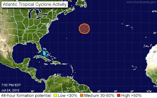
I'm going to keep this short and easy...because the either the orange circle in the North Atlantic or the Near North Atlantic will die out or become some type of tropical storm... shame to waste the name Ernesto on that but who knows.

Here's another map of possible area's of tropical cyclone formation...


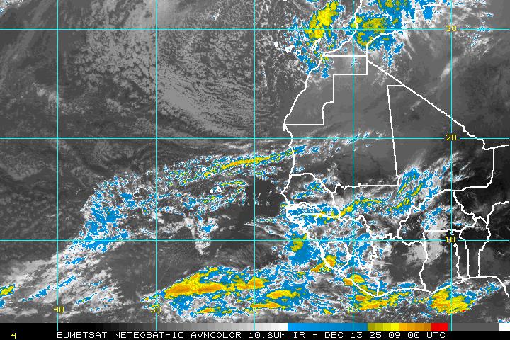
There is a beautiful wave off of Africa that is going to have a hard time staying together and models do not as yet support it. Note the big blue circle by the African Wave...


This is a real work in progress and will see what we see tomorrow with regard to what is still on the maps. Note, there is also a weak wave low down near South America that won't do anything big but it is there.

Models for the 40% Orange Circle:


Area up close and personal:


And, that is basically the bottom line.

One thing I do want to point out is the reason there is a system so far north with a 40% chance is because of the tremendous amount of tropical energy that is moving off of the Carolinas... look at this loop and see the bright orange flow east from Cape Hatteras?  Normally the flow would be from the south moving WNW... not due East off of North and South Carolina ... but with the tremendous heat we are getting and rain storms every day... moving east, it is building up this energy that I do believe later in the season can become a problem.

http://tropic.ssec.wisc.edu/real-time/mimic-tpw/natl/anim/latest72hrs.gif


The flow on the bottom of the map above is NORMAL.. it's called the ITCZ and even with the dust there is moisture there flowing east to west...   however..........the second orange line to the north is energy moving west to east ... that is not normal (though it is feeding the orange circle nicely) and nothing in between.

At some point.. something's got to give.

Keep watching.

Been busy with my daughter's wedding and travel arrangements and other things and honestly waiting all day to get a real feel for what if anything might happen ...models did show some small little burp of a storm up in the Atlantic or more so hinted at it.. let's see what the NHC hints at tomorrow.

Thanks for reading..

Besos Bobbi

Sunday, July 22, 2012

Officially Miami Tropical Wave... S FL... Yellow Circle

TC Activity

Well, that yellow circle went up rather quickly, a "special tropical weather outlook" was issued as wind reports of over 50 mph came in from several parts of the South Florida, Florida Keys area.. They didn't even wait until 2pm.


Models are great predictors of tropical development ...however you shouldn't have to wait until you see trees bending out the windows before you put up one measly, yellow circle. But, will give them credit, they did decide to issue official information on it that ups the attention level of the average person in the South Florida area.

Friends told me all morning how windy it was and is... wind at the ground level, not just rain but strong winds. There's a very tropical feel to the air this morning in South Florida and the Keys.


SPECIAL TROPICAL WEATHER OUTLOOK
NWS NATIONAL HURRICANE CENTER MIAMI FL
1040 AM EDT SUN JUL 22 2012

FOR THE NORTH ATLANTIC...CARIBBEAN SEA AND THE GULF OF MEXICO...

1. A VIGOROUS TROPICAL WAVE LOCATED OVER THE NORTHWESTERN BAHAMAS AND
THE FLORIDA STRAITS IS PRODUCING NUMEROUS SHOWERS AND A FEW STRONG
THUNDERSTORMS. A WIND GUST TO 53 MPH WAS RECENTLY REPORTED AT FOWEY
ROCKS FLORIDA...AND DOPPLER WEATHER DATA INDICATE STRONGER
THUNDERSTORMS ARE LOCATED OFFSHORE THE SOUTHEAST FLORIDA COAST.
SURFACE PRESSURES ARE HIGH AND UPPER-LEVEL WINDS ARE ONLY
MARGINALLY CONDUCIVE FOR DEVELOPMENT...SO ANY ADDITIONAL
ORGANIZATION OF THIS SYSTEM SHOULD BE SLOW TO OCCUR. REGARDLESS OF
DEVELOPMENT...THIS DISTURBANCE WILL BRING PERIODS OF STRONG GUSTY
WINDS AND LOCALLY HEAVY RAINFALL TO PORTIONS OF THE NORTHWESTERN
BAHAMAS...CENTRAL AND SOUTHERN FLORIDA...AND THE FLORIDA KEYS OVER
THE NEXT DAY OR SO. THIS SYSTEM HAS A LOW CHANCE...10 PERCENT...OF
BECOMING A TROPICAL CYCLONE DURING THE NEXT 48 HOURS AS IT MOVES
NORTHWESTWARD AT AROUND 15 MPH.

ELSEWHERE...TROPICAL CYCLONE FORMATION IS NOT EXPECTED DURING THE
NEXT 48 HOURS.

$$
FORECASTER STEWART
NNNN

http://tropic.ssec.wisc.edu/real-time/mimic-tpw/natl/anim/latest72hrs.gif


Small evidence of a possible system forming, though pressures are high...though they can drop and the GFS and other models are "hinting" at something trying to form or a weakening of the ridge at that point over the next few days..

Keep watching....
Besos BobbiStorm

Florida Tropical Wave

Well, the Cuban Wave just became the Florida Wave as it moved it's way predictably WNW into the Florida Straits.


Nice blow up visible on satellite imagery. Remember, the water temperatures are highest in the Florida Straits and through that region.

http://www.ssd.noaa.gov/goes/east/carb/flash-avn.html

Now remember something... it's not organized. For now it is just a big, blob of rain.. but anything that close a populated region bears watching as it will create misery during the day and there is always the chance something can develop down the proverbial road.

The NHC isn't a lot of help on this one. All they will say publicly is:

TC Activity

Nice but no cigar. They seem to have developed a new philosophy, culture there of not discussing anything until it becomes totally cyclonic... and unless you can decipher the Tropical Atlantic Discussion ...which I can but most likely you cannot...they are passing everything off to the NWS to breakdown as "local weather" and really that is no acceptable in my opinion. The local weather in Raleigh showed the wave down near Florida and highlighted it in their quick look at the tropics, they felt it was worth watching.. but no the NHC is on automatic this summer and they are not updating their page even for a zero% chance... hmmmmnnn....

Some discussion, even a little discussion on why it has a low chance or no chance would be appropriate during the Hurricane Season when people look to them for information not the NWS as they might a winter front south bound in December.

This is ...by the way...one reason I love www.spaghettimodels.com it covers the tropics and it's a rich source of information always... especially when TWC is showing taped segments during live, strong, severe weather events and the NHC is silent.

There is this rich dialogue out of the NWS office in Key West. Hope you understand it:


THE APPARENT INVERTED TROUGH FOUND IN THE ANALYSIS YESTERDAY...HAS
BEEN EXPOSED TODAY AS A TROPICAL UPPER TROPOSPHERIC TROUGH. THE
EVIDENCE IS IN THE WATER VAPOR IMAGERY WITH THE VORT LOBE OVER THE
SOUTHERN FLORIDA PENINSULA. IN ADDITION THE WESTERN EXTENT OF THE
ATLANTIC RIDGE IS TILTING A BIT TO THE NORTH WHICH IS RESULTING IN A
SUBTLE INCREASE IN WINDS OVER THE STRAITS AND HAWK CHANNEL. WITH THE
ADDED SPEED CONVERGENCE...LIFTING ON THE LEE SIDE OF THE TUTT..


There you go....they "found" an inverted trough in yesterday's analysis....

....in Melbourne's always excellent discussion the NWS is dealing with the same area and calling it a "Tropical Wave" rather than the detailed, meteorological term Inverted Trough, etc..

TONIGHT...TROPICAL WAVE FEATURE TRACKS INTO THE SOUTH HALF OF
FLORIDA. KEPT SCATTERED STORMS ALONG THE COAST AND SOUTHERN OSCEOLA
AND OKEECHOBEE COUNTIES WHERE THE MOST MOISTURE AND LIFT ASSOCIATED
WITH THE WAVE IS EXPECTED TO OCCUR. LEFT A SLIGHT CHANCE OF STORMS
KISSIMMEE NORTH OVERNIGHT WHERE THERE SHOULD BE LESS LIFT BUT STILL
PLENTY OF MOISTURE TO WORK WITH. CONSIDERING IT WAS 81F AT 2AM AT
THE OFFICE...UPPER 70S FOR MONDAY MORNING LOWS LOOKS REASONABLE.

MON-MON NIGHT...TROPICAL WAVE CONTINUES TO TREK NORTHWESTWARD OVER
THE PENINSULA. DEEP MOISTURE AND SOME VORT ENERGY ENHANCING LARGE
SCALE LIFT OVER REGION. THIS EXPECTED TO PRODUCE AN INCREASED
COVERAGE OF SHOWERS AND STORMS...WITH 60/70 POPS AREA WIDE WITH
NUMEROUS SHOWERS WITH EMBEDDED SCATTERED STORMS.

WSVN's blog says this about that:

http://www.wsvn.com/weather/blog/page/1/

The dust they are talking about is visible in this image as soaking up all the rain the way a miracle sponge would do if you could find one to clean your kitchen... good luck, I don't think they market Saharan Dust Sponges yet...

A voice of reason and knowledge is Phil Ferro who reminds us that Tropical Waves are fickle and anything heading in our way... deserves attention. He is so right. Attention means of course you pay attention to it. You would think the NHC could have at least given it a meager yellow circle with a Zero Percent Chance for those people who do not know how to surf the web, read my blog or go on Twitter looking for information.


Stormy Sunday?

Posted by Phil Ferro
As we head into the weekend, we could see the return of hazy skies as more African dust is expected to settle in. We may get a stray shower or storm on Saturday but by Sunday more rain could move in. The second half half of your weekend will offer wetter weather. Sunday may be hot, humid, and stormy due to a tropical wave located over Cuba. This wave is headed our way. Keep in mind, tropical waves are very difficult to forecast, they are fickle and unpredictable,so  rain chances are in place if the moisture behind this tropical wave holds.

Read more: http://www.wsvn.com/weather/blog/posts/MI95715/#ixzz21MHrIrXR


Back to BobbiStorm here...

The dust does a great job, but the dust begins to thin out on our side of the Atlantic so sometimes these waves go under the radar as if they have some cloaking device (called Dust Camouflage) and when they get into the Bahamas or cross over into the Gulf of Mexico they have a slim chance of developing.

Keep watching...

Enjoy the day.... go play somewhere or stay home and play... but whatever you do, enjoy today and check back tomorrow..

Besos Bobbi

Ps...note how dry the Atlantic is...those little blue dots are what is left of big Cape Verde Waves that exited Africa into the dry, dusty Atlantic.


Special Bonus Loop
Watch the Flow of Tropical Energy East off the Carolinas
High up there... something to keep watching
small possible "roll" happening with the 
Florida Wave


Saturday, July 21, 2012

Cuban Wave


http://www.ssd.noaa.gov/goes/east/tatl/flash-avn.html

And, I don't mean Marco Rubio...

Loop the loop above and you will see the Tropical wave work it's way WNW up the island chains without a name, without a destiny but with a definite plan in mind.  WNW, stair stepping it's way north. Not much else to watch in the tropics. May as well watch the wave.

Big storms over Texas every day as temperatures there climb up to dizzying heights. 107 in Dallas today,  the temperature that is...

http://www.dallasnews.com/incoming/20120721-saturday-s-107-degree-high-breaks-dallas-area-record-for-july-21.ece

Wild rainstorms in Raleigh today, crazy thunder and noisy, happy frogs.

And, in Key West it's hot... like it always is in July when drunken men who claim to look like Ernest Hemingway come to down and run around up and down Duval Street.

Just another day in paradise...

Wishing I was watching something more than a Cuban Wave...... but it's better than nothin'

Sweet Tropical Dreams

http://www.youtube.com/watch?v=aPNGrHI1s-o
surprise bonus track for a friend...


Friday, July 20, 2012

No Tropical Wxr News... Sad National News

Not much to say about the tropics today. Nothing happening.

A system is flirting with the Gulf, edges closer... comes near... frontal boundary and Upper Level Low. Shows you how you can't just go by one picture.


Not even one loop really.

http://www.intellicast.com/Storm/Hurricane/AtlanticSatellite.aspx?animate=true

People play games all the time, trying to convince people of things that are not true. There are a lot of strange, sick, weird, crazy people out there living there life to the beat of their own drum. This picture is an illusion.  I could... write some story to someone who didn't know the difference that Tropical Storm Suzette just made landfall in New Orleans... near the French Market. And, if you knew nothing about tropical weather you might go "wow, bulls eye on New Orleans" when in fact it was an illusion and there was nothing going on at all... just illusions and games.

In fact, there is a wave slowly moving through the Caribbean but you can barely see it. Transparent sort of clouds .. maybe I'm here, maybe I'm not. Maybe it could blow up later but the models show no development.

Then again... you could watch the system in the Gulf to see if something develops...or off the Atlantic coast as a frontal boundary once again disappoints and gets stuck across the Carolinas.

Sad day today for the nation... for people everywhere. Some man, for a reason none of us can fathom...but probably is connected to mental illness hidden away and kept up tight inside until he snapped killed a dozen or people in a movie theater in Colorado. Children, babies all targeted as their parents ran for the exits rather than staying down. Those who ran were shot... I mean seriously, what would you do? Lie down and pretend to be dead? Oh, and there was tear gas or what they think was tear gas... I'm an asthmatic, boy that would suck for me..if the bullets didn't get me the tear gas might.

Sad... very sad. Something happened... what we don't know...


So, on this day of National mourning for the dozen or more people killed and 40 or 50 more who were injured, say a prayer today for the families of the dead, the families of the injured, the injured and for this nation and people everywhere who have to stop pretending and stop being politically correct about mental illness. That may sound mean but I have several close friends and even a few distant family members who suffer from different types of depression or ADD.. most are fine, okay, just a little down sometimes.  Others, a few I know, need to be probably in some form of institution for their own good, for counseling, for drugs for a change... a shot in the dark that somehow they can be fixed for their own good and others around them... but no one in today's politically correct world wants to stand up and get involved... a lot of forms to fill out and repercussions..  I know a child who was in an institution briefly and needed help badly (a child of a friend) out West actually and they will not give a diagnosis because by law he is not 18 yet and it might preclude him from joining the Armed Forces. Right, like I would want him in the Navy...

I have friends who suffer from depression. Artsy types are prone to depression and being restless and they hide in their rooms, they rarely interact with others .. other than the many characters they create in best selling stories. They live on the edge...  they function, they survive... they thrive creatively and they barely live socially or take chances living the life they want.. filled with fears.

This is the world we live in.. it's a big, beautiful world. Some open it up like an oyster looking for the pearl and when they don't find it, they move on to the next oyster and keep looking for the pearl. Others sit dreaming of pearl necklaces, yet never live their dreams. Others sit James Thurber like playing games online or reading books, lying in a hammock creating fantasies in their mind.. some function, some don't. We over medicate, we underrmedicate. We eat garbage for food and you know the old computer programming saying, garbage in..garbage out.

We glorify a movie that is filled with violent characters and images yet we pretend publicly that we are sorry violence happened. Weird statement if you ask me by Warner Brothers.

I know... garbage happens, garbage in..garbage out and we make fun of people who go to Church and try and live conservative sort of lives... yet we seem to glorify dysfunction and accept it as a norm.

Somewhere...James Egan Holmes slipped through the cracks.. whatever haunted him or toyed with his mind ....there were signs, people ignored... sad, very sad for a dozen people and their families and the responders that dealt with the tragedy and the families of the 70 or so that were injured...

We need to start fixing our problems.

And, again ...Mother Nature doesn't have anything on this tragedy. A Category One or Two Hurricane would be a walk in the park compared to the nightmare in the movie theater last night in Colorado.

Besos Bobbi
Ps ...be glad you didn't hear my rant on gun control and hunting and the culture of violence and when was the last time you saw some 20 year old woman go crazy and shoot up a Mall or a movie theater and aim a gun at 4 month old babies or 5 year old children? Probably next to never...


Thursday, July 19, 2012

Dusty Waves in the Caribbean

It's something to look at it....


http://www.ssd.noaa.gov/goes/east/tatl/flash-avn.html

Look at it this way and know that if it hadn't gotten stuck traveling with dust it's whole life, dragging it down... it would probably have become one heck of a hurricane.

More later.... after we see what's left of it by 2pm.

No yellow circle...

Next we talk about the drop dead gorgeous wave off of Africa...


Besos Bobbi

Tuesday, July 17, 2012

Life Goes On...

So, I check the tropics pretty often... some have said I am addicted to weather and they may be right. And, maybe they aren't. Reminds me of a song a guy I went with liked... you may be right, I may be crazy ???   Crazy for Tropical Weather.

There isn't any.

I may go to a tropical shrink or a good chiropractor. Mid July and nothing out there on the tropical horizon.

Okay, I have said "tropical" often haven't I?

I wouldn't say I'm addicted to TWC ....but when the hair color box said to let it sit for "10 minutes" rather than setting a timer, I judged "10 minutes" by the "Local Forecast on the 8s"


Honest. If there was a Weather Watchers Anonymous group, that would definitely be my first confession.

So, now you know the rest of the story....................life goes on while we wait for something to develop.

If the NHC puts up a YELLOW CIRCLE on their website I may faint from the shock....

... hey ... maybe Fabio will try to do L.A. and head for California. If they are going to get weather from the tropics it would be in an El Nino year...

And, lastly...............to my dear friend... the ProducerSlashDirector... stop sending me end of the world emails... chill.... take a pill.............relax..........breathe... go watch a Meryl Streep movie.

Chow for now...Bobbi

Looping music:
http://www.youtube.com/watch?v=pJhcGepfG04


Monday, July 16, 2012

Convection & ULL Off Coast of Carolina... and Cousin Sal in Miami

The only thing worth looking at in the Atlantic Basin today is the ULL off the Coast of the Carolina, due East of Florida in that same tropical incubator that gave us Beryl and Alberto.  I do not expect tropical development, however I do expect a lot of color on the satellite imagery and a lot of rain along the Carolina beaches... possibly Georgia...


Note the ULL in this Water Vapor Image off the coast of South Carolina and note the moisture below off the coast of Florida.


Interestingly the moisture that usually lingers over South Florida has been swept away and it's getting caught up in the swirling Upper Level Low to the NE. Watch this loop and you can see it played out. If you are in South Florida today, take a walk on the boardwalk... sip a drink from the ocean side restaurant behind the Ritz-Carlton and enjoy the view. The moisture has taken a bus for the Coast of Carolina.

http://www.ssd.noaa.gov/goes/east/eaus/flash-avn.html

Here's the discussion out of Savannah, one of my all time favorite cities to do nothing in but soak in the flavor of the city itself, a beautiful place if you have never been there.. a must see.

".NEAR TERM /THROUGH TONIGHT/...
NO CHANGES NEEDED WITH THIS FIRST UPDATE OF THE MORNING. RADAR
SHOWS POP UP SHOWERS RIGHT OFF THE BEACHES FROM ISLE OF PALM TO
KIAWAH TO OSSABAW ISLAND...WHICH SHOULD MOVE INLAND AS THE MORNING
PROGRESSES. I PUT OUT A MARINE WEATHER STATEMENT MENTIONING THE
CHANCES OF WATERSPOUTS DUE TO FAVORABLE ATMOSPHERIC
CONDITIONS...BUT NO REPORTS AS OF YET.

OTHER THAN A SPOT OR TWO...WE NEVER REALLY SAW MUCH IN THE WAY OF
GROUND FOG THIS MORNING. THAT WILL BE REMOVED FROM THE GRIDS AT 7 AM.

&&

.SHORT TERM /TUESDAY THROUGH THURSDAY/...
PRETTY GOOD MODEL AGREEMENT THIS PERIOD. A CLOSED MID/UPPER-LEVEL
LOW LOOKS TO MOVE INLAND FROM THE ATLANTIC TUESDAY BEFORE WEAKENING"

 If  you go to the Myrtle Beach information, another fun place,  that will experience possibly severe weather today due to the proximity and movement inland of the Upper Level Low that is swirling off shore...visible on radar.

".NEAR TERM /THROUGH TONIGHT/...
AS OF 3 AM MONDAY...GRADUAL MOISTENING OF THE COLUMN TODAY AND
TONIGHT AS AN UPPER LOW MAKES ITS CLOSE APPROACH TO THE COAST FROM
THE EAST. THIS UPPER LOW WILL COME IN PHASE WITH AN H/5 TROUGH
TRANSITING FROM THE WEST...THEN WILL DIVE SOUTHWEST ALONG THE
COAST AS IT COMES UP AGAINST STRONG UPPER RIDGING OVER EASTERN
CONUS. AT THE SURFACE WE WILL SEE LITTLE CHANGE IN THE OVERALL
PATTERN...WITH A PIEDMONT TROUGH STRENGTHENING INLAND AS A BERMUDA
HIGH REMAINS ANCHORED OFFSHORE.

EXPECT ANOTHER DAY OF CLIMATOLOGICALLY-CORRECT TEMPERATURES AND
ISOLATED TO WIDELY SCATTERED CONVECTION STARTING LATE THIS MORNING
AND CONTINUING INTO THE EVENING"

My point I suppose is oddly there is a lot of rain caught up in the Upper Level Low that is reaching the ground, yet the dust that is shutting down the Atlantic Hurricane Season currently is at very high atmospheric levels. Odd? Maybe? Not sure... seems strange.


"Cousin Sal" dressed in red moving towards a date with the Bahamas and South Florida.

Again.................the season has been shut down NOT by the developing El Nino BUT BY THE AFRICAN DUST that has sucked all of the tropical moisture out of the Atlantic Basin. There are other complicating factors but the main factor in the Atlantic is the African Dust.

My friend Ken, who writes for the Sun-Sentinel, brings up an interesting point. The dust is at a high level, not expected to dump itself on cars in the Hollywood Florida area as it so often does. It still is a problem for people with breathing problems, anytime the dust is near however it's higher up than normal. Interesting. 

http://www.sun-sentinel.com/news/weather/fl-weather-week-20120715,0,5641907.story
Yup cousins can sometimes be a pain in the neck, other times they are your best friend and your partners in crime.In this case, "Cousin Sal" is doing his thing and the waves have not been able to develop. Sort of like a really good hitter coming to bat, but not as good a hitter as a great pitcher not letting the ball make contact with the bat. Score one for Sal. 

Note the wave off of Africa that everyone on TV was gaga about has hit the dust... the dirt, dying in a cloud of African Dust, choking it off at it's roots... unable to breathe it is just slowly withering away.

As for me, gonna play today. Gonna go to one of my favorite places, have a healthy snack, sip some good local coffee brew and write a bit today. Take a ride, watch the world fly by and gonna worry on the tropics tomorrow. As for cousins, there's an old saying "Man plans, God laughs" and imagine that applies here somewhere.... then again my father used to always say...with a chuckle... "God has a funny sense of humor."  Time will tell... 

Song for the day: One of my all time favorite songs... I so love this song.
Besos Bobbi

Ps.. "sun and the moon seem to acknowledge each other" "his heart was a low country heart" "African drums..." "the bulldozers bury the past" "while fortune plays on borrowed days in their alligator shirts, now I realize who killed the Prince of Tides" incredible song ...... "history was there for the taking" JB who loves F. Scott Fitzgerald understands how the spoils go to the rich and the rich feel they can do anything they want to do... even if it means buying up the sunrise.  

http://www.youtube.com/watch?v=z4znyqGIWH8

Gotta click to hear the song...

http://en.wikipedia.org/wiki/Daufuskie_Island

Bonus track... another great Jimmy Buffett song... 

"Diamond as big as the Ritz, whatcha gonna do with it

A blessing can become a curse if you keep it to yourself...
....the prophecy of the unattainable dream"

"every day he lives in fascination"

"Whatcha gonna do with this, tell me whose gonna save you...
....when you're a slave to the diamond as big as the Ritz"

great fusion there...FSF and JB...

sweet tropical dreams................

http://www.youtube.com/watch?v=iXvJzPRE2jY


Sunday, July 15, 2012

Quiet Sunday... Nothing Going On...

Well, something always going on... just sometimes you can't see it...

New strong wave off of Africa has possibilities but not jumping all over it just yet.

Watch the area north of the Bahamas, East of Florida, south of South Carolina near an old frontal boundary and weird mix of old tropical wave and ULL.

Enjoy the day... Besos Bobbi

Friday, July 13, 2012

TGIF, RSW WXR, Wake Up Little Suzy, Mercury Retrograde & Solar Flares

This morning's post is a round robin of tropical thoughts and esoteric trivia that is relevant today as we go into this weekend.

First off.... the main area to watch today is the area off the West Coast of Florida. There was a weak, surface circulation yesterday (over land) near the coast moving west... there has been consistent rain for days in a line from Key West north to Tampa dumping rain on areas already water logged from Debby. There is also an Upper Level Low in the Gulf that will make it hard for anything to really get going. But...we are watching pressures in this area as we watch for the E storm to show his face and stop playing peek a boo!

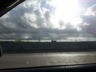
Going to show 3 views of the same picture here... radar, TV sat and a picture my brother took on his way north towards Tampa.

Radar...note yellow cell off shore


TV Satellite View:


Picture From the Road Looking West... at yellow cell on Radar

(thank you Ron)


Bottom line: 
There are always different ways to look at the same thing... and there is definitely something there. However, surface pressures are still high and it's nothing more than something to watch... or take a picture of on a morning drive to Tampa. Nice of my brother to listen to his sister and drive carefully, but take pics!  

So, if you are flying into RSW you might expect a bit of a bumpy ride, however that is par for the course for that area isn't it? Guess that's why so many people going there go to FLL and drive across the state...or they like the ride or view of the Glades I guess...

Either way................RSW to TPA is a bonanza for weather chasers looking for the perfect picture. As a friend says, "Never Stop Chasing" (Reed always makes me smile) and... from what I have heard my Great-Grandpa spent most of the latter days of his life sitting on the porch overlooking Tampa Bay watching the clouds and the water. Weather watching IS genetic!

Bottom line if you are in the Carolina's you are watching the end of the front that is sitting offshore as there is the smallest sense of  swirl there not the area near SW Florida. Local news shows that spot, not the spot down near the Keys and Tampa...  

And, to me.... bottom line meteorologically... am still watching the ULL in the Bahamas that is moving west, due to move west across the State of Florida. I'm noting more moisture, a continued trend.. and note that big circle of color off the SW Coast of Florida.


And, in the world of the weird.... again am going to mention what Weather Astrologists have been talking about (yes there are some online and offline) .. Mercury is going Retrograde on Saturday. Often weather models do not work right...according to them and mix ups create quirky forecasts and sometimes systems RETROgrade vs doing what they are suppose to do. So, between the solar flares and the mercury retrograde ...watch out. i want to say Hurricane Betsy's weirdness was during a Mercury Retrograde...will research that today.

TGIF... So looking forward to Shabbos.... a day to relax, watch the weather outside from the deck if it is not raining too much, take a walk... do some good reading, rest my mind and enjoy good food with family and friends.

Will update this as weather and time permits IF something changes.... at some point the NHC is going to have to break down and put up a yellow circle somewhere.............

Besos Bobbi

Ps... may go see the new Rob Reiner movie this weekend... maybe... break my own rules regarding Rob. Some mean reviewer trashed it and I found myself feeling protective and sorry for him and annoyed at the viewer and I thought it looked nice... um... maybe... possibly... we'll see. Why are people so mean? I was "pissy" not mean and for a reason... something to think on I suppose as the basin is quiet. Or not... enjoy the song.... a great song sung by so many but I chose the this version in honor of annoying brothers everywhere.... Wake Up Little Suzy... ;)  


Moral of the story... well you know the moral of the story.... are they singing "what are we gonna do with your mom???" lol someone should definitely have Crepe Suzettes on Bastille Day! 


I may eat strawberries again but note I am NEVER EVER NEVER going to go see any  movie named Ted or with the name Ted in the title ;) and note I can out sneak some sneaky people any day of the week... never believe everything you "hear"  ....   end note to "crazy friend" et al...


Thursday, July 12, 2012

Watching the Tropics and Waiting...


I keep watching the Juice Loop and watching the passage of energy from one area to the other in the Great Big Blue Tropical Basin... a lot of blue and I don't mean "sky blue" but dry blue... dry air and a lack of yellow orange color which is what we should be seeing.  It is worth noting the ITZ is beginning to become more in line with climo... still a lot of African Dust drying out the Far Atlantic ..


So, nature being nature wants to flow, to move, too ooze and transfer energy around the planet so she looks for another way, another opening ... like a "back door" on an old computer. 


Hurricanes serve a purpose, so do Upper Level Lows as do all types of weather, they keep the air moving around Planet Earth. Mixing, moving, flowing.... we are not a stale, stagnant planet and the upper level air patterns, ocean currents... all work hard ..overtime actually to keep this a beautiful place for us to live.. most of the time :)


Studying the tropics without the help of an INVEST or the NHC issuing more information as they do when there are yellow circles means reading and talking to friends on Twitter, reading various governmental discussions which don't say much and going with your gut... it's not easy. It's like playing I Spy or whatever it is people play now days.


From the Atlantic NHC Discussion

 "UPPER LEVEL LOW IS CENTERED OVER THE CENTRAL GULF 
NEAR 24N89W. RAIN AND SCATTERED SHOWERS ARE N OF THE YUCATAN
PENINSULA FROM 21N-27N BETWEEN 85W-91W. EXPECT THE TROPICAL WAVE
TO MOVE W OVER THE NEXT 24 HOURS WITH CONVECTION. ALSO EXPECT A
SURFACE TROUGH TO BE OVER THE TEXAS COAST OVER THE NEXT 24 HOURS
WITH CONVECTION."

SEE: Upper Level Low in the Gulf that is going to blow the nice little circulation center ..or "twist in the atmosphere" near Tampa out of the water.. most likely.

http://www.ssd.noaa.gov/goes/east/gmex/wv-l.jpg


Note the reason you go to the WV is because on other imagery you cannot see the Upper Level Low, it is as if it goes rogue.


Look how detached the ITZ flow is from the moisture up near Florida. For something to really get going it needs to make a connection. A quarterback needs a receiver to throw or pass the ball to or he grounds it or goes down trying to scramble. Hoping that makes sense...

Next you go to the Marine site.............and it says:
"SYNOPSIS...A FRONTAL TROUGH HAS MOVED INTO THE NW WATERS AND IS
EXPECTED TO STALL FROM THE MISSISSIPPI DELTA TO SE TEXAS. THE
RIDGE WILL REBUILD W TONIGHT PUSHING REMNANTS OF THE FRONTAL
TROUGH NW OF AREA EARLY FRI. TROPICAL WAVE ALONG 82W S OF 25N WILL
MOVE INTO THE MIDDLE GULF SAT AND SUN...THEN WEAKEN AS IT PASSES
THROUGH THE SW GULF ON MON."


THEN you go to the Discussion out of Tampa NWS:


UPDATE...

"A WEAK AREA OF LOW PRESSURE IS LOCATED NEAR THE MOUTH OF TAMPA BAY
THIS EVENING...WITH SCATTERED SHOWERS AND THUNDERSTORMS CONTINUING
ACROSS THE FORECAST AREA. WILL CARRY CHANCE POPS ALL AREAS THROUGH
THE REMAINDER OF THE EVENING HOURS...WITH ACTIVITY THEN EXPECTED
TO FOCUS OUT OVER THE GULF FOR THE MOST PART AFTER 2 AM. THE
EXCEPTION WILL BE OVER COASTAL ZONES...ESPECIALLY ACROSS SOUTHWEST
FLORIDA WHERE STEERING FLOW AND SURFACE SPEED CONVERGENCE WILL
REMAIN MORE FAVORABLE TO PUSH A FEW SHOWERS/STORMS ONSHORE.
OVERNIGHT LOWS LOOK ON TRACK TO BOTTOM OUT AROUND 70 TO THE LOWER
70S INLAND AND IN THE MID TO UPPER 70S AT THE COAST."

Back to the NHC Discussion regarding the diffluence out near the Upper Level Low that I wrote about this morning.

THE ATLANTIC OCEAN...
TWO TROPICAL WAVES ARE OVER THE ATLANTIC. SEE ABOVE.
ELSEWHERE...WIDELY SCATTERED MODERATE CONVECTION OVER THE
BAHAMAS FROM 25N-29N BETWEEN 72W-80W MOSTLY DUE TO UPPER LEVEL
DIFFLUENCE FROM AN UPPER LEVEL LOW CENTERED NEAR 27N74W. A 1032
MB HIGH IS CENTERED W OF THE AZORES AT 36N37W PRODUCING FAIR
WEATHER. A SURFACE RIDGE AXIS EXTENDS SW FROM THE HIGH TO
32N70W. IN THE UPPER LEVELS A SERIES OF SMALL UPPER LEVEL LOWS
ARE CENTERED OVER THE CENTRAL AND WESTERN ATLANTIC AT
33N42W...26N64W...AND 27N74W. SCATTERED RAIN AND SHOWERS ARE
NOTED OVER THE CENTRAL ATLANTIC FROM 23N-28N BETWEEN 44W-62W.
EXPECT...CONTINUED CONVECTION OVER THE BAHAMAS OVER THE NEXT 24
HOURS. ALSO EXPECT CONTINUED PRECIPITATION WITH THE TROPICAL
WAVES.

BOTTOM LINE:


NOT MUCH HAPPENING... BUT... NOW ...there is more to watch than yesterday... 


Nice day today on a personal level. Nice despite a bad headache, too much rain, too many cicadas and yet had a nice day... a quiet dinner with Tofu Curry and Sushi :) and Thai Tea... nice... very nice. An almost cool breeze in the evening. Watched Burn Notice and enjoyed the AIR BOAT RACE ... now that is Old Miami.  Someone working on that show must really have a touch of Old Miami in them.

Enjoy the nice weather.... if you don't have nice weather... do something else... go to a Mall, a library ..crank up the music and play Jimmy Buffett... one thing you know for sure about the weather always, wait a while... it will change :)

Sweet Tropical Dreams, Bobbi

Ps... a Space Alert of sorts has been issued for Solar Activity which will hit the earth just about the time the Mercury Retrograde begins on July 14th.... which coincides with Bastille Day... have some French Campaign and enjoy the day.

ULL in Atlantic West of Florida -- Worth Watching

12 Hours Ago:


Same ULL 12 hours later... NOW. Note how the dark area has been filled in with convection which is growing and may continue growing as the day progresses. 

Something's going on there and it is worth watching! Nothing else to distract you tropically unless you want to watch the storms in the Pacific.

So, this morning's tropical ramble is a heads up to continue watching the evolving ULL in the Atlantic west of Florida. It's location and size warrants us to watch it... even though nothing may develop. The reason we watch is twofold. It's compelling, it grabs your attention and it's hard not to watch. It's also mesmerizing in it's way. And, the second reason to watch is that sometimes storms do develop from these close in systems, old frontal boundaries, Upper Level Lows working their way down through the levels grabbing moisture where they can to suddenly transition to tropical and when they do so they are not 1,200 miles away in the Atlantic from a Cape Verde Wave that is going to miss the islands but they become a system that is up close and very personal way too close for comfort. They happen.... like Grace mixing it up with all the other factors that brought you The Perfect Storm.

http://en.wikipedia.org/wiki/1991_Perfect_Storm

Vinnie was another one like that, check out Hurricane Vince.
http://en.wikipedia.org/wiki/Hurricane_Vince_(2005)

There have been many hurricanes, more than we realize that formed in non-conventional ways because the problem with Hurricane History is we only remember the big storms, the most common patterns and we forget how quirky the evolution of some storms can be. We also only read about them after the start to develop and we don't read about the wave that worked it's way west across the entire Atlantic from the Cape Verde Islands unable to ever pull itself together due to many factors and then finally south of Cuba... it finally gets it's groove on and turns into Hurricane Camille. The storm charts start with the storm forming in the SW Carib, but it started in Africa. It might have even started in the Indian Ocean, as many Cape Verde Waves come off of Africa and can be watched before they even build up over the Congo... over the Indian Ocean.

Camille:

Trivia question...did you know the NHC was tracking 2 storms that formed on the same day. Debbie 1969 went out to sea... the Atlantic was not a user friendly place for waves to develop in the Summer of 69.


Look at the Labor Day Storm of 1935. It didn't "just form in the Bahamas" but it blew up there.


It's a slow process sometimes and we forget where the moisture originally came from to form a "tropical wave" ...

My point... we often forget the origins, the beginnings of the mess we find ourselves in...no one ever goes back to the beginning and no one ever studies "history" vs the "science" of weather.

Models, tropical ones...not Victoria Secrets ones...do take that into consideration while making predictions however.... sometimes you get a year that does not fit one pattern... like this year. It's a transitional year. Transitioning to El Nino, however El Nino like Alzheimer's is only diagnosed completely after the fact. That's not forecasting, that's diagnosing while looking in the rear view mirror.

Hurricane Forecasting is not a perfect science, it's a science in progress....and we are getting so much better now at it than we did years back when the 1935 Labor Day Storm "BLEW UP IN THE BAHAMAS" from nowhere.  It wasn't from nowhere, it has a slow evolution and the ingredients did not ripen until that point on the globe... it didn't just pop up from the Bermuda Triangle.

Hurricane Betsy in 1965 barely survived a very slow, tortured birth and early childhood. Like Andrew it almost didn't make it.  One of the best, detailed discussion of the formation of Hurricane Betsy is in a paper published long ago. It's the behind the scenes story..not the one you read on the major sites that will tell you how much damage Betsy did in Florida and Louisiana. I own a copy, let's call it a gift from someone at the NHC... fantastic reading.

History repeats. It does not repeat often with the big ones. It repeats enough that the coastline of North America over time has been formed, carved away by the currents of the Gulf Stream and storms that formed and worked there way north and east out to sea...or that slammed into some small town.

This is why meteorologists are always looking for that "close in" development that could suddenly turn tropical. Maybe this will... maybe it won't, but it's possible. Or let me rephrase that... in any given year, on any given day anything is possible in the tropics. If you don't believe that, explain Hurricane Alice that developed on December 30th, 1954 in the Caribbean.

Keep watching... there has been an ongoing hand off of energy from the moisture over Florida and possibly the region to the north which is the remains of the old frontal boundary lingering just off the coast of Myrtle Beach and that moisture is getting slowly entrained into the ULL out there spinning that the NHC sems to be ignoring ...waiting to see if it's worth writing about or circling with yellow.

Big kudos to the people online who discuss these events and stick their necks out talking about them rather than writing "No Tropical Development for the Next 24 Hours" and really appreciate sites like http://www.spaghettimodels.com/ and others that are loaded with the little data that people like me love to feast on for breakfast.  


Note there is a small purple circle south of the Carolinas. A slim possibility, yet one does exist. Those  are the things you find on Spaghetti Models. Jim on Hurricane City with his Tropical Update. They delve deeper, than the average Moe when looking at the tropics... to give us a heads up on what is happening.


They know... history repeats itself. History always repeats itself... 


Something definitely evolving....then again.... it might fall apart.


Keep watching...especially if you live in Florida or The Bahamas ;)


http://www.youtube.com/watch?v=sTUIHK7gHRE <-- enjoy am in a forgiving funny mood ;)

Besos Bobbi


http://www.amazon.com/synoptic-study-incipient-stages-Hurricane/dp/B0007K2TQQ