Hurricane Harbor

A writer and a tropical muse. A funky Lubavitcher who enjoys watching the weather, hurricanes, listening to music while enjoying life with a sense of humor and trying to make sense of it all!

Thursday, July 31, 2008

Strong Tropical Wave in the Carib and Strong Storms in Minnesota Today


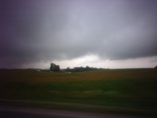
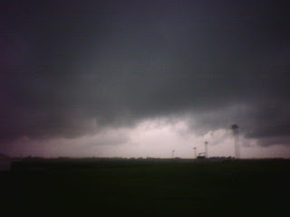
First off drove through really wild storms in SE Minnesota this morning on the way to the airport. Amazing, so different from Miami. The sky gets so dark and then gets darker and darker and then it opens up and storms. Not like Miami. My son was right about that, very different. Winds blew, the weather radio doesn't work cause we were too far between big cities I suppose... the phone didn't work either so couldn't tell what was happening but the last time I saw corn fields bend like that was in the movie Twister!

Wild... really.

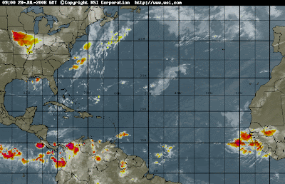
As for the tropics.. nice wave in the Carib however there are supposedly strong winds and shear that will rip it apart. However it's looking pretty good right now. Looks can be deceiving though.

Water too cool by Africa and the air too dry.

So... the Carib and possibly the Gulf are the only game in town.

I'll be back in town tomorrow... more later.

Besos Bobbi.. from Houston in transit!

Leaving Iowa - Storms Everywhere But the Tropics


Some possibilities here and there in the tropics but nothing that is going to get a name today.

A wave in the NE Carib looks interesting as it is moving into warm water soon and sometimes things like that can spin up but doubtful. The SW Carib looks quieter. The wave off of Africa is having problems with dry air and probably SAL though haven't checked SAL today. It's clearly having problems either way. Nice little wave crawling along 2/3 of the way to our hemisphere that could flare up over warm water soon.

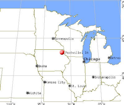
Had a nice trip. Saw my son with his baby, saw my other son, saw my grandson and that was nice. Cute, very cute. Older sons are cute too! Postville is as nice as it always is, filled with warm, friendly people. Nice lady next door has a large garden in her yard where she grows most of her summer vegetables. Her husband reads the paper while she gardens. They both look fairly happy. Content. Productive. A lot happier than people running around in the big city complaining about traffic and the high cost of produce and stress. Makes you think. They also seem not to worry much on global warming or other big problems. Gas is a bit cheaper here too.

So.... have weather today on the way to Minnesota maybe I will get some good pics? And, looking forward to a cup of Caribou Coffee at the airport (really is better than Starbucks I think.. can't believe I say that) and a long layover in Houston where I can play online a bit.

Miami awaits, steamy, tropical and thundering from what I've heard. People in Miami talk a lot about hurricanes when you get a really wet July. Someone do statistics on it, I have... wet July's usually lead into tropical summers.

Take care.. leaving the land of white bread and corn fields. Love to you all and watching the radar.

Be well.. Besos Bobbi

Tuesday, July 29, 2008

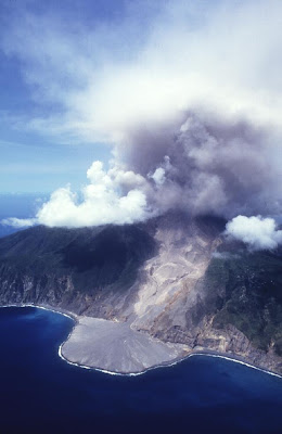
LA Shakes but Montserrat Blows Its Top... in the Tropics


And people in hurricane circles wonder if this can in any way affect the weather most specifically hurricane weather? Does ash lingering in the atmosphere interfere with tropical development?


http://stormcarib.com/reports/current/montserrat.shtml

well?

I do remember in 1997 there was a lot of talk... here we are and again we are talking.
http://stormcarib.com/hurr97b.htm

Went for a walk over to the library here, very nice. Warm winds and pretty gardens.
Will post pictures later but you get the idea..nicer than LA which is still rattling from aftershocks from the 5.4 earthquake earlier today.

Stay safe where ever you are.. and maybe something might form in the Gulf of Mexico.. maybe, you never know. If it lingers around long enough... worth watching.


They have apple trees here and grape vines in backyards and pretty flowers, friendly people.

More later..

WXR RADIO for Postville, Iowa

My son sent me the link:

http://www.weather.gov/nwr/streamaudio.htm#livestream

Wow..do I feel better!

:)

Going over to the general store and the library later. Big City!

Hello From Postville, Iowa... Watching Waves from Far Away


No tropical development in the Atlantic Basin today which is good as I am far, far away in Postville, Iowa. I did miss the big storm of protest earlier in the week here but today it is quiet and bucolic in Postville. Warm, sunny and not very tropical!

I do like the wave off of Africa. Really, beautiful structure and moving slow and I think it's a keeper. I don't believe it will re-curve fast as I do not see development that fast. I don't think the models are dealing with reality and they don't seem to remember it's July not September. It may never develop, it may fizzle but it isn't going to zoom off to the Azores so fast. Well, I don't think so... hard to tell anything for sure in July and it is still July.

So..from the wonders of wifi I have the Internet in Iowa and from the wonders of satellite TV I have TWC and about 500 channels. So, I will be watching and reading from out here in the heartland!

See the wave:

http://www.ssd.noaa.gov/eumet/eatl/jsl-l.jpg

I'm watching that wave all the way from far away in Iowa!

What did I get to see besides the yummy little baby boy?

I did get to see a beautiful sunset in a beautiful, bucolic setting of a cornfield from the side of the road. When I can upload my pics I'll post some on the blog. Unfortunately Virgin Mobile does not work in this part of Iowa. Actually, neither does Cingular unless you are on certain hills from what I have heard. Amazingly, my sidekick does at times.

I saw a beautiful rainbow as we flew out of Houston, the colors are so vibrant from the air. It was beyond beautiful. I made the blessings for a rainbow and smiled. Flying into Houston as we went over the storms in the Gulf there was a little bit of turbulence. And, I wondered again could those storms organize? Is it possible?

Arriving in Minneapolis I realized it was about 35 years ago almost to the week that I came to Minnesota for the first time. Years ago... spent a few summers of my life here. I love Minnesota, it's clean, pretty and almost looks normal or whatever my image of normal is other than palm trees blowing in the breeze on south beach in an afternoon thunderstorm. And, I found myself wondering as we drove down from Minneapolis what it must look like here in a thunderstorm. Such a beautiful ride.

I love the open sky and to be able to watch the clouds dance across the horizon which they do here in Iowa or this little corner of Iowa that is more Minn/Wisc I think in ways than Iowa. I wonder does Kansas and Oklahoma look like this? Looking down in the plane all I saw was farms and wiggly sort of little rivers.

What is in a name? Looks a lot like Wisconsin to me in parts.

Speaking of cheese.. my son works at the cheese plant as a kosher supervisor and he has now learned how to make cheese it seems. Last night he made ricotta cheese from buttermilk that he made earlier in the week. Life on the prairie. A month or so ago he helped deliver a calf on the farm near here.

Okay... so enough of Iowa. People are friendly here, no matter what anyone has told you and it's pretty and warm and I am visiting my yummy grandson. So, cute. Adorable. Really, have seen a lot of kids and he is one of the cuter ones. Mother and Father are doing fine and no they are not from Iowa but California. The baby may have been born in nearby Decorah but his father was born on Sunset Boulevard in Los Angeles at Kaiser Hospital!

What a world... so big and so wide and to get away like this is a real treasure.

So..that's it. Lots of Somalians here lately it seems. I saw them walking through the streets though this shouldn't be such a big surprise as the first thing I saw upon arriving at MSP airport was Arabs everywhere, walking around and orientals. I remembered again how International and Big City Minneapolis is and has always been. Sort of like Portland Maine, a real cosmopolitan mix of people mixed in with the original Swedish and Norwegian farm folk who first lived on these northern plains.

It is America and it is America at it's finest. A land where people have come for centuries to start over, to find work, to find new lives and to live safe far from persecution and prejudice. My great, great grandparents came from England to the South and lived in Key West and Tampa. My ex-husbands family came from Germany to escape persecution. My children are genetically linked forever with the Frank Family for if Anne Frank had lived and made it to America as was her dream she would have been my kid's great-great Aunt I suppose if I did the genealogical math right.

So, here I am watching African waves from the heartland in a city where a meat packing plant keeps the little dying city alive with revenue as it's workers from all parts of the world find work and spend their money.

In the words of the great Dolly Levi of the Matchmaker/Hello Dolly fame not the Tropical Dolly "money is not worth a thing unless it's spread around encouraging young things to grow."

In Iowa things are growing.. more than just cornfields, the IGA food market stays alive, the schools stay alive and when a town loses it's school it tends to die out and corn grows and cows grow and children and families grow.

And, the clouds grow... and maybe while I am here I'll get to see some real Iowa Afternoon Thunderstorms.. or any thunderstorms before I travel back to the tropics.

OHHHHHHHHHHHHHHH BY THE WAY........ my weather radio doesn't work here? Hello? Does that make sense? Don't they have tornadoes here? I asked my son but he says he just goes to weather.com with a live stream and the town has a siren to let you know if there is a twister nearby............. okie dokie... well don't I feel safe.

Besos Bobbi

Monday, July 28, 2008

African Wave & Sneaky Wave in the Carib???


Hi.. posting this from the beautiful Ft. Lauderdale Airport that has free wifi access and lots of places to charge computers. As airports go.. FLL is one of the nicest.

Just wanted to point out that this being the tropics things can pop up anytime even if they are not highlighted in yellow or orange crayons on the NHC maps. Doesn't happen often but enough so don't let your guard down because when things spin up close to home they just act like it was always gonna happen and the hype begins.

That being said.. it should be a quiet week. Then again I have a friend Yaffah who always says never say "should" so.. please note the wave down by the Caribbean that just appeared to flair up suddenly. Like hello?

And..further off by Africa is one beautiful wave, beautiful. Keep an eye on it and let's see if SAL will cause problems or not.

Enjoy.. I am off to Iowa! Via Houston. Talk later!

Besos Bobbi!

Thursday, July 24, 2008

Hurricane Holiday


As Dolly moves very slowly west, still dumping rain and still visible on satellite imagery as a storm hungry hurricane trackers look for snacks in the fridge but aren't finding any.

There is a delicious dot out over the Ocean...far away and not convecting a lot but it is a dot and it does have color.

This wave came off as a wild wave, great circulation and a pocket of moisture bigger than Australia but alas it lost it's convection and became what is commonly known in my parts as "a naked swirl" however it's not totally naked. It's clinging to a fig leaf there and it's pocket is still visible on visible but for now.. it's just a dot that hungry trackers are eying as Dolly slips away and it's a big quiet ocean.

Updates on Dolly and Damage later.. just highlighting the Swirl and saying that I like the wave behind it better. It's lower. I know it doesn't have the stuff the higher wave does but it's not as high.

Note the NHC has pretty much dropped it and the NRL isn't doing much with it but those just tracking are still watching the wave so I am mentioning it. For their sake ;)

Location, location and location.

More later... Bobbi

Wednesday, July 23, 2008

Hurricane Dolly Recap & Bits of News

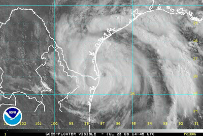
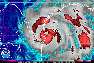
Hurricane Dolly made landfall near South Padre Island this afternoon around 2pm.

Not much I have to add and am too tired to add it even if I could think.

Beautiful pinwheeling storm and a lot of damage, trees down, hopefully nothing too much structurally though tomorrow will tell the tale. Some flooding. We'll see.

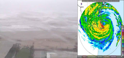
Great video of Cantore doing what he does best. Standing in a Cane screaming..

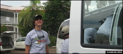
Interesting story here for those interested in the human side of things. I have a son Zalmy in Orlando in a similar camp and thought to myself a few times when I planned to send him away ... "could a hurricane hit while he is at camp?"

I have a son Levi who was away in camp in NY State one summer and they walked on the Jewish Sabbath to some small temple in a nursing home every week to help with Sabbath prayers. He called me up one Sunday and asked me to send him new sneakers. Seems they walked on Saturday (the shabbos) and it turned into a several hour hike through nonstop rain. The sneakers were near shredded. I said, "you walked thorugh a hurricane!" Who knew? (Obviously not him) Hurricane Bob, outer bands.. Was years back before every camp is online and you can text news in and out. The old days. But.. hurricane season comes and down south we think on these things and obviously should up north as well. The lady at the post office who helped me get the sneakers into a Priority Mail Bag asked why I was sending him sneakers. I said, "he walked through Hurricane Bob!" Should have seen her face........

So...this is a good story on how a camp had to evacuate and imagine a few parents of any religious denomination can imagine having your kids evacuated during a hurricane.


"A camper from Camp Gan Israel of South Padre Island takes a look at the sky before leaving the Texas coast in advance of the approaching Hurricane Dolly."

http://www.chabad.org/news/article_cdo/aid/705210/
jewish/Hurricane-Dolly-Arrives.htm

As for me... my son Shuky and his wife gave birth to a baby boy in Postville, Iowa early this afternoon just as Dolly was coming ashore in Texas. So... guess my weatherboy son now has a weather baby :) I'll be going to Iowa for part of next week so if we can keep all hurricanes away from Miami until after I come back I'd really appreciate it!

Wow, am I tired. Fell asleep to Dolly spinning on radar last night. Today seemed forever, the storm edged slowly towards the coastline and I kept waiting for word from my son .. my little Shuky lol.. now I am going to bed.

Very cool, very exciting day.

Guess those kids will have a summer to remember and will tell over tales for years to come. Years back my ex-husband took the kids from Hebrew Acacemy in Long Beach CA to the Grand Canyon one President's Day weekend and they got snowed in with a rare blizzard. There was flooding in Arizona where they were, then they went to the Grand Canyon..snow! They got stuck at the El Cajon Pass with high winds and they wouldn't let the big camper go across. Was like the trip from hell... for the people planning it but they ended up putting the kids on an Amtrak to get them back to Long Beach, California and for years all the kids remembered from that long weekend was the snow and the train ride back. Kids in LA/Long Beach rarely see snow or trains. The parents were nuts... they called me when they heard about the flooding, they called me when they heard about the snow and then....the high winds. I was home with a baby and my best friend who had a baby the same week. Like one long slumber party :) we took phone calls from worried parents as our husbands tried to figure out how to get them safely back to Southern California.

Being a parent... happens in one long push when the baby comes out and one long gulp for air and then..................for the rest of your lives you are changed. You put on TWC and find out a strong line of storms with a hook and tornado warnings are headed for where your kid lives. You send kids to a sleepaway camp and hope they don't get a hurricane. You send kids skiing on a NCSY trip and get calls to be told their friend just passed them going down the mountain and landed with a broken leg and a broken arm. Or... you daughter calls from the clinic to say she went out of control and tumbled down the mountain and slammed into the line taking out 2 people.

Weather... always happening and you watch it just a little bit closer when you have kids of your own... which I suppose my son Shuky will have to start doing down the road.

Dolly really did the trick in the end didn't she? A late bloomer but she goes on record as a Category 2 Hurricane after a mediocre early existence where she kept trying to find her groove. Like the little engine that could she did!

Besos.. night... sweet dreams and mazel tov!
Bobbi

Edging Towards Landfall.. Looks like Landfall to Me..


Great image from www.flhurricane.com

Some links and quick info...local channel's there.

http://www.kurv.com/

http://www.krgv.com/

http://www.krgv.com/ click on videos

http://www.krgv.com/2008/7/23/995007/-I-Survived-Dolly--T-Shirts-Being-Sold

Nothing like living in a tourist trap.. but hey it's how they make their living so buy one if you'd like as the money will definitely go to a local economy that will be hit hard until after the clean up. Remember this is the beginning of summer
and those beach cities will feel the economic loss as people travel to otherbeach towns to spend their money!

greatest radar link I've seen:

http://www.kurv.com/wx10.html

http://weather.unisys.com/satellite/sat_wv_east_loop-12.html
note the storms to the NW of Dolly suddenly died out, high pressure is setting in
storms to the north of Dolly are blowing..

thinking this is going to be a prolonged rain event and she isn't going anywhere fast think: flooding, heavy flooding somewhere around the rio grande or north ...

and personally think part of this storm has made landfall and I'd like some verification..

Dolly Nears Category 2 Strength


She is as is predicated strengthening as she is making landfall. Her winds are up, her barometer is dropping (signs her winds will go up more) and she has become tighter and finally more traditional looking.

Very clear case of a late bloomer and hope the local medias have prepared the people there for this scenario.

Big difference between a Cat 2 and a Cat 1 and some cells can have strong vortexes with high winds much higher than 100 mph that can create havoc on a localized basis.

Stay tuned for all updates and prepare for twisters to pop up in bands after landfall.

This is a BIG event. Really bigger than most people have been led to believe.

And...she is making landfall now... as the eye wall edges closer to the shoreline.

Note the intense colors in the eye wall.

Hurricane Dolly Edges Towards the Tex/Mex Coast


Not much to add here as time is short and there isn't much more to say other than as she intensifies slowly for every 5 mph higher she goes there are that many people who will be without electric for some time. When a storm hits an area that hasn't been hit in a while it used to be called a "Tree Trimmer" yet now in the post Wilma days it is a grid trimmer... takes out the old infrastructure and lies hanging poorly or poles leaning too much and not kept up and more people lose electric than should. If the power companies there have been doing their jobs it won't be that bad and as the area is not as heavily populated as some places along the Florida coast Jack and Jill will be able to put back the system faster than what we went through in Wilma.

Great coverage of Dolly on The Weather Channel with Jim the Man in the storm in the surf with the great shots and the stinging sand in the rain is on the spot.

www.hurricanecity.com is doing live updates.

Very nice feature over at www.flhurricane.com of various weather cams with the shot of the radar spinning next to it.

If you live in the South Texas - Tex/Mex area board up, hunker down and ride out the storm. Unless you live on a barrier island of course, who would stay on a barrier island in a storm? Smiling....well some people do but it's prudent to leave.

If you live elsewhere across this beautiful country.. grab some popcorn, cold drinks, set your TV to TWC or your web browsers to your favorite radar or satellite loop and keep watching!

Besos Bobbi

Tuesday, July 22, 2008

Hurricane Dolly - 7 PM Update. 75 MPH


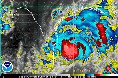
Dolly finally did it. She found her groove late in life just before the biggest act she has yet to undertake.. that of becoming a landfalling hurricane!

To be stacked means she is properly aligned and she can intensify even more as she is sitting over an area of low wind shear and relatively warm water.

Watch her progress below on this long but wonderful loop.

http://weather.hawaii.edu/satellite/satanim.cgi?res=4km&banner=uhmet&chnl=ir&domain=
gmx&size=large&period=2880&incr=60&rr=900&satplat=goeseast&overlay=off

From the last Storm Discussion I want to highlight the last lines "IT SHOULD BE
RE-EMPHASIZED THAT...DUE TO THE INHERENT UNCERTAINTIES...ONE MUST
NOT FOCUS ON THE EXACT LANDFALL POINT IN THIS FORECAST.

DUE TO THE SLOW MOTION AT LANDFALL...DOLLY COULD DUMP VERY HEAVY
RAINS IN THE AREA."


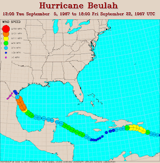
A slow moving storm like this can and will do immense damage over a large area and in an area that has not seem a hurricane in a while. In some areas people remember Beulah and the damage she did but that was a long time ago and this is no small tropical storm any longer.

Here is the track of Beulah which explains why so many people in the media are mentioning it.. similar track.


It's been a while since that area had a direct hit but a real hurricane.. which is surprising in ways but here is a list of some Texas Canes.

http://www.usatoday.com/weather/hurricane/history/whtexas.htm

Be well... stay safe, run from the water and hide from the wind!

Be back with more details later this evening...

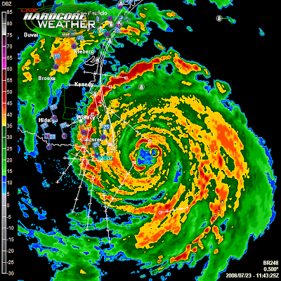
Tropical Storm Dolly Shows Her Face on Texas Radar

Quick notes to be updated later today.

Dolly is now visible on Texas Radar has her bands move towards the Texas Coast. She is still trying to intensify though not looking much different from the way she looked last night.

Either way..she is a large, wet storm that will wetten up a large part of Texas and her breezes may blow as far north as Houston. I said "breezes" please do not evacuate! Save the Rita Mode for later in the 2008 Hurricane Season. This was a nice ridge that set up over the SE and it hasn't rained on my flowers in two days. The big Fashion Shoot on South Beach is back to having their tents set up all over the place down the street from me. The models at lunch are beginning to make me feel a bit short... tall, beautiful models will be out showing their sexy suits in the bright Florida sunshine.

http://www.theautochannel.com/news/2008/07/17/093410.html

And...why I say this is because the strong high that brought you Dolly may bring you a few other strong storms later this hurricane season. IF something gets down in the Gulf it will be lifted this year by the many frontal zones that will continue to sweep down across the plains and when that high retrogrades a drop to the east... the door will be open for a Florida hit.. and mean Florida as this could be the year where a front brings it far enough north that not only South Florida but the Tampa area has to watch out.

Have to run... get dressed, straighten my hair.. have a chance at not being rained on today.

Time will tell.

Keep watching Dolly... the models who are not handling early storms that well feel this storm may pull a bit to the right. Not sure... I think it's border bound. Stick with that Victoria Secrets in Brownsville as Galveston I think is way out of the picture except for some nice wind. Try their hair products and go with curls today!

Stay tuned... the infamous Edouard may be forming in the far off distant Atlantic.
Will post pictures later..

Over and out, much love.. Bobbi

Monday, July 21, 2008

Hurricane Warnings Go Up For the Texas Coast - Dolly


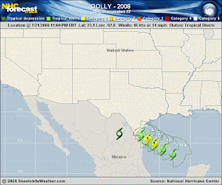
Graphics from www.skeetobite.com


From the main desk at the NHC..
"At 10 PM CDT...0300 UTC...a Hurricane Warning has been issued from
Brownsville to Port O'Connor Texas. A Hurricane Warning means that
hurricane conditions are expected within the warning area within
the next 24 hours. Preparations to protect life and property
should be rushed to completion
."

Sort of like headlines from the Daily Planet Weather Room..

Seriously.. some links that might come in handy for you or anyone you know living in the area affected.

Note that a Tropical Storm Warning is up in other areas but I felt this was important to highlight.

A lot of people out there fishing, hiking at the parks and enjoying the beaches that can get caught off guard by the fast speed and rapidly changing situation regarding Dolly.

NOTE... despite that fact that Dolly has been hard to pin down in the past she is rapidly intensifying tonight and may have finally found her center in some Swan Song she is singing she will go out in style with a hit someone along the South Texas Coastline or possibly around the Texas/Mexican border.
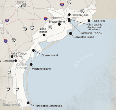


http://www.portoconnor.com/ (click on weather.. takes you to NWS page)
Some nice information on local history and the Matagorda Island Lighthouse.

Brownsville:

http://www.cob.us/
some history: http://www.cob.us/history.asp

These aren't just names on a map but places rich in history and their own unique Texas culture.

Go to City Departments.... Emergency Prep and a good page comes up..

http://oem.cob.us/DisasterHurricane.asp

"An NWS WARNING indicates that a hazardous event is occurring or is imminent in about 30 minutes to an hour. Local NWS forecast offices issue warnings on a county-by-county basis."

This is a well put together page for all of us to look through in our own little parts of the Hurricane Coastline from Texas all the way up to Maine aka "Bob's Country"

From this page here... good page, good advice. Print it and save it and post it on your fridge even if you don't live along the Texas Coast! 3 words for all of us to think on and act on

GET READY NOW

http://oem.cob.us/Hurricane%20Ad%20-%202005%20-%20062105.pdf

Three simple words that can make such a difference...
GET READY NOW!


The Brownsville Police Department and the Brownsville Office of Emergency
Management would like to encourage all Brownsville area residents to make sure
that a hurricane this season doesn’t catch anyone unprepared. Take some time
now to make plans on when and how you and your family will evacuate in the
event of a major hurricane. Make sure that your disaster supply kit is ready.
Check your vehicle to make sure that it could make the trip out of town. Sit down
with elderly relatives to make sure that they are taken care of.
Preparation takes time...
You have time now...
You might not have it later...
HURRICANE TIPS FOR BROWNSVILLE RESIDENTS
EVACUATION
This year, Brownsville residents evacuating
from a hurricane will be asked to
travel farther than ever before - to points
beyond McAllen and Hidalgo County.
The primary evacuation destination
is San Antonio - the closest large
inland city. Be sure that you’re prepared
now for the trip - know how you will get
there, what you will take, and who will
need to go with you.
Brownsville evacuation routes:
• US HIGHWAY 281
• US HIGHWAY 77 to Raymondville
(US 77 will be closed in the King
Ranch during an evacuation).
DISASTER SUPPLY KIT
Your Disaster Supply Kit should be kept
in a dry location, preferably in a plastic
container of some sort. At a minimum, it
should include:
• WATER - One gallon per person per
day (minimum suggested is three gallons
per person for a three-day kit)
• MEDICINE - Prescription and nonprescription
• FOOD - Non-perishable or canned
food
• CAN OPENER - Manual - not electric
• RADIO - Battery-powered, with extra
batteries
• FLASHLIGHT - With extra batteries
• FIRST AID KIT - Properly stocked
• SPECIAL ITEMS - For infants, elderly,
or family members with disabilities
• MONEY / DOCUMENTS - Insurance
cards, credit cards, cash, etc.
YOUR HOME
Be sure your home is prepared for
hurricane winds:
• WINDOWS - Measure, and obtain
shutters or cut plywood to
cover each one
• TREES - Remove diseased and
damaged tree limbs well before
the storm
• DOORS - Strengthen garage
doors and double doors
• MANUFACTURED HOMES - Be
sure to check the tie-down
straps - get professional help if
needed

MORE INFORMATION
OEM.COB.US


Nite Bobbi...with dreams of sandpipers on a beach in South Texas in my head...
Monday Night 7/21/08 Tropical Storm Dolly Update


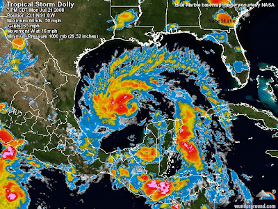
Just a brief note here to say that watching Dolly filling up the whole GOM with her umbrella of clouds is amazing.

Doesn't she almost look like a dragon this way?
Pic is from www.wunderground.com/tropical .. some great new additions Jeff Masters has added for this 2008 season. Check it out!

She might not be Andrew or Katrina but she may do big damage when she comes ashore somewhere around the Tex/Mex border. Personally, I think she will intensify going in but she's been fickle for on and off development. She is what she is as they say.

So... be glad she didn't stack up just right or the GFDL would probably have been right and she would have been a monster. The populated cities of the Gulf and the oil rigs have a reprieve but for how long?

Keep watching.

Need some sleep, tired and a lot has been going on between work and home.

Boy the Meyer kids can be noisy but thank God they have fun and have friends and I am hiding in my room tonight.

Lots of love everywhere... sending some to all of you too!

Love Bobbi

Sunday, July 20, 2008

Tropical Storm Dolly Intensifying


And..might even add pretty rapidly.

The ULL that hindered her existence has moved out of the picture and she has really pulled herself together.

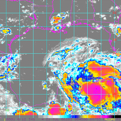
Watch the loop which reminds me of the Victoria Secret Pink Campaign and watch her spin and consolidate.

Something to think on and if a CDO breaks out all bets are off as to how strong Dolly will get as she enters the Gulf Of Mexico and how far the cone may need to be moved.

Loop:
http://metofis.rsmas.miami.edu/~dortt/satellite/Gulf/IR/GEIR0807210045IR4.gif

http://www.nwhhc.com/

A weak Dolly is easy to forecast, a strong one... watch out and keep informed with the latest from the greatest at the NHC.

Seriously, read my blog, watch the boards, surf the web but for the bottom line in forecasting please go to the National Hurricane Center for the official word!

http://www.nhc.noaa.gov/

And note... the orange box over Africa which should be our next named storm and next invest. Edouard... Jaws music. I'd youtube but I am too busy looping and talking online.

First things first and Dolly is pulling her act together and I think her second act is going to be a lot stronger than her first was.. worrying on the third act a bit..

Dolly @ 5PM and Honey I'm Home :)


Okay, went AWOL this afternoon. Left the loops to those who do the looping best and went to the Mall. Aventura Mall. You'll have to scroll down for the rest of the pics. Nah.. know you are reading this blog for my posts not the pictures ;)

So, I'm not good at the Mall. Take a girl whose been working in libraries for the last ten years or more and put her in the Mall and it's like a Jacuzzi of sound not bubbles. Never heard so much noise, one store's music bleeds into the other. Returned a purse, couldn't find one I liked to replace it. Spent quality time at Victoria Secrets with a gift card someone sent me :) and came home smelling from Pure Seduction, Breathless and Rapture and some nice hair curl gel scented spray.

Figured a storm like Dolly deserves a trip to Victoria Secrets!

Hey...we all have our priorities...
Played at the Apple Store with the I-Touch. Can get on Hurricane City and Wundergound (which almost sort of loops the satellite image) but you really can't animate the way I want to with it. Even the I-Phone doesn't really animate though I have been told you can download "Apps" however the girl helping me with really pretty green nail polish couldn't figure out how to download. My son who is with Apple running business accounts says you can. He also says the key board is easy to get used to. Played with the new sidekick and having problems deciding if I can go Blackberry or I am forever a Sidekick girl? I mean if they don't loop... what difference does it make? Verizon's supposedly has one that loops. Will have to check this out later. On a brighter note the nice man at T-Mobile did say I smelled good though ;)
Hard to decide... do I upgrade to a Pearl.. which I think is easier a keyboard to use than the Iphone and less breakable and get a I-touch for other things or stay with the Sidekick? We'll see.. time will tell. Not like I'm going to be able to use any good services in Postville.. last time I was there it only let me talk on the sidekick and my Virgin Mobile got thrown in the toy box in "off/no service mode" and it took days for someone to come across it and get it back to me. Yeah, I know.. they put up some new cell towers... right...

So........back to Dolly.

Dolly is like this.. A WildCard. and no I don't mean Virgin Mobile's sucky phone my son has and keeps returning for new ones. Well, they weren't meant to be landed on when jumping 6 stairs with your skateboard but anyways...

Dolly.... she is a wild card or even possibly a Wild Cat!

You see right now she is still rolling along doing the tango with the Upper Level Low that brought her to the party. But, the Upper Level Low is beginning to finally get tired and might be leaving early to go home and catch it's breath down on the Yucatan. Perhaps it's going to go diving and let Dolly dance on.

She is moving NW.. not west, not west north west and I am still not sure if we have the right cords as she is a sneaky system and she might be more to the north or she might reform more to the north and in which case she is in a better position to stay over water longer.

Either way she is going to track across the flat Yucatan (just because it looks like a mountain peak do not think there are big mountains there... it's flat like Florida) and she's moving at a decent clip. Once in the Gulf she will be over warm water with a high aloft. Wait.. let me quote the discussion very warm water. She will be in excellent position to intensify rapidly into something she is not now which is a real player. She could get tired and fall apart and lolly gag around the Gulf of Mexico looking for a new upper level low or front to catch her eye and just become a messy rain storm.

My money is on Dolly.

This is a system that could have died a dozen times as she tracked her way across the big wide Atlantic. A little bit of this wave, a little bit of that wave, a mid level center, a low level center ... find a center. She has been playing peek a boo for some time but if we believe the models they have her number and they are expecting her to pull a fast one in the Gulf of Mexico in a few days.

We'll see... possibly.

Either way I am including directions for Dolly in case she wants to spruce up for any new gentleman callers. You know how cute those storm chasers can be...not sure Jim Edds will notice as he sloshes by in the surf but hey Dolly go for it.. you only live once ;)

Victoria's Secret Galveston Area
100 Highway 332 W
Lake Jackson, TX 77566
(979) 292-0216‎
www.victoriassecret.com

Victoria's Secret Brownsville Area
2370 N Expressway # 1158
Brownsville, TX‎ - (956) 547-9773

For Dolly... think maybe something cowgirl like or pink.


As for Africa... oh well... that's full of color, red, intensity... long haul girl. Got lots of time to decide which outfit fits that one and imagine that one will be Edouard and maybe need to look for some baby blue nightgowns for Eddie boy...

But, then what do I know?

Either way.. I'm homed, back at the loops, paying the bills and trying on my new.. make up ;)

Chow for Now.. Bobbi!
(gloves and all... I'm good!)


Blue... for Edouard ;)

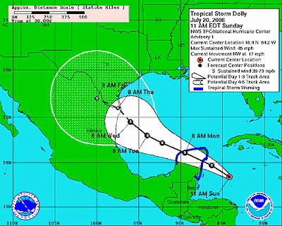
Tropical Storm Dolly - Official from the NHC


WTNT24 KNHC 201539
TCMAT4
TROPICAL STORM DOLLY SPECIAL FORECAST/ADVISORY NUMBER 1
NWS TPC/NATIONAL HURRICANE CENTER MIAMI FL AL042008
1545 UTC SUN JUL 20 2008

AT 1145 AM EDT...1545 UTC...THE GOVERNMENT OF MEXICO HAS ISSUED A
TROPICAL STORM WARNING FOR THE YUCATAN PENINSULA OF MEXICO FROM THE
BORDER WITH BELIZE TO CAMPECHE MEXICO. A TROPICAL STORM WARNING
MEANS THAT TROPICAL STORM CONDITIONS ARE EXPECTED WITHIN THE
WARNING AREA WITHIN THE NEXT 24 HOURS.

TROPICAL STORM CENTER LOCATED NEAR 18.4N 84.2W AT 20/1545Z
POSITION ACCURATE WITHIN 30 NM

PRESENT MOVEMENT TOWARD THE NORTHWEST OR 305 DEGREES AT 15 KT

Waiting... Steve Lyons with Recon Data


This has to be for Gian at HurricaneCity and for those of you who no longer watch TWC but it's a sort of classic moment. He did the whole discussion on Cristobal while clutching the recon vortex message from the Developing Dolly.

Well... waiting for the NHC to write the discussion, advisory and put out a whole graphic package and to see if they will indeed update to TS or TD but either way..

She's developing and pulling more to the right than the previous discussion indicated.

Waiting on Dolly...

Tropical Storm Dolly Forming in the Caribbean

Or as everyone around is singing "Hello Dolly!"

Always remember some goldfish my brother named Dolly, wasn't pretty :( but was a big fat sort of round goldfish that reminds me of this Wave that has gone without a name for way too long.

Waiting for the update, the discussion and the new models.

NRL site has this up:

04L.DOLLY, TRACK_VIS, 20 JUL 2008

And, that is about as official as it gets.

TWC has definitely gotten some media package from NHC as they have changed their promos and waiting to see the new track which I would bet money will be slightly to the right of the old tracks.


Seems recon found the center, closed it off and pinned the tail on Dolly.


Did you think I was going to show Barbra or Carol? LOL..nah, go straight to the best ;)

Developing...

Yep..Dolly is developing...

Be back later..

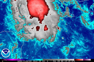
Sunday July 20, 2008 Tropical Storm Cristobal & The No Name Storm


Picture above is the Wave not currently named from wundergound.com

Going to try and keep this on topic and not go off on some rant right now but no promises.

Going to start off with a comment on Joe Bastardi that might explain why I do enjoy hearing his comments at times on tropical systems. He number one calls them as he sees them and he points out often that he is just Joe Bastardi and not down in Miami at the Hurricane Center. He is just saying what he feels and the man feels and says a lot.
One thing he mentions a lot that I do like is that he talks about "the weather" not specifics as to where the center of the storm or possible storm is.. if there is weather he follows it like a bouncing ball or in this case a red bouncing ball.

Sometimes weather IS the story and it is what causes the damage whether there is a closed off center/circulation found or not. Heavy rains in mountainous areas of Haiti or Central America can do more damage than two tropical storms like Cristobal sliding along the Outer Banks.

Yet we wait for official designation to call something a Tropical Depression VS a Tropical Disturbance. Both can do a lot of damage to a thatched hut in the tropics though neither will do much to a strong built house in South Florida.

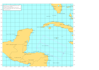
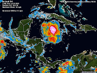
We focus too much sometimes on details on anything short of a Hurricane as Tropical Storms do so much damage in flooding and there was an No Name Rain Storm that created havoc in Hispaniola a few years back and received a lot of attention in the way of complaints that it wasn't named. An alert was issued. An alert was issued with 94 too and yet it still hasn't been designated a depression let alone a Tropical Storm.

Personally, if I was a betting girl I would say she IS a Depression and there are Tropical Storm force winds in that wave that will affect someone soon. To me that is calling it as I see it so to speak.

Why?

Consistency. It has consistently maintained convection and has been rolling across the Caribbean like a bright orange red beach ball with someone's name on it. Can't see the name cause it's rolling fast.

Hope that recon can find the center and where it is closed off and upgrade it to a minimal Dolly later today. IF the center is to the north of the previously perceived center than the models are off and the future model runs would tend to be to the right of where they are now. And, that is a big "if" but if this wave was rolling towards a beach in Miami would everyone be so cavalier about it "just being a wave approaching the Keys or Palm Beach?

Maybe. Time will tell. Imagine they could say the NWS is updating South Florida properly for severe weather (and so it is) but I think 94 has reached intensity strong enough to suffice an upgrade.

As for Cristobal... nice part of the country it's creating some nice wave action for.

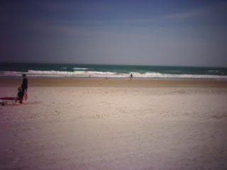
On a nice warm day in March the beach looked like this and amazingly was 80 degrees but the water was cold..or so I was told. I just stayed on the beach and worked on my tan and watched the waves from my perch on the sand.

:)


Check out these waves at a few local Beach Cams.

http://www.wrightsville.com/bchcam.htm <-- updates itself automatically.

http://www.avalonpier.com/piercam.html <-- needs you to manually update.

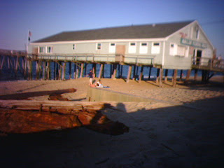
Nice pic of Avalon Pier when I was there earlier this summer. Funny when out over the pier you don't visualize the Pier from another view... just a building up on stilts on the edge of the water.


So, Cristobal is a named Tropical Storm even though the Wave isn't.. so here we sit on July 20th waiting to see if the Caribbean gets a new named storm today.

Keep watching.. just remember if the models have bad data it's garbage in, garbage out. If the wave becomes a storm and that storm is further north then the models will be initialized further north and things could change. Mexico can become Brownsville Texas and Brownsville Texas can become Galveston real fast with that much hot water to travel over.

Something to think on. Be back later with more thoughts I am sure.

A hit is a hit whether you have strong weather or not and when strong weather hits you ...you don't ask what is in a name you ask what hit you.

No Names can be just as bad as Named Storms sometimes.

And, this no name storm is not moving so west but more north of west..wnw? And should get into the GOM if that is the case.. or maybe not. We'll see.


You tell me:

http://www.ssd.noaa.gov/goes/flt/t2/sloop-bd.html

Be well... mucho besos Bobbi

Saturday, July 19, 2008

Tropical Wave Discussion - Cristobal Forms


Just some notes before going to bed that I really think the wave looks better this evening than it has all day.

Really is spinning better, turning, churning, looks to be doing something. I know we have said this before and all but it really does look better.

From the wide view high up looking down at the Basin you can barely pick out Cristobal yet the Tropical Wave aka Invest 94 is large, round and looks to be on the verge of finally doing something. I think it at least deserves Tropical Depression Status!


http://www.meteo.dm/pages/satphoto.htm <--- nice site!

As for Cristobal..what is there to say. It is going to slide along the coast and will bring rain and great surf to some beautiful North Carolina beaches.

I've spent some time up there this year and probably will spend a lot more next year. Wrightsville Beach has been my favorite so far. Spent a beautiful afternoon there, very nice. Wilmington is nice, liked it a lot. Beautiful Moroccan Restaurant there, good food, quaintly decorated, nice sweet tea and just overall one of the nicest little restaurants I've been to in a while.. and been to a few and it's Kosher for those who care on these things. Authentic. Not Moroccan style but a real, nice little place.

Review online..
http://www.crownheights.info/index.php?itemid=1224

Menu:
http://www.nagilacafe.com/

Nice place to go after the beach and unwind.

Dinner menu:
http://www.nagilacafe.com/nagiladinnermenu.html

So... that's it for now.

As for the Outer Banks..they are nice, outer.. loved Coquina Beach which was quieter and seemed to have more locals.

http://www.learnnc.org/lp/multimedia/2001

So...back to the tropics... Cristobal is a nice storm, as they go..

94 could be Dolly if it goes strong enough to get a name. Look at this pic.. looks like the head is down and in berthing position.


Let's get this show on the road.. PLEASE!

Besos, Sweet Dreams and Lila Tov Bobbi!
Ps.. look at that wave moving off of Africa...

Friday, July 18, 2008

Waiting on the NHC & Bastardi's Birthday

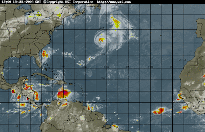
Expect the system off the SE Coast to be named before the system down in the Carib that I still think will get a name but might take longer. We should have the C storm soon!

Should is a difficult word though, have a close friend who is allergic to it!

And.. lastly, Happy Birthday Joe Bastardi!

I'll never forget his birthday, it's oddly the same day, same year as one of my best friends and old boyfriends so... Have a good year with the weather you love the most!

Chow for NOW!

Bobbi ;)

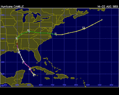
Hurricane History 101 - Hurricane Camille


Hurricane Camille is a case in Hurricane History as she didn't just pop up from a stray rain shower south of Cuba. Nope.

Camille came from a weak, tropical wave that made it's way across the Atlantic, wandered into the Caribbean and took her time getting herself together.


Many waves are like this. They can't find their center or their groove. They know where they want to go but not how they will get there so they drift along with the westbound winds until they get to our side of the world.

Sometimes...often...they crash into the coastline of Central America, bring a little rain to the ABC islands and Jamaica. But, other times they find their groove and conditions improve and they are no longer bucking headwinds from an Upper Level Low or they find a patch of particularly hot water or they just sit up, take a look around and decide now is the time.

Yes, I am personalizing these storms because basically it's fun to see them as entities not just mere moisture and convection and bars of high pressure and low pressure but they are pure science and mathematics. A whole lot of "ifs" and most just keep going unless..they develop enough to pull themselves away from the lower level winds and feel the pull the upper level features and they want to go poleward at some point. Always. They don't if a high pressure system (those boring bars of pressure) doesn't allow them to but while the cats away the mice will play and before you know it you have a storm climbing in latitude trying to find a weakness to take it to the Gulf of Mexico.

See... Atlantic Cape Verdes are almost easy in comparison as they usually re-curve out to sea. But, once a wave is in the Caribbean and beginning to dream of Texas or Louisiana there is no where for it to go but to hit land. It becomes a bull in a china shop.

Will this wave continue it's wanders as an unknown entity or find a name and fame along the coastline of the Gulf of Mexico?

Will it play out with a track like Camille? I said track not intensity note. Probably not. Could it? Given the chance it could. Watch the GFDL.

http://moe.met.fsu.edu/cgi-bin/gfdltc2.cgi?time=2008071806-
invest96l&field=Sea+Level+Pressure&hour=Animation

A friend told me they might fly out on Friday into the wave, Friday was the day they were most worried about it seems. That was back on Tuesday. Tropical Forecasting takes patience. We study history so that we don't get blinded by it later in the forecast period. History rarely repeats itself but in a year where a Bertha flew off the African coast early in July with the same name as the previous Bertha that survived the July Atlantic Crossing... we have a pattern of anything is possible.

Stay tuned, it's one of the biggest free dramas on the planet. Sit back and watch. You're paying for the Internet anyway.

Besos Bobbi
TGIF

Thursday, July 17, 2008

Bill Gray Speaks & 4 Invests From NRL in the Atlantic. Bumper Crop


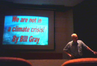
This is a picture of Dr. Gray waiting for the computer to get set up and the people to sit down to hear him speak on the always controversial topic of "Global Warming" or more so how much we can attribute to human involvement vs other factors such as cycles and ocean currents. The auditorium was filled with meteorologists and oceanographers and a few forecasters and students and me. Your mind reels with data when you listen to Bill Gray speak. Must have been wonderful to be a student in his classes. I can see... amazing. Had a few professors like that ...Dr. Clem for one, when that man would start talking on treaties and international law and geography you were living life to the 100th degree every second you were in the class.

Seriously. I went to hear Dr. William Gray speak on Tuesday. It was wonderful. The man is a joy to listen to speak. He is smart, brilliant, funny, quick, intensely passionate and easy going all at the same time. Watching him talk to old friends about old friends and listening like a fly on the wall. Spent some quality time afterwards at the NOAA Library over on Virginia Key. Great library, can get lost there for hours waiting for friends who are working late to be done. If there is one spot on Planet Earth that rates up there with perfection it is Virginia Key in the middle of Biscayne Bay. You can't not think on hurricanes. Not because I was at the AOML/HRD headquarters but because it sits on a place called Bear Cut that was formed when the 1835 Hurricane smashed into the south shore of Miami and cut up the mangroves almost all the way to the river in places. One of the worst hurricanes to hit Miami and yet we have such little data... scars in the hardwood hammock and trees still standing or that regrew from being torn apart and Bear Cut that didn't exist on the maps until after the storm passed. And... look over to the south towards Key Biscayne and you see the old Hurricane Hole where boats can anchor to protect themselves from the Gales in a Hurricane.


Nice library. Yep, was a great talk by Dr. Gray that I will discuss in detail more another time when I am not on vacation, resting up and trying to figure out what I am going to take to Postville with me. Course only going if there are no named storms within 5 days away from Miami thankful for good friends and for getting my nice little red umbrella back as I might need it in rainy Iowa.

Time will tell... waiting for time to tell us where we all are going.

Waiting to see if one of the current 3 Invests at the NRL does anything or is it just going to be the July of Bertha dancing in the Atlantic? I can see advisories written still in August at this rate... we will remember Bertha in September at this rate.


Not sure which ones if any will make their way into a market by you but stay tuned.

The one off the SE coast now currently known as 96 will bring rain along the shore of South Carolina, North Carolina and it's probably already raining in Georgia. From Florida north you can see rain. Not a named storm. Just rain for now.

Cruising too fast through the Caribbean is a Tropical Wave which has had much ballyhoo yet... not a name. Not even a TD Number.

So... while there is a lot going on.. nothing is going on.

Love ya all, Bobbi

Ps... just to think on something. Bill Gray talks a lot these days on the currents in the Ocean and thermohaline layer and well... this planet is covered with more water than land. Anyone who went years back to the old Planet Ocean which just happens to be where AOML is now would know how important a role the ocean has in everything that happens on Planet Earth. Except for the small amount we effect the whole planet and the larger way one large volcano can change weather in any given year.. climate is long term and very tied to the flow of the ocean and the interplay between the atmosphere and the oceans.

http://www.aoml.noaa.gov/phod/acvp/gray.htm

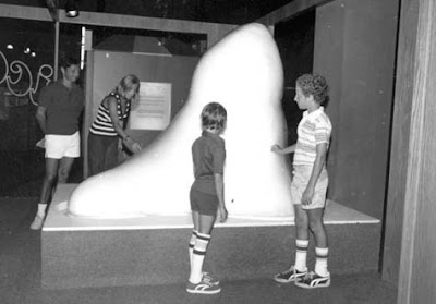
I remember when my brothers stood next to the same iceberg and learned how icebergs worked. When they watched the movie that explained about the Ocean. Was a great place Planet Ocean and I thought on it much the other day. Here's a pic for my brother Jay. We used to take my youngest kids there to touch the iceberg, to walk through the hurricane exhibit (awesome) and to see the movie and climb in the little mini submarines. Great Place.


http://www.lostparks.com/planetocean.html


Tuesday, July 15, 2008

Old School Satellite Imagery - Tropical Waves & Root Beer


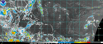
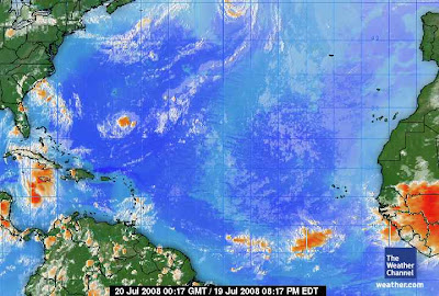
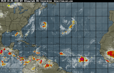
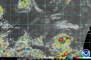
This is what you call old school tropical imagery but it loads fast and gives a great big picture. There are many satellite images that update faster, show details a plenty but for a fast pretty look at the Tropical Atlantic there is sometimes nothing better than a fast look at the HIRES and I'm talking zero calorie root beer!

One wonders if the models are initialized somehow on the wrong wave. And, yes I know the one out by Africa is still low but low works right now with the mess in the Atlantic Bertha is leaving behind and she or he or it will climb in time.

Going to rain in Miami I think and my vote is on the further east wave. Though both could connect. For that matter even the area in the Carib could pull together once past the shear zone.

Love and Kisses and enjoy your weather... Bobbi

Monday, July 14, 2008

Leap of Faith

One of my all time favorite movies and what is needed to believe in this Tropical Disturbance that looked far better last night than it does tonight. It still has shape, it has some rudimentary bands but it lacks a center. It's not stacked properly and moves in a spiraling way but more push me, pull me like as if part of it is not where it should be. John Hope would really complain about lack of convection and color. He was never one to wax poetic about a wave that couldn't keep it's oranges and reds to it.


We'll see.. does take a leap of faith but anything is possible in the Tropics where warm water temps are available for intensification.

Further East we have a wave I like better but I have been told to let it sit a bit, have patience and wait for it to come together.

Have patience. Leap of Faith. My gosh.. feel like some weather preacher man is standing on his soap box trying to give me inspirational weather moments and lessons on life. Hmmmmnnnn. No... don't go there Bobbi. LOL. Anyways...

Nice site that Jesse Farrel.. no... Feely...no Fuller. Wait let me check. Fuller. What was I thinking? Where was I? Nice site Jesse has put together and posting it here so I can remember where I left it and others can enjoy it. Pretty site, great palm tree... purpose of the site is to dedicate itself to Caribbean Weather. Carwea. Great name... sits in my mind funny like I've heard it before. Pretty, easy, simple site to surf for info with a beautiful Palm Tree on the top. Name reminds me of some book report I did once on some tribe of Indians maybe.. anyway, check it out and enjoy it!

http://carwea.weebly.com/index.html

What else?

Bertha. She has finally begun to move on and hopefully the wonderful people of Bermuda can pick up the pieces and clean up and get back to normal. At another time I will talk more on Bertha. Right now I am tired of talking about Bertha and looking at her and I am wondering more on Bermuda and why they have coconut palms so far north.

I am thinking about Columbus (Christopher) and if he really sailed through a hurricane during a time of year when hurricanes don't form. Maybe, perhaps in 1492 there was some warm period of time when the hurricane season was longer or different. Maybe great pockets of warm water existed that no longer exist. I mean the famous story of Ole Chris and the Hurricane that saved his life took place on July 1st, 1502. Early for a strong storm that most likely would have formed in the end of June and it would have had to survive shear in the Eastern Caribbean to get there wouldn't it? So.. maybe in the late 1400s and early 1500s hurricanes were stronger and formed earlier. I mean Columbus wouldn't have lied would he? Not to mention there were eye witnesses and it was recorded. So much we don't know for sure. A shame we can't interview him and ask him questions on hurricanes and his life.

We can do so much in this world today and yet the secrets of Time Travel elude us always.

Yet, we think we know so much but do we really know of the past and the storms of the past? I wonder with eyes wide open and a mind that thirsts to know and learn without preconceived notions.

Going to bed. I have a big day tomorrow. Lots of work to do and in the afternoon I get to play hooky and hear Dr. Bill Gray speak over at NHC/HRD RASsomething other on pretty Virginia Key. Tired tonight but looking forward to hearing him speak and read a paper and see some friends and maybe, hopefully learn more about hurricanes than I know tonight.

It's an ongoing science.. an ongoing process a never ending story unfolding constantly on the always flowing Water Vapor Loop.

I love it.

Again...watch the wave and enjoy the weather!

Besos Bobbi
Ps...Zzzzzzzzzzzzzzzz

http://www.ssd.noaa.gov/eumet/eatl/wv.jpg

(Happy Belated Birthday Preacher Boy)

Sunday, July 13, 2008

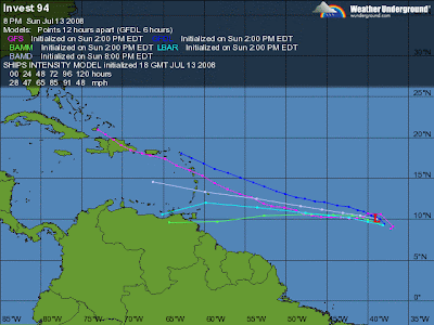
Coming to a Tropical Theater Near You.. Next Tropical Depression


This one seems slated for that designation... tomorrow probably. Wait and see if it stays together, builds, looks as good in the daylight as it does tonight.

http://www.ssd.noaa.gov/goes/east/catl/loop-bd.html

And...this one poses a problem... possibly, if all the intangibles work out we have a real trouble maker this time. But..it's early still and a lot can happen between there and here.

Besos... nite Bobbi
Sweet Dreams Bertha ;)

Rainy Dark Sunday In Miami - Beautiful


With windows wide open watching the rain fall down over the eaves and hitting the ground with a pitter patter syncopated rythmn and cachony of clattering raindrops hitting the ground over and over hypnotizingly beautiful! Check it out!


Hurricanes, Homer Winslow and stormcarib.com


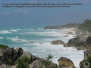
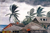
Beautiful images from stormcarib.com (and excellent reporting from a great site) remind me of Homer Winslow and his pictures of the Tropics and Hurricanes. The colors and the feel, he was so on the money and looking at the pics on stormcarib.com you can appreciate how much. Pics on stormcarib indeed look like paintings. Art imitates life and life imitates art perfectly.

http://stormcarib.com/reports/current/bermuda.shtml