Hurricane Harbor

A writer and a tropical muse. A funky Lubavitcher who enjoys watching the weather, hurricanes, listening to music while enjoying life with a sense of humor and trying to make sense of it all!

Thursday, May 31, 2007

Is Barry Brewing In The Tropics? Model Links


Okay, so we are watching a system down in the Caribbean slowy brewing and possibly coming together.

The NHC issued a Tropical Disturbance Statement throwing in their hat to a ring as has the Navy with their NRL Invest of the area.

http://www.nhc.noaa.gov/text/refresh/MIADSAAT+shtml/311549.shtml?

salient point: ALTHOUGH THIS SYSTEM HAS SOME POTENTIAL FOR
TROPICAL DEVELOPMENT OVER THE NEXT DAY OR SO...THE LOW IS EXPECTED
TO MOVE SLOWLY NORTHWARD INTO THE SOUTHERN GULF OF MEXICO WHERE
ENVIRONMENTAL CONDITIONS WOULD LIKELY FAVOR FURTHER DEVELOPMENT AS
A NON-TROPICAL LOW. REGARDLESS OF DEVELOPMENT...THIS SYSTEM SHOULD
BRING HEAVY RAINS ACROSS WESTERN CUBA AND SOUTHERN FLORIDA OVER THE
NEXT COUPLE OF DAYS.


They don't mention here that there is a probability that they will be sending planes in as needed tomorrow morning. There is a plan of the day if it is needed: http://www.nhc.noaa.gov/text/MIAREPRPD.shtml?

So... we watch, we wait.

We talk of how it looks a lot like Arlene did in 2005 and I think personally this little rainmaker can be more like Irene whose "weather center" went ne up into the Miami area even though the low pressure center sort of went up the west coast of Florida where Jim Cantore stood around in barely any wind or surf waiting while the SE coast of South Florida got swamped with flooding rains and high winds. Personally, SW Florida can use all the rain it can get.. hate to steal theirs.

Time will tell as always and the Recon will seal the deal as usually the NHC waits to get the best view of the storm up close and personal.. their little dropsondes dropping down into the area to give us a better picture of the pressures, windspeeds and such.

Would be a great kick off for the 2007 season to have a storm named on Day One. If that doesn't force Floridian's to go out and buy their hurricane supplies early and take advantage of the tax free week..nothing will.

Early models are linked below. Pay attention to Skeetobite.. he is as good as it gets when it comes to this stuff even though there are a ton of sites offering possible model tracks online.

http://www.skeetobiteweather.com/picservice.asp?t=m&m=92

Freebie Link of the day.. for those of you who do not have a grocery store or gas station giving out hurricane maps you can print out a chart from this link.. and track away.

http://www.nhc.noaa.gov/pdf/AT_Track_chart2.20060925.pdf

What might be Barry is barely visible right now on visible imagery but come tomorrow.. might be a different story.

http://www.ssd.noaa.gov/goes/flt/t2/loop-vis.html

My thought? Bobbi's Bottom Line?

I wouldn't have given it much of a thought this morning but it really is trying to pull itself together. There is a sort of curvature and even some early banding sort of structure which makes it sure look like it's trying to form. It needs to fear the shear if you ask me.. if it can get past the shear and consolidate around that little center... we might have Barry Brewing in the Tropics.

...oh come on.. sounds so good doesn't it? Barry Brewing the Breakfast Blend at Starbucks? Will the morning see NHC issuing advisories?

Stay Tune .. Developing.......

Tuesday, May 29, 2007

Recipe for a Hurricane Season African Waves & It's Almost Summer..

There is a beautiful little wave out in the Atlantic, far away headed west bound towards the New World or our world .. however you prefer to think on it.

Sign of summer almost here here... one wave at a time until the big waves later in the summer. This one will probably make it across and crash into South America as they often do this time of year but still.. it's a very nice wave and worth noting.


Link below to an article on how the monsoons in Africa are related to landfalling canes over here.. patterns, etc. Us weather people love patterns. I imagine somewhere along the line they must have read someone's thesis on monsoons in Africa, I mean they didn't think this up themselves but they did study it and proove their point well. Increased rain over the Sahel region and monsoons definitely heighten the chance for more hurricanes. But... it is ONE factor and you have to add heat to the engine and have warm sea temperatures and some factor like a strong El Nino with very strong winds going the wrong way at the height of September will inhibit the Canes from forming...

http://www.sciencedaily.com/releases/2007/05/070523153030.htm


It's like a cake, a little too much cloves and it over powers the cinnamon. A little rum to the cocoa and ooh la la! Too much rum to the cocoa and you can't figure out what that dark stuff is they added to the cake!

It's a recipe, every ingredient is important and too much of this or that throws the whole season off? As for the 2007 Hurricane Season? Let's just see how this season plays out... Personally, I like coconut in my chocolate. Okay, I like coconut in my rum.

So take some Captain Morgan's Parrot Bay Rum and add in a little rain from Africa, a few sexy cute weather guys and a big African Wave take away El Nino add in La Nina and some hot water temps and you got one heck of a Hurricane Season!

Will find graphics later to support this as I am late for work and going back to work.

You heard it here first, formular for the 2007 Atlantic Hurricane Season!

Captain Morgan's Parrot Bay Rum + Rain in Africa + Sexy Wxr Guys + Big African Waves - El Nino + La Nina = Busy Atlantic Hurricane Season!

Monday, May 28, 2007

Back on the Mainland in Miami

Hey. Back on the mainland, off the rock, back from the land of bubbas and conchs and quiet sunrises as the sky lightens slowly and water sprays the rocks that surround the beaches of Key West. Amazing sunrises... you go and sit on the sea wall near one of the rocky make believe "beaches" and watch the water rush in, rush around and over the little rocks and slabs of worn down coral and create little eddies and water falls, strong surf all week, amazingly beautiful.

Stayed by a friend who has one of the most beautiful houses I've been in for a long while. Lots of beautiful pictures of nature, colors colliding perfectly and open to the elements more so than most. Hope it never gets tested in a strong hurricane but all houses do and even the most boring, concrete block sort of house in a cat 4 or 5 is not a place you would want to be trust me. So... if you have a chance to live your life..close to nature, sky, color, fresh air... enjoy it, live in the moment and hope the hurricane shutters work :)

Seriously... is any home really safe? And, then... I interevied Dr. Joseph Porter's granddaughter who grew up her whole life on the south side of the island, across the street from Louie's Backyard in a house that weathered every storm since way before the 1919 storm. People didn't evacuate (built up high and built well) and people hunkered down and hurricanes and tropical storms were just part of life living in the tropics. Do people leave New Jersey or New England because of Noreasters? And, we all know how those people claim a good noreaster is way stronger than a hurricane (rolling eyes and smiling here). Does TWC cover evacuations for strong Noreasters? Haven't noticed any recently.

Either way... went to the Grotto, lit a candle, had a picnic there actually, sat, nibbled on something and sat in the gardens thinking on my great, grandma. Went to the NWS/NOAA building and will write on that later... all I can say is VERY NICE GUYS and climbed up to the roof where they launch the blimp thingie and had a great view of the island and a nice talk. Will talk on that later. New Eco-center museum I cannot wait to take my brother Ronnie to and my son Zalmy. Unreal nice, nice people, great movie there by the man responsible for the underwater scenes in Free Willy. Interviewed so many nice, sweet wonderful conchs for an article I am writing (K O N K is the way you say it not the CH sound..they hate that) and... just wonderful and the wind.. oh was so windy and beautiful.

I said yiskor at Bnai Zion on Shavous which is the synagogue my great, great grandparents helped start in the 1880s when it was still Rodeph Shalom and had a nice lunch there on Shabbos. Friday night I was at Chabad for a nice service and a nice meal with the regular gang of guys who hang out there.. great salads, great moroccan fish lol.

Anyway.. home, back on the mainland, have a million notes to look through and have a wedding to go to tonight so I will try and write coherently tomorrow.

Will watch the models, watch the loops, relax, wake up.. come back to reality.

I love Key West. People are warmer, calmer, more relaxed and in tune with themselves and the world around them. Flowers smell sweeter, air feels softer, rain falls prettier and the waves crash on the little rocks that are the base of what Key West is... a rock in the middle of the Ocean with air rushing at you from Havana on it's way north to Florida... a very beautiful island.

I want to live there, I just really want to live there.

And, I can write better there than anywhere else I have ever been. Thoughts race at you that need to be written down faster than the strong onshore breeze that blew across the island all week while I was there.

Beautiful house, nice people, good friends... what more do you really need in life?

Well... whatever weather you like the best too I suppose or you wouldn't be here reading my blog, right?

Love Bobbi

Friday, May 25, 2007

Still in Key West...

Couldn't manage to make it back to the mainland and off of the rock.

Going to Chabad tonight, eating there and walking, walking, walking back to Old Town tonight ... stopping in at Bnai Zion for lunch tomorrow to celebrate friend's birthdays in May and... to say a prayer for this season's hurricane season sparing this little island. As a sweet lady who was valedictorian of the class of Key West High 1940.. she whispered in my ear yesterday with a beautiful smile and said, "it is such a pretty island isn't it?"

Hurricane trivia for today... 1948... a liquor store "out on the boulevard" was trashed in a hurricane and half the island got drunk from the liquor bottles that covered most the area... seems everyone ..even those who weren't drinkers got drunk. Sobered up and then cleaned up. A rare hurricane event for an island that rarely gets hit directly. Most old timers I interviewed cited Georges as their hurricane to remember. No matter how old or young.. Wilma was a pain but Georges was the real thing.

Good shabbos, going swimming in my friend's pool and going to stare up at the sky and give thanks for what I have today.. and every day.

GFS still ain't happening :) lol but sure is windy here and keeps pouring in the middle of the night... when the tourists are finally asleep I suppose.

Thursday, May 24, 2007

Windy in Key West - NWS Key West Really Beautiful But The Deli Restaurant is closing...

Spent part of the day over at the National Weather Service in Key West where they were nice enough to give me a tour. Beautiful place, very nice guys, great view from the top of the building! Up where they launch the balloons and gather data. Very interesting. Amazing to think the 25% of them get returned when found which is a pretty high ratio considering most probably get found over the water. After the balloon measures the info there is a piece that falls down and has a return to sender envelope. No postage, just drop it in the mailbox..and people do, go figure.

So... a very windy holiday in Key West, fresh air and an eerie sense of what it would be like with a storm blowing in not just a "high pressure gradient"

The Deli Restaurant is closing down at the end of the month. I can't believe it. Been there forever.. over 50 years. I even interviewed Bobby the owner the other day regarding something else and he never mentioned it. Sharon Wells told me a short time later in her studio, I just stared. He is such sweet man and it is such wonderful place where so many locals eat breakfast, talk and just share their lives. Can't imagine where people will go.

I know it's not his job to keep running a restaurant forever and nor is it his job to try and hold on to what is gone, what was yesterday yet you can't help but wish he would change his mind and we could just linger a little longer and hold on a little harder to a world where... everyone knew each other by name and everyone got treated the same.

I'm sad but he deserves a lot of credit for hanging in there and keeping the place going. I suppose half a century is a long time, some of us just have a hard time saying good bye to something we love and a whole lot of us love The Deli Restaurant in Key West.

I know I always loved going in, getting a cup of coffee and just sitting and collecting my thoughts, my notes and rewriting things I was working on a bit. Staring up at the light as it pours through the cut out seahorses on the front door and watching people walk in, walk by and talking about the day to day life of living in Key West.

I will write on it another day I am sure but just know a great group of sweet, older people eat lunch there every day. Not to mention the Police Chief, locals... and even a few tourists. A real institution closing down and it bothers me more than Dennis Pharmacy... seeing as how I am not a cheeseburger person .. unlike Jimmy Buffett I can't say that I would or wouldn't know if they are the best in town.. but I do know that the Bernreuter family has run The Deli with love and attention to detail and provided people with the feeling they were home eating a good, home cooked meal.. nice staff, good food, great pictures on the wall by Donna Hayes and well... can't think of another place like it anywhere though I am sure there are a few but not in Key West and going to the Dennys or the IHOP just won't cut it.. won't be the same.

Reprinted from an article found online from the Key West Citizen.
:(

Yup... a new office for the National Weather Service gets built, opens... the old one out by the airport closes and I hope those nice weather have another place they like to eat other than The Deli because that like the old weather office is closing, life does go on but it never stays the same.

Landmark eatery to close next week
BY ANNE-MARGARET SOBOTA
Citizen Staff
Another Key West favorite will end a decades-long run when it closes its doors for good at 4 p.m. May 29.
The Deli Restaurant, at Truman Avenue and Simonton Street, is closing because of what owner Bob Bernreuter described as changing economics on the island.
Bernreuter, whose family has owned The Deli since 1950, said the cost of doing business in Key West continues to rise, while business steadily declines. He said there's no one else in the family who wants to take over the business.
He also blames the busy hurricane season of 2005 for a general slowdown in the area.
"Last year there really wasn't the recovery that everyone had hoped for," Bernreuter said. "We have a good local following, but it's just not enough anymore. ... If I raised the prices to where they'd have to go, it wouldn't be The Deli anymore."
Bernreuter said he has no intention of selling the corner property, but he will lease it. He lives next door on Truman Avenue, while his parents, John and Joan Bernreuter — who established the restaurant — still live in the house next door on Simonton Street.
"I don't foresee a restaurant going in," he said. "We want that era to end with us and get a less intensive and [less] risky business in there."
Bernreuter said the decision to close was a difficult one, and he thanked the local community for all its support over the years. Since making the announcement to his employees last week, he has been working to find other jobs for The Deli's 15 workers, some of whom have worked there for 10, 15 and even 25 years.
Bernreuter said he will focus on his writing and publishing company, Key West Publishing LLC, which he started a few years ago.
The Deli Restaurant is currently open daily from 7:30 a.m. to 4 p.m.

Tuesday, May 22, 2007

Checking Out, Checking In.. Busy Season Coming

Points to ponder... on TWC even they mentioned how this is supposed to be a really bad hurricane season and NOAA has decided to plan a million dollar party for the 200th anniversary of a government agency while cutting money from the hurricane center's budget. Like come on guys... make a picnic somewhere... bring your own casseroles and soda pop, put the money where it belongs and just send flowers. http://ww11.1800flowers.com/

The government is going to release their own report (so there Dr. Gray) written by the men Dr. Gray trained to explain why it is going to be a busy hurricane season. El Nino is gone. Poof.

And, so am I!

Going to Key West.. to the rock, to paradise, leaving the mainland behind. Going to pray at the synagogue that my Great, Great Grandparents started way back when in Cigar Land USA, before ditching it for Tampa and then eventually My-am-muh ;) Going back home... stopping in at Chabad if the weather holds otherwise I'll be wandering around Old Town. Staying at a friends house (God Bless wonderful friends) and reading a lot of stuff for my book and an article I have to write soon. Flame Trees ... poinciannas for most of you, Frangipangi in bloom, showers out on the gulfstream, big storm coming soon... need to touch home base before it blows away. Will go to the grotto and offer a prayer.

Checking in.. checking out... less than ten days and counting before the Official Start of the 2007 Hurricane Season!

Be well.. Bobbi

Sunday, May 20, 2007

Beautiful Day In the Neighborhood

Poured this morning. Street flooded, way up over the sidewalk. Then the sun came out. Blue skies. Very blue. Very bright. Went to shop for shoes with Sharon who says there will be "multiple hits" this hurricane season. Okay... And, bought a small dresser at Pier One on 75% off. Looks waterproof for those multiple hits, can store my writing there inside plastic bags. Beyond cheap, never saw anything so cheap there. The pillar candles cost more. Does that hurricane tax free period apply to pillar candles at Pier One I wonder? So warm outside in the sun yet breezy and almost cool in the shade. Yet ANOTHER Last, late season cold front made it through.
Going to another Laz wedding and going to Key West for Shavous and giving great thanks for the most beautiful, spectacular day. May is such a wonderful month in Miami. Always was.. still is. Then comes June... whoooshhhhhh....

Friday, May 18, 2007

Important Issue, More $$$ for Hurricane Research Needed

Really that is the bottom line, lack of money to do the research that is needed NOW to deal with this hurricane season and future ones. Nothing more hot a subject than this and nothing to look at in the tropics today.

Governor's Conference going on in Ft. Lauderdale regarding hurricanes. Bill Proenza is speaking publicly on this issue, check out the article in the Miami Herald where he goes on the record complaining ... pretty ballsy as they say for a rookie Hurricane Director, he has my admiration at this point for not being afraid to speak his mind. Easier for people to get burned, frustrated and leave the public sector and go to work for private industry because they are sick inside from holding their tongue and not being honest. Government jobs are not all that easy.

Poster at www.flhurricane.com posted this very eloquently, more eloquently than can i so I am reposting it here hoping it has a wider audience.

http://flhurricane.com/cyclone/showflat.php?Cat=0&Board=weatherqa&Number=74879&Searchpage=1&Main=74879&Words=&topic=1&
Search=true#Post74879


IF everyone who reads this, anyone who enjoys studying Tropical Weather or any type of weather would write ONE letter to their congressman, senator, governor.. hell write your local mayor, you have nothing to lose. How many silly emails do we send a day, how many stupid jokes to we pass around, how many unimportant emails do we write and yet how many of us have taken the time to write a politician pleading with them to try and make a difference with something so important and basic as more money given to (and not taken away from) HURRICANE RESEARCH.

http://www.myflorida.com/ <---- address of your local politician you elected

You want to make a difference with Global Warming:
Stop using aerosol sprays.
Stop buying Styrofoam.
Stop driving big fancy cars. Carpool. Take Public Transportation.
Stop buying foam paper plates, wash a dish. Conserve water.
Share a Shower.

Until you have done these things... don't tell me how much money needs to be spent to research Global Warming, write an email on that too.. no paper trail, very green way of doing business.

http://www.myflorida.com/ <---- address of your local politician you elected

But, come two months from now when and if the Azores and Bermuda High merges as many feel it will and then the Sonora High gets into the game... and you are sitting in some coastal Florida Town watching some big, bad Category 4 Hurricane coming at you fast and furious .. don't complain why the NHC isn't SURE whether Erin will hit Pt. St. Lucie or Sebastian, whether Key Largo gets the eye of the storm or Homestead up the road and don't come complaining to me that no one said Erin would jump from a weak Cat 2 to a bad Category 4 that fast even though the NHC had you under a hurricane watch or warning and hinted at the possibility for rapid intensification as Erin passed over the very warm waters of the Gulfstream. Don't complain the NHC wasn't able to get a better handle on it if you don't do your share now and write your local politician now and ask the government to give the Hurricane Research Division of the NHC (HRD it's called) more money $$$ so that the NHC can better tell you where, when and how strong Erin or Pablo will be when it is coming at you west bound at 20mph with winds of 140 mph! And, as for Texas, Louisiana and even Alabama...that goes for you too!

http://www.myflorida.com/ <---- address of your local politician you elected

You want to do your share for Global Warming? Bring a cup with you to Starbucks, wash a dish, take a bus, share a shower.

Write someone important NOW because this hurricane season is going to be one big wake up call I think and money talks, emails get read, pass this around please.

http://flhurricane.com/cyclone/showflat.php?Cat=0&Board=weatherqa&Number=74879&Searchpage=1&Main=74879&Words=&topic=1&Search=true#Post74879

Thursday, May 17, 2007

Thank You.. Blue Skies


And, I don't mean the song but might download a version from ITunes. Oh thank you.. beautiful blue skies and the smoke is gone. Fire is still burning somewhere but Miami Beach is Blue again.
Beautifully, bright, deep, blue. Bonus: poincianna trees are suddenly aflame with color..

Wednesday, May 16, 2007

Trying to Predict the 2007 Hurricane Season ... is A Lot Like Trying to Predict Who Will Win American Idol

I mean really, when all is said and done... when each weather person has his day in the sun, her fifteen minutes of fame on the nightly news while trying to predict the outcome of the 2007 Hurricane Season... it sort of is a lot like trying to predict who will win American Idol. You know back before the Idol season really starts and all those early shows in various cities are filled with names not remembered of singers and actors all vying for Simon's attention just to be remembered long enough to get a ticket to Hollywood.

Yup, sort of a lot like trying to predict "who makes it to Hollywood" and who will be in the top 4, 3, 2... who will win the title of American Idol 2007?

Every weather watcher does it. They go through the list of names (see below) and they try to connect with one or two names and figure out which storm will make it to the final top 4. The major named storms. Not those errant little wannabee storms that spring up in the Bahamas and run off to sea fast or the ones out by the Azores going the wrong way to fame. You know which storms..the ones that become MAJOR CATEGORY 3 or 4 or even 5 storms and threaten some big, over populated sexy city known for it's food, drink and some genre of music. Will Miami get his this year? Will New Orleans get a double slam? How about Charleston? No one ever starts the season in the media by screaming Port Arthur Texas is going to get slammed or watch out Wilmington.. ever notice that? Do you EVER hear any forecaster saying "Pt. St. Lucie is under the gun this year?" Noooooo, everyone wants to figure out which storm is THE storm and then they immediately want to figure out which fancy ole city is going to get hit.

Maybe Andrea was your ex-wife and the name worried you. Maybe you had a crush on a Chantal in college and you think something like this "Chantal, wow..what a name. C storms make it to land a lot. Cleo did. Hmmmmnnnn, let's see where would a storm like Chantal go? Charleston or maybe Savannah?"

Yep, trust me we all do it. We act a little blonde doing it but we do it. And, I have nothing against blondes.. I've even been one a few times. But, after all that education, all that experience, all that weather savy some on air weather personality at The Weather Channel is still sitting there staring at that name trying to figure out if THE STORM OF THE YEAR will be Dean or Humberto. Someone somewhere is laughing at the thought of some annoying, possible news headline that reads "Humberto Hits Haiti" or "Barry Blasts Belize"

It's a weird list of names, usually a list filled with duds but then well.. what did Andrea replace.. does anyone remember.

Or the ever popular game on message boards.. "which storm will we get up to"
Pablo is the name most people are predicting. Wouldn't you love to see a hurricane map designed by Pablo Picasso? I mean how many Bermudas or Floridas would it have? Giggling, the coffee must be setting in I am waking up ;)

Yes we all do it.

We all try to predict which name will be the Katrina, the Camille, the Andrew of 2007.

We all try and predict where this year's bumper crop of storms will go.. up the coast or down the river or straight across Florida all the way into West Texas.

Time is getting close, adrenalin is beginning to pump, a bunch of clouds in the Caribbean is calling trackers attention and that list of names is sitting there like those candidates on American Idol who won the winning gold ticket to go to Hollywood and we sit there staring at the list wondering which name will go all the way and be the most remembered Hurricane of 2007. Which ones will go off quietly into the night and never be heard from again?

Trying to predict the results of the 2007 Atlantic Hurricane Season is a lot like Trying to Reason With Hurricane Season.

You got a better chance with American Idol.

Have a wonderful Wednesday!
See if you can Miss Cleo like connect to any of the names below. Write a few down on paper and predict where they will go and as how big a storm. You got just as much of a chance as predicting the winner here as Joe Bastardi, Chris Landsea or Phil Klotzbach. Max Mayfield might be sitting home right now wondering in his folksy way if Erin is going to be the big one but no matter which one.. he and Bryan Norcross will both remind you that it only takes ONE to rock your world!

Go for it, give it a try.

2007 Hurricane Names

Andrea
Barry
Chantal
Dean
Erin
Felix
Gabrielle
Humberto
Ingrid
Jerry
Karen
Lorenzo
Melissa
Noel
Olga
Pablo
Rebekah
Sebastien
Tanya
Van
Wendy

I still can't decide. I was always a little partial to the name Barry. Cute boy in 6th grade I danced all night with at some wedding that would have been boring without Barry but hmmmmnnn not sure. Maybe Barry in the Bahamas? Hmmm Sebastien, ummmm... going to work, chow for now.. Bobbi

Ps.. did you know the spell checker gave me "no suggestions" for Klotzbach lol.

Tuesday, May 15, 2007

GFS Model Dreams of Barry Developing

Worth looking at:
http://moe.met.fsu.edu/cgi-bin/gfstc2.cgi?time=2007051512&field=Sea+Level+Pressure&hour=Animation

Bloggers and weather fanatics are oohing and awwing over possible development of a quasi tropical system that could become Barry later in the week. IF not Barry.. one angry looking coastal storm I suppose. And, get this.. formed possibly from the same frontal boundary that gave us the late not so great Andrea. A 2 for 1 Frontal Boundary, how bou that.

And, it's not just the GFS model.. a few have shown interest in the area. Weather sites online should start to mention it in a day or so unless the models drop it like a hot tamale because they don't want to get burned speculating.. not until they really believe a bit more.

I think it's too early to say. Usually I like to see

http://weather.unisys.com/satellite/sat_wv_east_loop-12.html

You can see the area of speculation burst through a bit in Red
http://www.orbit.nesdis.noaa.gov/smcd/opdb/aviation/loops/realtime/atlwv_loope.html

So... anyways... ya'll keep watchin' now

I am, I will. Well, gonna watch the Country Music Awards tonight but will peak on and off the computer to see if it gets interesting. Personally, I think it's moving the wrong way.

It Rained!

It rained!
It poured!
It was wonderful.
Thunder rolled.
The wind blew.
The wind gusted really a lot.
The stars came out and I fell asleep staring up at some big planet in the East that was visible.
It blew the smoke away if just for the night.
It was wonderful.

Sky is milky white again with the hint of rain later today ..

My boungenvilla needed the rain. My crotons needed the rain.

My frangipangi loves the rain.

And so do I.
:)

Tropics quiet today though people are whispering about the NW Caribbean being a possible breeding ground later in the forecast period.

My brother Ronnie sent me the graphic I posted yesterday in my email.
That was to make Jay laugh ;)

We are afterall such a weather family.

Like to take a hotel room somewhere and just stare out at the storm and write and write and write or just stare and stare and stare at the rain falling down.

Of note it rained in Ft. Myers I believe yesterday to the total of around 4 inches in a very brief hourly period and they were 6 inches below normal for this time. 4 inches of rain... Don't believe all those people who say we would have to have 2 tropical storms, a hurricane and a broken fire truck to make up what we need. This is Florida... when it rains, it pours and if you don't believe me then you don't remember Irene.

Have a wonderful whatever day of the week we are on today.
Bobbi

Monday, May 14, 2007

Say It Ain't So Joe!


When I first was introduced to Joe Bastardi he had two things going against him that always made me stop and think ... uhhhh, ummmmm... "can this be a set up" it's just too weird.

1.. He says he is born in Rhode Island (not a good start with me)
2.. He has the same birthday as one of my best friends/ex-boyfriends who I adore.

Just seemed to be too weird. Thought it was a joke, a "crazy friend" sort of weather joke maybe or whatever... but I used to take his forecasts with a grain of salt. Okay, being honest here... I took his forecasts with the whole canister of the good old Morton Salt container.

Over time.... I came to just let the birthday and the Rhode Island thing go and chalk it up to the fickle finger of fate and weather weirdness and just enjoy his long, rambling forecasts... Got to wonder about a man who loves football and can ramble and write longer posts than me. Ummmmm...

Anyways... so a lot of people either love or hate Bastardi..there seems to be no in between shades of Gray and not sure how William Gray feels on him either. I never asked, don't plan to..

Sometimes he is very good in his observations. Other times he seems like a wishcaster wannabe on some message board screaming "batten down the hatches in Baton Rouge" which is most often where some little weather poster usually grew up before moving away with Kim and Dorothy to Smallville but I digress here mysteriously...

wishcaster defined: a person who lives in or grew up in one area and thinks every storm out by Africa is headed to that specific area.. be it miami, houston, new orleans or whatever town they are most connected to.. while in wishcasting mode.
Anyways... some good friend sent me Joe's recent red flag warning forecast for the State of Florida.

The link is here.. please look: http://vortex.accuweather.com/adc2004/pub/images/
promos/hurr2007/cone.gif


After having a strong glass of tequilla or cranberry juice if you are not a drinker, grab an aspirin if you have a weak heart and get back to me...

waiting............

ready??? still with me here??

Joe is carving a bowling alley sort of red strike zone over Florida.. not New England and not Texas though he does think Texas has higher odds then normal but then when does the little College Station fan (third hmmmmnn) not have his eye on the Great State of Texas??

You can read his forecast on accuweather, you can watch him on accuweather... you can go on any old message board and hear people slam him or praise him and reword his forecasts.

I'm not going to do that.. not here, not anywhere. I have given up trying to understand people. Fickle hurricanes are easier to figure than people..especially those born in Rhode Island I have found.

Nothing personal against Rhode Island mind you, not really.. flora is beautiful, great state to drive through on your way to Boston or Maine. Pretty water, green homes, sort of quaint. It's really five different islands but anyways, we won't go into the personality disorders of all those little islands and the weird witch trials that went on around there.. all those Bays you can't really spell.

And, we won't even discuss the Block Island storm.. the movie or the famous Long Island Express.. whisper 1938.. noooo noooo nooo...

But, really say it ain't so Joe...
Say Florida isn't going to get hit any which way it can...
Say you didn't put Florida on Red Hurricane Homeland Hit Alert Level!

Well... maybe the GFS model reads Joe because the GFS model is throwing up some interesting stuff onto the tropical table.. give it a few days, might change, probably will change.. but shows a system forming threatening Florida.

Personally, I think that Florida will most likely get a hit at the very least and probably by a storm on it's way to somewhere else.. first stop to misery on the tropical express.

A big massive high builds in or the heat ridges join together and some storm will ride under the high on it's way to west Texas... or... some storm will come up and hit Florida on the backdoor (don't let it slam please) and cruise on up the coastline after exiting the finger of Florida sticking down into the warm, balmy, tropical waters that a storm can feed on and develop fast into a memorable, historical, tropical tragedy.

I could write here today about Max Mayfield and Bryan Norcross collaborating on a new website.. I will another day.

I could write about the upcoming tax break.. I will another day.

I could write about the remnants of Andrea, but I won't ..

I could write here about my thoughts on how the Hurricane Season is a lot like watching American Idol.. I might tomorrow.

There is a lot I can write about. Mother's Day was great from start to finish. Went out on an early breakfast date which was nice, then my brother and I took my mother out for Mother's Day (got a blueberry/kiwi smoothie and had a small piece of baklava) for desert as I had already eaten. I went out for Starbucks with one of my best friends Zee and Rivky my daughter made me a cake and then my son and daughter in law and other son took me out for drinks and sushi and I had some vegetable coconut curry thing which was awesome not to mention.. Long Island Ice Tea :)
Yup.. nice, very nice. Then I woke up randomly around 12:36 or so and the radio was on and there it was... Matt darlin' angel was playing Windmills of Your Mind, or My Mind... or our mind or well someone's out of their mind but either way. Smiled, wondered who sang that version and if I have it somewhere on one of the many music CDs that someone makes me (I have a few versions, Sting, Dusty.. ) anyways...

So... as for me and Joe.. it's like this.

I believe Joe is ALWAYS worth listening to and ALWAYS entertaining. I think that one day FIU which now has a football team and a meteorological school will give him headaches trying to forecast football as well.

But, for now... will keep his forecast in mind with a few good grains of sea salt and wait and see what really happens once the season gets going.

But really... is that like the most inflammatory sort of graphic you have ever seen a month before the season?

Then again I believe Dr. Gray's report and the other reports out all put Florida in danger of being hit this hurricane season.

Then again...when isn't Florida in danger of getting hit in the hurricane season?

This is what you call Hurricane Country now isn't it?

Smokey Hurricane Country :(

Have a good day, have a good week and pray for rain!

Bobbi
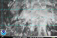
Where's the Rain Mon when you need him?
Friday, May 11, 2007

Avalon Is Burning In the Dark


As the sytem that was once known as Andrea slips into semi-concousness drifting in the Gulfstream worth barely a mention in the news and a possible whole inch of rainfall predicted....

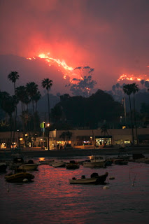
Avalon sits in the glow of a fire on Catalina Island on the other side of the world far away geographically but vividly in the news everywhere. Avalon, wow.. a name from my past. Amazes me, a blaze burning on that very beautiful Channel Island.

In this apocalyptic Spring where fires ravish the Hollywood Hills, endanger Griffith Park and smoke up most of the state of Florida ....the famous island of Catalina has been added to the list of places caught in the whirlwind of fire and weather of Spring 2007.

Dateline Avalon.... Catalina Island is on fire and burning in the night.

Does any name conjure up dreams more than Avalon?

When I lived in LA in the 80's you waited for a nice clear day, after a rare rainstorm to go up to the top of the Bonaventure Hotel, have a drink and look out across the water on it's ever spinning view of the world for a glimpse of Catalina Island... when it was Catalina's turn to come into view from the revolving bar... there she was in all her glory, across the Channel visible only in good weather, waiting in the distance ...rising up like a dream in the blue Pacific.

Avalon. I can't remember when there was a fire burning there in the past and there must have been... but I sure can't remember it. Living in Long Beach before LA always looking west to see if you could see Catalina from Signal Hill.

I could see it when in Laguna Beach with a friend a few years back, watching the sun set over the water and far off in the distance... Catalina.

Amazing.

What is this world coming to?

Named storms in May, wild fires in the Okefenokee Swamp, flooding misery in Missouri and now fire just miles from Avalon :(

How dare that fire cross over into Florida, don't we have enough fires burning down here already?

No Virginia.. it's not global warming as much as people tossing cigarettes recklessly, rivers flooding in Spring and who knows who set Catalina on fire...

California is burning again..the dry winds blow up and down the dried out chaparral covered mountain sides and the canyons burn. They burned in the early 80s didn't they? They burned in the 30s and the 50s and they burn again today. Yep, they did. Duarte burned, I don't forget easily. Once I drove into the Valley with a fire in the Hollywood Hills and the whole sky turned amber and gold and fiery red flames leaped about up on the hilltop. California burning is nothing new, Catalina is a little bizarre but this Spring has been bizarre. Maybe it's that drifting smoke caught up on the edge of Andrea floating down from Georgia that is making me remember things I would rather not think on and things I would rather forget. Memory floats in the ashes of a long ago fire.

One only wonders what Summer will bring..

Last weekend at Bais Menechem I stood with a friend by the fence watching the bonfire burn for Lag B'Omer. The fire department had a truck nearby, it was a very controlled bonfire in keeping with the holiday and beautiful to watch, beautiful to stare at with my pyromaniac friend who it seems enjoys staring at fires too from a safe distance. But, people can get burned in them badly, they need to be respected, shouldn't live up in the hills there when you can get wiped out in Long Beach if that Long Beach fault goes or the San Andreas shakes, rattles and rolls.. Oh gee.. just thought on the name, hope it doesn't do that this Spring.

I'll take hurricanes any time, she says as she realizes she can smell the scent of fire burning far away in Collier County.

Going to put on Kiss Country (what station did I listen to in California?) and not worry on old times not forgotten in California and not worry on Virginia and not worry on Andrea while I prepare for Shabbos.

Chicken, yellow rice garnished with green peas and red pimentos just the way my Grandma who lived in Tampa growing up taught me. All the usual suspects, wine, challah, whole wheat challah and some sort of cake if I get around to baking one. Israeli salads, avocado something. Chicken leftovers for Deborah to make chicken salad tomorrow and cholent in the crock pot.. my life has rhythms not just rhymes and Shabbos is tonight.

I'll light the shabbos candles, say a prayer for those caught in the fires, their lives turned upside down and their property in danger. I'll say a prayer for fireman to stay safe in the eye of their fire storms and I'll probably go to a kiddush tomorrow for a friend who had a baby.

Life goes on, night follows day, day follows night, day by day we move further away from the past and the faster the world turns the faster it brings the past right back to us.

Don't burn Avalon. Stay safe Virginia. Keep watching the tropics.. Barry can't be far away.
http://geography.about.com/od/physicalgeography/a/2007names.htm

Thursday, May 10, 2007

Asking a favor... while watching Andrea hang on ...

No not singing hang on andrea hang on here.. but it is musical.

Sameach Podcast Musical :)

My son's podcast is up for an award by the Jerusalem Post and I would really like it if anyone reading this would vote for it..listen to it if you would like as it's good, fun and full of music. And, it's free... open your horizons here while watching Andrea spinning off the coast and trying to hang in there. Models by the way are wierd and not set in stone so it's possible she hangs in, possible she drifts further south than figured and or go out to sea and intensify.. who knows?

Prayers to those in the Mid-West with the flooding misery in Missouri and parts of SW Iowa.. horrible to see so much water where you don't want it and so little where you do.. namely over the fire torn regions of Florida and Georgia and drought stricken Florida... and as for California.. oh don't let Griffith Park burn...

McArthur Park can melt all it wants but please don't let Griffith Park burn.

Here's the links to the voting site.. you must verify on the bottom to vote.
It's a great podcast. I didn't realize my son was so funny.. go figure that one :)

please take two seconds and vote for Best Podcast Award
Sameach Music Podcast... music does make the world go round

http://jibawards.com/index.php?option=com_wrapper&Itemid=231
and Best Podcast Episode Award

http://www.jibawards.com/index.php?option=com_wrapper&Itemid=220

Hey.. Mother's Day is Coming.. you could help me get a bigger present here
Starbucks Card.. Barnes and Noble, come on you know how to make me happy ;)

Wednesday, May 09, 2007

Hurricane Season Begins - Andrea at 11am..

Recon called home!

It seems that Recon find the proof they needed to help the NHC make the decision that starts the 2007 Atlantic Hurricane Season a little bit early this year with the birth of Andrea out in the Atlantic, spinning off the coast and a beauty to watch on satellite imagery.

Birth Details:
ABOUT 150 MILES EAST OF JACKSONVILLE IS ACQUIRING
THE CHARACTERISTICS OF A SUBTROPICAL CYCLONE. THE SYSTEM CONTINUES
MOVING GENERALLY WESTWARD AT ABOUT 5 MPH.

Waiting to see how big she is and how strong but as of earlier this morning I believe recon found winds in the 55mph area.

Going to be a long season and if Andrea manages to make it across the state of Florida intact ..there is plenty warm water in the Gulf for her to cause problems there.

Unless another cold front will inhibit her from intensifying in any way.

Then again that was the thinking yesterday but the thinking seems to be fluid like the storm.. and the new graphics from skeetobite show something else happening.

Either way.. bet we are going to continue seeing smoke from those fires down in Miami. And, watching the fire carefully online in LA.. I used to live near there, very familiar with Griffith Park and that area.. hard to watch the flames get so close.

But.. at the moment, I have priorities. Fires closer to home are burning and we have a named storm in the Atlantic and well..gee that means the TWC will have a tropical update on later today.

http://www.skeetobiteweather.com/picservice.asp?t=m&m=90

Recon is IN the "System" ..we will have data soon

They put out an 8am report at like 7am .. I thought my clock was still broken on the computer. Don't ask.. long story.

Anyways... we are waiting to hear from the planes. You know like when you have a friend flying and are waiting to hear news, you go online to flight tracker and it doesn't work well and you have to sit and wait...

Hurricane Tracking/Chasing teaches you patience if nothing else.

The swells at the beach at Miami Beach were awesome yesterday, if I didn't say that already I'm saying it now.. or again. I went with one of the guys at work and just sat, stood, ran in and out of the surf. Not high surf, long rolling waves which came in way far up on the beach exposing chunks of coral and big shells. I took a piece for a paperweight at work. Really nice. Up the coast a bit in Ft. Lauderdale they were having problems with water going so far up the beach from the swells that it ran over the road a few times. The Del Ano on South Beach kept moving the chaise lounges up as well... Dark, deep blue skies, white foam on the waves as they curled. Didn't seem like Miami. Kept thinking my son who used to surf who is living in Iowa these days would have loved it.

So..we are waiting.

What is in a name? Really?

A system is a system with a name or without one and friends up in the Carolinas told me they are having more damage from this storm than the garden variety Tropical Storm or Category 1 Hurricane.

Maybe it's true and Noreasters are stronger than hurricanes...

I wouldn't know but maybe someday I will.

For now.. seems this little Southeaster is doing quite a job on the beaches. Swells have been felt as far south as Puerto Rico.

Whatever the designation this system gets or doesn't get.. it will be remembered for a long time.

Save the loops.. they will make nice screen savers when the hurricane season is over and there is nothing exciting to look at on the satellites.

Have a good day everyone, enjoy .. be happy...love and be loved,

Bobbi

Tuesday, May 08, 2007

Will the NHC Blink? Special Statement Issued

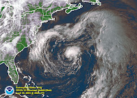
This is an old picture of subtropical storm Ana:


This is a link to an image of the system off the coast of the Carolinas currently referred to as NON-Tropical Low

http://www.ssd.noaa.gov/goes/flt/t1/vis.jpg

WATCH LOOP of current Non-Tropical Low spinning off the coast:
http://adds.aviationweather.gov/satellite/displaySat.php?region=TPA&isingle=mult_big&itype=vis


I don't understand why it is not considered a sub-tropical. But, then I only studied meteorology and oceanography briefly for my degree in International Relations.. weather matters when working with world politics. Ask Lex .. he knew.

So, anyway.........

I have been watching (though staring would be the proper word) the amazing low that has been called a coastal low, a nontropical low and a cut off low .. anything but a subtropical low for the last few days.

Anyone who knows me knows I like to call a spade a spade, a duck a duck and not play make believe games with high falluting language to explain away why something isn't what you see it is.. what you know it is..

This is in my opinion... just mine and a lot of other people I trust... a subtropical storm at the very least.. definitely trying to cross over into a hybrid..

It deserves respect, it deserves a name, it deserves attention and advisories.

And.. more so the SE Coastal cities deserve respect.

A High Wind advisory with words about hurricane force winds do not cut the mustard.. sorry.

This isn't the NWS (National Weather Service for someone who surfed in here) but the NHC.. National Hurricane Center. And, if a storm is producing hurricane force winds in the subtropics and has cut itself off from whatever system spew it forth and it is spinning wildly just off shore and headed towards the coast there needs to be attention, advisories and yes.. even to some degree media attention even if it comes off as hype.

People need to know.

The Navy knows, they have an invest up:
http://www.nrlmry.navy.mil/tc_pages/tc_home.html

People on message boards on HurricaneCity.com and Flhurricane.com know..and other boards.

Heck my brother Ronnie sent me some link to a board even I never heard of..

So..now that the Special Statement has been issued today and yesterday they sent out a check of their Seahorse system of email advisories they send out... will be get Andrea a bit early this year?

I would think so. Not my call ... not anyone's call but the NHC but my inquiringly, curious mind wants to know why wouldn't you issue a Subtropical Storm Advisory for this system which is a whole lot closer than Ana was out by Bermuda and likely to cause real damage somewhere here a long the Florida/GA coast.

Wiki has a great write up on Ana from April of 2003..
How is this not like Ana? I don't know.

wiki:
http://en.wikipedia.org/wiki/Tropical_Storm_Ana_(2003)

Will out NON-Tropical become Andrea?

There never seems to be any good rule of thumb for when a system gets a name as a subtropical and when it doesn't.. someone has to make that call and that would be the NHC.


Oh LOOK! A Special Statement from the NHC..

Are they blinking?
Only time will tell.

Welcome to the real world of the National Hurricane Center Mr. Bill Proenza, how do you like it now?

"DSAAT
SPECIAL TROPICAL DISTURBANCE STATEMENT
NWS TPC/NATIONAL HURRICANE CENTER MIAMI FL
950 AM EDT TUE MAY 8 2007

A NON-TROPICAL LOW PRESSURE SYSTEM...CENTERED ABOUT 230 MILES
EAST-SOUTHEAST OF THE GEORGIA AND SOUTH CAROLINA COASTS...HAS BEEN
MOVING SLOWLY WESTWARD AT 5 TO 10 MPH. THIS SYSTEM IS PRODUCING
GALE-FORCE WINDS AND HEAVY SURF ALONG THE COASTS OF NORTH
CAROLINA...SOUTH CAROLINA...AND GEORGIA...WITH STRONGER WINDS
OFFSHORE. ASSOCIATED SHOWER ACTIVITY HAS INCREASED SINCE
YESTERDAY...BUT NO SIGNIFICANT STRENGTHENING OF THIS SYSTEM IS
EXPECTED. THE LOW IS BEING MONITORED FOR SIGNS OF TROPICAL OR
SUBTROPICAL CYCLONE DEVELOPMENT...AND AN AIR FORCE RESERVE
RECONNAISSANCE AIRCRAFT WILL BE AVAILABLE TO INVESTIGATE THE SYSTEM
TOMORROW MORNING...IF NECESSARY.

INTERESTS ALONG THE COAST OF THE SOUTHEASTERN UNITED STATES SHOULD
MONITOR PRODUCTS ISSUED BY LOCAL NATIONAL WEATHER SERVICE FORECAST
OFFICES. ADDITIONAL INFORMATION ON THIS SYSTEM CAN ALSO BE FOUND
IN HIGH SEAS FORECASTS ISSUED BY THE NATIONAL WEATHER
SERVICE...UNDER AWIPS HEADER NFDHSFAT1 AND WMO HEADER FZNT01 KWBC.


$$
FORECASTER KNABB


Stay tuned.. developing, just off the coast and possibly coming to a theatre near you if you be living in Savannah or Jacksonville or anywhere in between.

Bobbi.. going back to staring mode..
http://adds.aviationweather.gov/satellite/displaySat.php?region=TPA&isingle=mult_big&itype=vis

Monday, May 07, 2007

Strong Cut Off Low - Back Door Cold Front (windy day...)

We had an incredible storm here last night. I mean incredible. Heavy lightning, strong winds (strongest we have had in ages) and somewhere in Weston a tornado touched down briefly. Sat with Zalmy on the porch and watched the light show until we had to batten down the hatches as the rain began to come in at a horizontal angle through the jalousies.

Woke up this morning to cool air blowing in blustery through the windows.

Another cold front. A Back Door Cold Front... swinging down through the state being whipped down here by a strong cut off low off the Carolinas... Thank you for the cool air.. night time lows back in the 60s again.

So, I am wondering just how "sub-tropicals" are different from cut off lows like this one? I'll get an answer online at hurrcity and I'll google it and eventually I'll understand it but from my point of view in a noisy house with all the venetian blinds rattling and a rare whirl sound in the wind that you only hear when the wind gusts up over 30mph... I am wonderfing if this storm will go down in the memory for strong May "cut off lows" and one beautiful, last cold front ;)

Never say last it seems... because the next one will prove you wrong.

Never say impossible as Joseph taught me once a long time ago... improbable maybe, impossible never :)
Storm Coverage Notes below... Back Door Cold Front Coverage that is.. ;)


From the TV:

Wind and Debris falling off of downtown buildings creating slow traffic on I-95 South into Miami.

Wind Advisory along the coastline, winds steady 20 to 25 mph and gusts up in the high 30s are possible.

Footage shown from Dania Beach Pier, windy, wild, grayish - green foamy waves. "the beach is not where you want to be today" (yeah, right..the beach is a block from my job, like I am not going to go sit and eat sushi and watch the waves roll in sometime today...)


From NWS:
NPWMFL

URGENT - WEATHER MESSAGE
NATIONAL WEATHER SERVICE MIAMI FL
546 AM EDT MON MAY 7 2007

...STRONG WINDS EXPECTED ALONG THE IMMEDIATE EAST COAST TODAY...

FLZ068-072-074-080000-
/O.CON.KMFL.WI.Y.0003.000000T0000Z-070508T0000Z/
PALM BEACH EASTERN-BROWARD METROPOLITAN-DADE METROPOLITAN-
INCLUDING THE CITIES OF...WEST PALM BEACH...FORT LAUDERDALE...
MIAMI
546 AM EDT MON MAY 7 2007

...WIND ADVISORY REMAINS IN EFFECT UNTIL 8 PM EDT THIS EVENING...

AREAS ALONG THE IMMEDIATE ATLANTIC COAST WILL RECEIVE WINDS OF
AROUND 25 MPH
WITH GUSTS OVER 30 MPH LIKELY WITH GUST TO AROUND 45
MPH POSSIBLE. THIS WILL LIKELY LAST THROUGH THE DAY AND DECREASE
AROUND SUNSET.

A WIND ADVISORY MEANS THAT WINDS OF 25 MPH WITH HIGHER GUSTS ARE
EXPECTED. WINDS THIS STRONG CAN MAKE DRIVING DIFFICULT...
ESPECIALLY FOR HIGH PROFILE VEHICLES. USE EXTRA CAUTION.

Sunday, May 06, 2007

Hot Day In May .. Field Trip to Train Museum

I had a very cool day. Amazing... spiced with History and Hurricane History and a ride on a choo choo train. Ate lunch in a cool, air conditioned club car out on the museum's grounds. Got to hear Dr. George talk about history the whole way down and back.. Florida history that is..

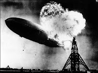
The Train Museum you see is on the old grounds of the Richmond Air Field that once housed a building 17 stories high to house the dirigibles that were there. It was used by the army in WW2 and then the hurricane hit. Somewhere, sometime in the fire the very large hangar and facility got destroyed by a fire so large that it was said you could see it from the rooftop of the Old Daily News building in Downtown Miami (now known as Freedom Tower).

So..on the anniversary of the late, great Hindenburg.. I spent some time out in Homestead where the Florida


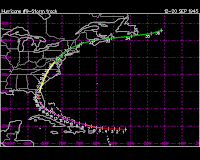
I mean what can you say about a spot in space that has had two major hurricanes make landfall upon it directly? Richmond Field... 1945.. 1992 Andrew..

I don't think most Miamian's realize how strong that storm was and most of my generation doesn't realize we were dealing with dirigibles out there..


There you go... the track of your typical September Cape Verde storm that comes "up over the islands straight at Miami" as my Grandma Mary would say.. and forgot to read the part about recurving before making landfall. A very, very, wet, strong storm.

Nice tour. Nice people. Miami High Class of 44, 45 and 46 or so were having their reunion and joined the tour. Sweet people. Talked to them about Canes though most wanted to talk still about Andrew. They said Miami was always flippant about Canes before Andrew. Sort of hunker down and ride them out. No one remembered doing much preparation for them when young.

One couple I spoke to was getting married in a few weeks. They were in love 62 years ago, broke up... and found themselves online years later... came to the reunion, getting married. So cute. Such a cute couple, very young looking, kept hugging each other, happy... maybe love does that to you. I had tears in my eyes hearing their story. Wow. Unreal.. Nice to know love can find you at any age and makes you feel the way it did back when.

Beautiful day except for the extreme heat and well...great day, great museum. If you have a chance go on out and visit next time you want to take a drive down Dixie Highway or down the Turnpike.

Does it really matter how you get there as long as you get there?

Over and out... Bobbi
Ps... my son and my brother went to the Air Show.. had a blast, both came back looking like Miami Lobsters lol.. very hot!

Wednesday, May 02, 2007

Waterspouts Possible Today In Miami?

Okay, so I wake up this morning from the annoying garbage truck that comes before six o' clock somewhere down the block and a pair of incessantly noisy parrots. Parrots run in pairs, never alone.. sometimes they run with other birds, but they are always noisy. Not as noisy as some nest of baby birds that the neighbor is soon going to flush out of their happy little abode when she tents her house.

Life in Miami in the morning.

I turned on the weather radio for fun, nostalgia.. I left my sidekick at work :(

Waterspouts possible out over open water and something about the possibility of rain. Possibility mind you, not probablability but in drought stricken south florida we will take anything we can get. We'll also take pics of the waterspouts if we see them. Of course it will rain today, I know where I am going for lunch to do some research and some karmic rainstorm always lets loose on such days.

Anyway, call it a sign of the times... May... clouds from the Glades may bump and grind and slam into showes out over the Gulfstream to borrow a line from Jimmy Buffett. Just today, not in the forecast every day but telling you in less than three weeks Miami is going to get slammed with some rainstorm that acts like God turned on the garden hose and let it rip... will test every unrepaired roof in Miami and those repaired badly.

Did Joe Bastardi really say South Florida isn't in a drought? Rumor has it (sorry) he did, I guess I'll check for myself but reliable sources said he said Northern Florida was really in a drought, not South Florida. Sure hope Joey isn't planning on diving off that boat dock on Lake Okochobee that is now out over dry Prairie Grass. No drought? What was he thinkin'?

See forecast below for Miami area.. nice, very nice.. if it happens.

HAZARDOUS WEATHER OUTLOOK FOR SOUTH FLORIDA...CORRECTED
NATIONAL WEATHER SERVICE MIAMI FL
504 AM EDT WED MAY 2 2007

FLZ063-066>075-022300-
GLADES-HENDRY-PALM BEACH WESTERN-PALM BEACH EASTERN-
WESTERN COLLIER-EASTERN COLLIER-WESTERN BROWARD-
BROWARD METROPOLITAN-WESTERN DADE-DADE METROPOLITAN-
MAINLAND MONROE-
448 AM EDT WED MAY 2 2007

...SCATTERED THUNDERSTORMS OVER INTERIOR AND EAST COAST TODAY...
...A FEW STORMS COULD PRODUCE STRONG WIND GUSTS AND HEAVY RAIN...
...ISOLATED WATERSPOUTS POSSIBLE OVER ATLANTIC WATERS THIS MORNING...

THIS HAZARDOUS WEATHER OUTLOOK IS FOR SOUTH FLORIDA.

.DAY ONE...TODAY AND TONIGHT

THUNDERSTORMS: SCATTERED THUNDERSTORMS ARE EXPECTED TO DEVELOP
OVER MAINLAND SOUTH FLORIDA TODAY AS BOTH, SEA AND LAKE BREEZES,
INTERACT WITH DIURNAL HEATING. THESE STORMS WILL MAINLY DEVELOP
OVER EASTERN INLAND AREAS AND DRIFT SLOWLY NORTHEASTWARD THROUGH
THE AFTERNOON AND EVENING HOURS.

WATERSPOUTS: THERE IS A MODERATE RISK OF WATERSPOUTS OVER THE ATLANTIC
WATERS AS LINES OF SHOWERS AND THUNDERSTORMS MOVE SLOWLY OVER THESE
WATERS THIS MORNING.

WIND: THE STRONGEST STORMS THAT DEVELOP TODAY COULD PRODUCE WIND
GUST IN THE 40 TO 50 MPH RANGE.

FLOODING: LOCALLY HEAVY RAIN AND PONDING OF WATER IN POORLY
DRAINED AREAS IS POSSIBLE, ESPECIALLY OVER THE EASTERN METRO AREAS, DUE
TO THE EXPECTED SLOW MOVEMENT OF THE THUNDERSTORMS.

.DAYS TWO THROUGH SEVEN...THURSDAY THROUGH TUESDAY

THERE IS A SLIGHT CHANCE OF THUNDERSTORMS FOR THURSDAY AFTERNOON.

NO OTHER HAZARDOUS WEATHER IS EXPECTED AT THIS TIME.

.SPOTTER INFORMATION STATEMENT...

SPOTTER ACTIVATION WILL NOT BE NEEDED.

FOR MORE INFORMATION...VISIT THE NATIONAL WEATHER SERVICE IN
MIAMI WEBSITE AT WWW.WEATHER.GOV/MIAMI.
$$